
Previously unmapped island discovered in Antarctica’s Weddell Sea
Scientists aboard the RV Polarstern discovered and surveyed a previously unmapped island in the Weddell Sea, Antarctica, during a February 2026 expedition, confirming a rocky landmass about 130 m (426 feet) long that had previously appeared only as an undefined danger zone on nautical charts.
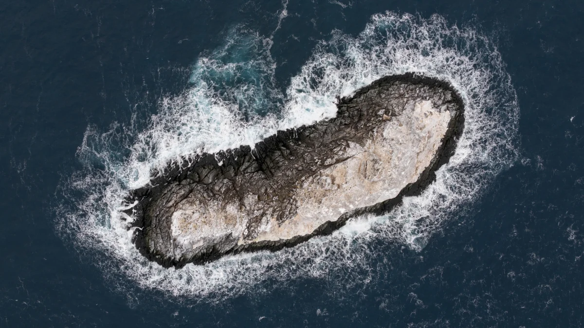
AWI researchers measured the rocky island at about 130 m (426 feet) long and 50 m (164 feet) wide after rough weather diverted RV Polarstern toward Joinville Island.. Credit: Christian Haas, Alfred Wegener Institute
A 93-member international research team from the Alfred Wegener Institute has been conducting oceanographic and cryospheric studies in the northwestern Weddell Sea aboard the RV Polarstern since February 8, focusing on the outflow of ice and water from the Larsen Ice Shelf and recent changes in sea ice extent.
Research operations were interrupted by rough weather, prompting the vessel to seek shelter in the lee of Joinville Island. During this diversion, crew and scientists observed a feature that had previously been marked on nautical charts only as an area of “unexplored dangers to navigation,” without defined coastline data.
Visual inspection from the bridge initially suggested a dirty iceberg. A closer approach confirmed that the feature was a rocky landmass rather than floating ice.
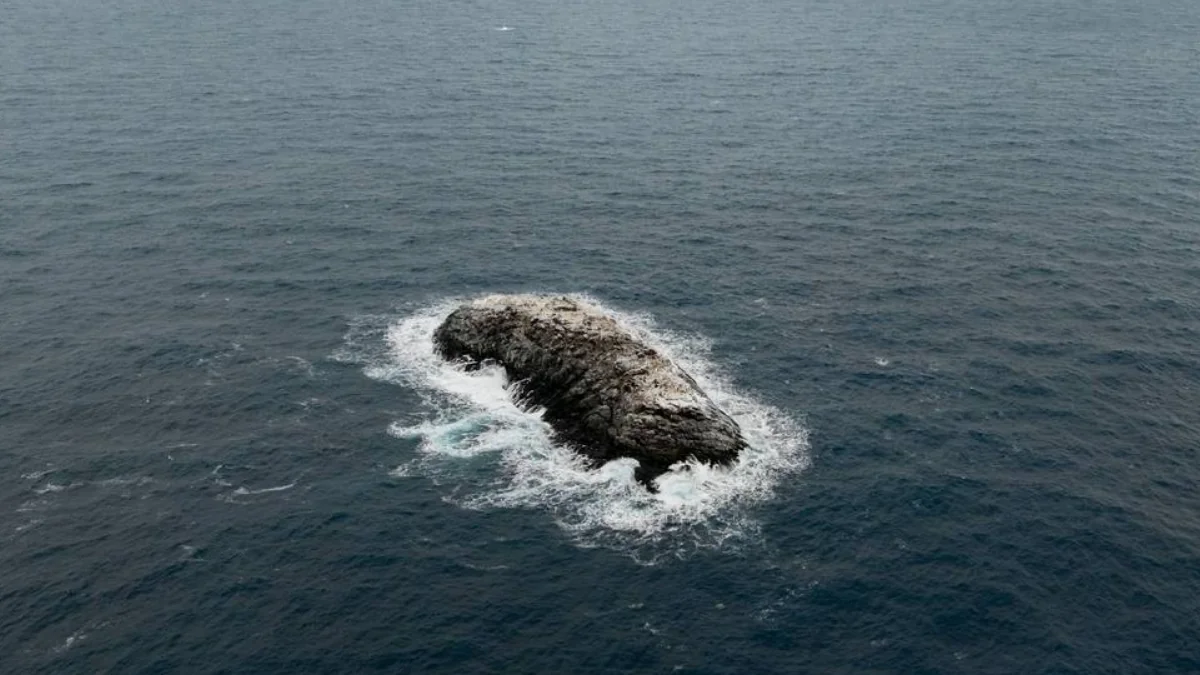
The vessel approached to within approximately 150 m (492 feet), maintaining at least 50 m (164 feet) of water beneath the keel while circumnavigating the island.
The team conducted a multibeam echo sounder survey of the seabed, deployed a drone for aerial imaging, and processed the data photogrammetrically to generate a georeferenced elevation model and measure the coastline.
Survey results show the island is approximately 130 m (426 feet) long and 50 m (164 feet) wide, rising about 16 m (52 feet) above sea level. The measurements provide the first documented dimensions of the feature.
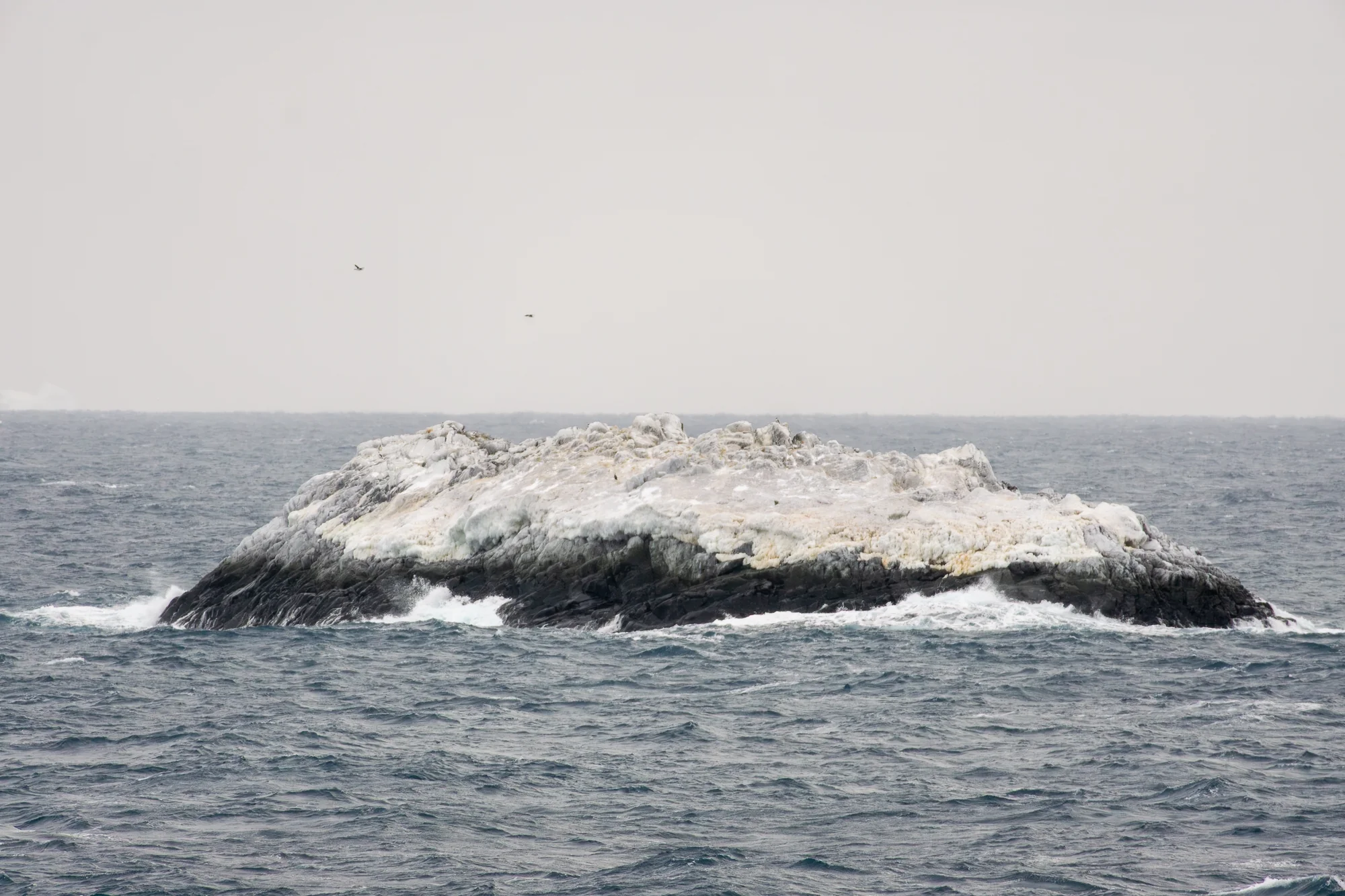
Existing datasets show inconsistencies in the area. Nautical charts indicated a hazard zone, but the feature was not represented as land in other datasets, and its recorded position was offset by about 1.85 km (1.15 miles) from the actual location. Satellite imagery did not clearly resolve the island because its ice-covered surface resembled surrounding icebergs.
The island has not yet been officially named. The research team will initiate the formal naming process and publish precise coordinates after completion. The feature will then be incorporated into international nautical charts and bathymetric datasets, including products such as the International Bathymetric Chart of the Southern Ocean.
Measurements collected during the expedition document changes in regional sea ice conditions. Observations show a decline in summer sea ice extent in the northwestern Weddell Sea since 2017, along with surface melting, reduced snow cover, and freshwater layers within and beneath the ice.
These conditions influence ocean circulation and ice–ocean interaction in areas affected by outflow from the Larsen Ice Shelf. The island lies within this environment, where ice cover and melt processes affect the detection and mapping of coastal features.
References:
1 Uncharted island soon to appear on nautical charts – AWI – April 8, 2026

I am an Assistant Editor and Severe Weather & Science Journalist at The Watchers, specializing in real-time severe weather coverage, geophysical event reporting, and research-driven scientific analysis. You can reach me at rishav(at)watchers(.)news.
Commenting rules and guidelines
We value the thoughts and opinions of our readers and welcome healthy discussions on our website. In order to maintain a respectful and positive community, we ask that all commenters follow these rules.