
Tropical Storm Cristobal forms WSW of Azores, becoming third named storm of 2026 Atlantic season
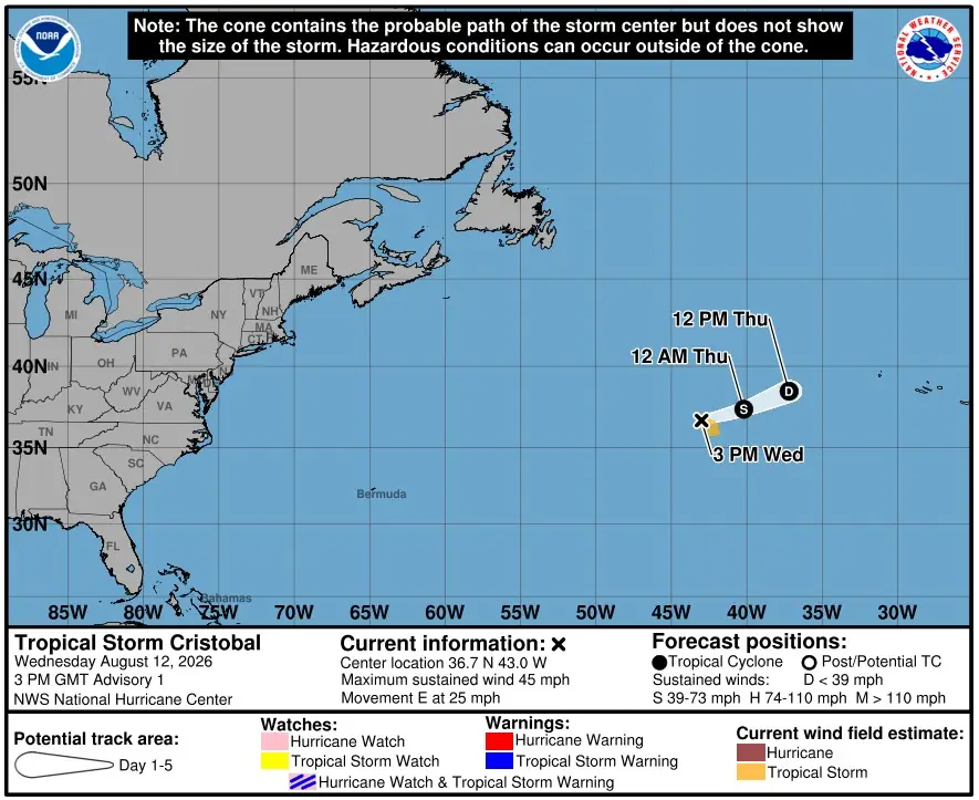
Tropical Storm Cristobal formed WSW of the Azores on August 12, becoming the third named storm of the 2026 Atlantic hurricane season. At 15:00 UTC on August 12, 2026, the National Hurricane Center reported maximum sustained winds of 75 km/h (45 mph), with no coastal watches or warnings in effect.
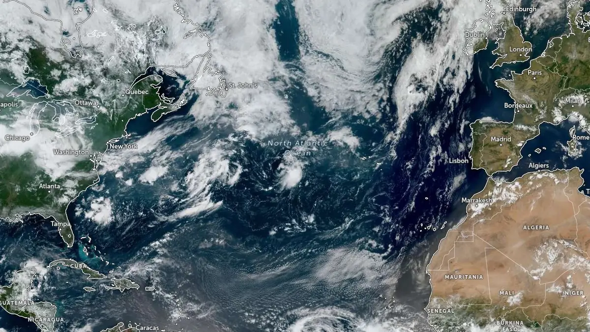
Tropical Storm Cristobal at 14:50 UTC on August 12, 2026. Credit: NOAA/GOES-East, Zoom Earth, The Watchers
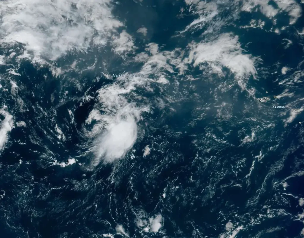
Cristobal developed from disturbance AL93 over the central subtropical Atlantic and was located well west-southwest of the Azores when the National Hurricane Center issued its first advisory. The storm was moving eastward at about 41 km/h (25 mph) and had an estimated minimum central pressure of 1 008 hPa.
A turn toward the east-northeast and a slower forward motion are expected later today and tonight. Maximum sustained winds are near 75 km/h (45 mph) with higher gusts.
Slow weakening is forecast, and Cristobal is forecast to dissipate on Thursday, August 13. Tropical-storm-force winds extend outward up to 150 km (90 miles) from the center.
No coastal watches or warnings were in effect with the first Cristobal advisory.
Cristobal followed Tropical Storms Arthur and Bertha as the third named storm of the 2026 Atlantic season. August falls within the period when Atlantic tropical cyclone activity normally increases, ahead of the climatological peak in September.
NOAA’s updated Atlantic hurricane season outlook, issued August 6, assigns a 75% probability of a below-normal season. The outlook calls for 7 to 13 named storms, including the two that had already formed by the time of the update, with 2 to 6 hurricanes and 0 to 2 major hurricanes.
To date, the 2026 season has produced two named tropical storms, Arthur and Bertha, and no hurricanes. Tropical Storm Arthur was the first named storm of the Atlantic season. Forming in mid-June in the warm Gulf of America waters off the Texas coast, Arthur brought record rainfall to portions of Louisiana and spawned tornadoes along the Gulf coast. Bertha also formed in the Gulf, originating south of the Florida panhandle before making landfall in St. Bernard Parish, Louisiana.
“Inland rainfall is a major cause of damage from tropical storms and hurricanes, as Arthur demonstrated,” said NOAA’s National Weather Service Director Ken Graham. “That’s why it’s important to prepare for every storm that’s projected to impact your area, even if it never reaches hurricane strength.”
For the remainder of the season, tropical storm activity in the Atlantic basin is expected to be tempered by El Niño conditions, which first emerged in the equatorial Pacific in June. El Niño increases wind shear, which tends to prevent tropical storms from forming or from getting stronger once formed. Other less influential factors include temperatures near average in the Atlantic Ocean and a neutral West African monsoon.
References:
1 Tropical Storm Cristobal Advisory Number 1 – NOAA/NHC – 15:00 UTC on August 12, 2026
2 NOAA maintains prediction for below-normal Atlantic hurricane season – NOAA – August 6, 2026

Teo Blašković founded The Watchers in 2011 and edited it until 2026, covering seismic and volcanic activity, extreme weather, space weather and near-Earth objects. Articles on this page are his archive.
Published in the last 24 hours
- Bay of Bengal system to become Cyclone Akvan, landfall forecast between Nellore and Tuni on November 20, India
- Tropical Cyclone Xavier reaches Category 2 over Northern Cook Islands, gale warning for Manihiki and Rakahanga
- El Niño floods kill 2 in Guayaquil as 172.8 mm of rain swamps Milagro, Ecuador's toll rises to 14
- Southern Thailand braces for heavy rain, 15 provinces on flood and landslide alert for November 18-22
