
Multiple water rescues conducted as severe storms bring 115 km/h (70 mph) wind threat to flood-hit Perry County, Ohio
Severe thunderstorms with radar-indicated wind gusts of up to 115 km/h (70 mph) crossed Perry County, Ohio, late in the morning of August 11, 2026, after parts of Perry and Morgan counties received 127–178 mm (5–7 inches) of rain overnight. Multiple water rescues were conducted while Flash Flood Warnings remained in effect following an overnight Flash Flood Emergency.
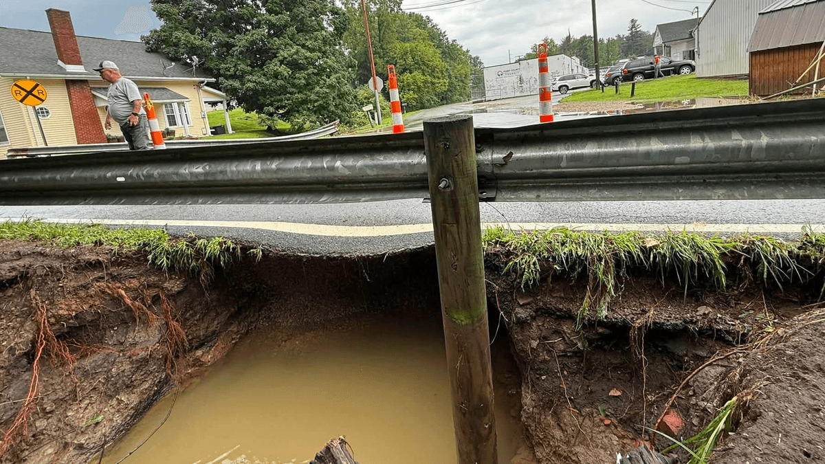
Flood damage in New Lexington, Perry County, Ohio on August 10, 2026. Credit: Perry County Ohio
Severe thunderstorms with radar-indicated wind gusts of up to 115 km/h (70 mph) crossed Perry County, Ohio, late in the morning of August 11, while multiple Flash Flood Warnings remained in effect after an overnight Flash Flood Emergency.
Water rescues were underway after 127–178 mm (5–7 inches) of rain fell across parts of Perry and Morgan counties overnight, flooding structures, vehicles and roads.
At 10:47 EDT, the National Weather Service (NWS) issued a Severe Thunderstorm Warning for southeastern Perry County, western Morgan County and north-central Athens County. The warning carried a considerable damage threat, with radar-indicated wind gusts of up to 113 km/h (70 mph).

The storms were moving east at about 80 km/h (50 mph). NWS warned of considerable tree damage, with damage likely to mobile homes, roofs and outbuildings.
Crooksville, Corning, Hemlock and Rendville were among the locations in the warning, which remained in effect until 11:30 EDT. NWS also said torrential rain could contribute to additional flash flooding.
NWS allowed the warning to expire after the storms moved out of the area. Gusty winds and heavy rain remained possible, and a Severe Thunderstorm Watch continued across southeastern Ohio.
Several water rescues were reported in Perry County. According to 10TV, its crews observed first responders conducting rescues and reported floodwater reaching halfway up the pumps at a gas station in the area.
Flooding remained the main confirmed impact in Perry County. At 11:06 EDT, NWS issued a new Flash Flood Warning for northwestern Perry County through 15:30 EDT.
NWS estimated that the latest storms had produced 25–38 mm (1–1.5 inches) of rain, with up to 25 mm (1 inch) more possible. The area received 75–115 mm (3–5 inches) overnight.
The agency said renewed rainfall would exacerbate ongoing flooding in northwestern Perry County. Jonathan Creek was likely out of its banks and flooding adjacent roads and low-lying areas between Thornville and Yost, with Thornville and Glenford included in the warning.
At 09:46 EDT, NWS issued another Flash Flood Warning for central Perry County and northwestern Morgan County through 14:30 EDT. The agency said 38–51 mm (1.5–2 inches) of additional rain was possible after 102–152 mm (4–6 inches) fell overnight.
NWS said the overnight rain flooded numerous structures, vehicles and roads in the warning area. Renewed rainfall was expected to worsen flooding and hamper recovery efforts, particularly in Crooksville.
New Lexington, Somerset, Perry State Forest, Crooksville and Junction City were included in the warning.
At 09:53 EDT, NWS issued a Flash Flood Warning for southern Perry County, Morgan County, north-central Athens County and northwestern Washington County through 15:30 EDT. Radar and automated gauges indicated that 76–127 mm (3–5 inches) had fallen, with another 25–51 mm (1–2 inches) possible.
NWS forecast repeated rounds of severe thunderstorms and flash flooding across southeastern Ohio and adjacent areas through August 13 under a northwesterly flow pattern.
The agency said the most significant round was forecast from late afternoon into the evening of August 11. Hazards included damaging wind gusts above 97 km/h (60 mph), isolated gusts above 119 km/h (74 mph), brief line-embedded tornadoes and renewed flash flooding.
Severe-weather and flood risks were expected to continue on August 12 and 13 before drier conditions arrived on August 14.
American Red Cross shelters were available at Crooksville Middle School, the Perry County Fairgrounds in New Lexington, and the Corning-Monroe Civic Center.
References:
1 Decision Support Weather Briefing – NWS – August 11, 2026

I am an Assistant Editor and Severe Weather & Science Journalist at The Watchers, specializing in real-time severe weather coverage, geophysical event reporting, and research-driven scientific analysis. You can reach me at rishav(at)watchers(.)news.

Commenting rules and guidelines
We value the thoughts and opinions of our readers and welcome healthy discussions on our website. In order to maintain a respectful and positive community, we ask that all commenters follow these rules.