
Successive atmospheric rivers forecast to impact U.S. West Coast
Successive atmospheric rivers are forecast to affect the U.S. West Coast through October 2, 2025. The first system that impacted Washington, Oregon, and Northern California on September 29 was forecast to dissipate by late evening, while a second, stronger event associated with a cyclone near British Columbia is expected to make landfall today. Forecasts call for 25–75 mm (1–3 inches) of rain in coastal ranges and up to 200 mm (8 inches) on the Olympic Peninsula.
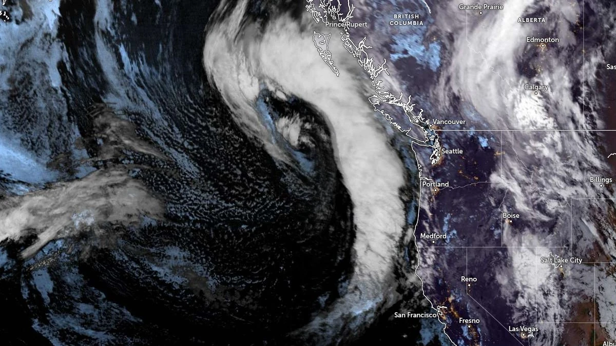
Atmospheric river impacting West Coast US and Canada on September 30, 2025. Credit: NOAA/GOES-East, Zoom Earth, The Watchers
A sequence of atmospheric rivers (ARs) is expected to influence the U.S. West Coast this week, according to the Center for Western Weather and Water Extremes (CW3E) and the National Weather Service (NWS).
The first AR, which brought moderate integrated vapor transport (IVT) to Washington, Oregon, and Northern California on September 29, was forecast to weaken and dissipate by late evening local time. A second AR tied to a strengthening cyclone off British Columbia is forecast to make landfall along the northwest coast by midday September 30.
Forecast guidance indicates IVT values of 500–700 kg m⁻¹ s⁻¹ over coastal Washington, Oregon, and Northern California as the cyclone intensifies and undergoes occlusion.
AR conditions in Northern California are expected to last over 24 hours, while Oregon and Washington may experience 30–60+ hours of AR2–AR3 conditions.
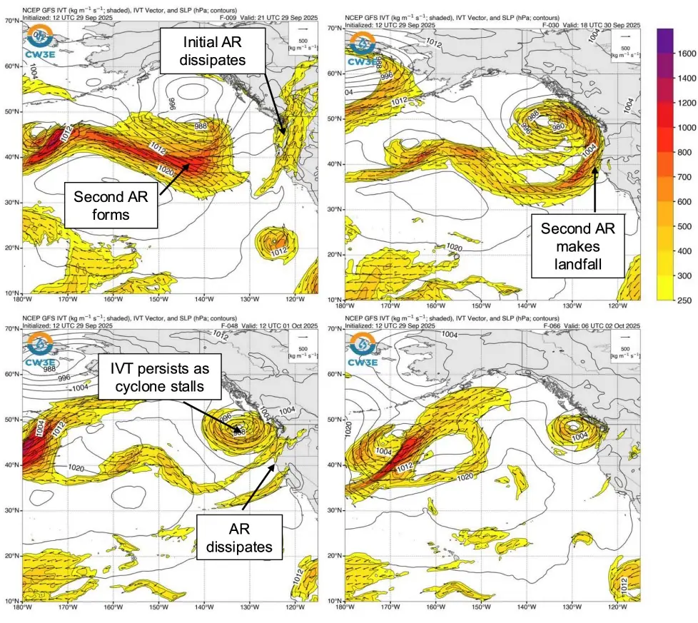
CW3E’s AR landfall tool highlights a probability above 90% of AR conditions from Washington to Northern California on September 30, with a continuation along the Washington and Oregon coasts for two additional days as the weakening cyclone stalls offshore.
Precipitation through 05:00 PDT (12:00 UTC) on October 2 is forecast at 25–75 mm (1–3 inches) across the Northern California Coast Ranges, the Northern Sierra Nevada, the Oregon Coast Ranges, and the Cascades. The Olympic Peninsula may receive 100–200 mm (4–8 inches).
The NWS Weather Prediction Center has issued marginal risk, level 1 of 4, excessive rainfall outlooks.
For the 24-hour period ending 12:00 UTC (05:00 PDT) September 30, the marginal risk covers Northern California, far southwestern Oregon, and inland areas of Oregon, Idaho, and Nevada. For the 24-hour period ending 12:00 UTC (05:00 PDT) October 2, the marginal risk is centered on the Olympic Peninsula.

While the rainfall could produce localized flooding, CW3E noted it is also expected to provide relief for drought-affected areas and assist wildfire containment.
As of the September 29 update from the Northwest Interagency Coordination Center, there were 16 active large fires in Washington and Oregon, including the Bear Gulch Fire in Olympic National Forest. Forecast rainfall may aid suppression efforts, though full containment will depend on storm evolution and fire behavior.
I'm a dedicated researcher, journalist, and editor at The Watchers. With over 20 years of experience in the media industry, I specialize in hard science news, focusing on extreme weather, seismic and volcanic activity, space weather, and astronomy, including near-Earth objects and planetary defense strategies. You can reach me at teo /at/ watchers.news.
Commenting rules and guidelines
We value the thoughts and opinions of our readers and welcome healthy discussions on our website. In order to maintain a respectful and positive community, we ask that all commenters follow these rules.