
Thunderstorms, heavy rain and flash floods to impact southern Plains and Midwest this weekend
Severe weather, including heavy rains, flash floods, and thunderstorms, is forecast to impact a broad region from lower Michigan to the southern Plains starting Friday, April 18, 2025, and continuing through the weekend, placing tens of millions of people on alert.
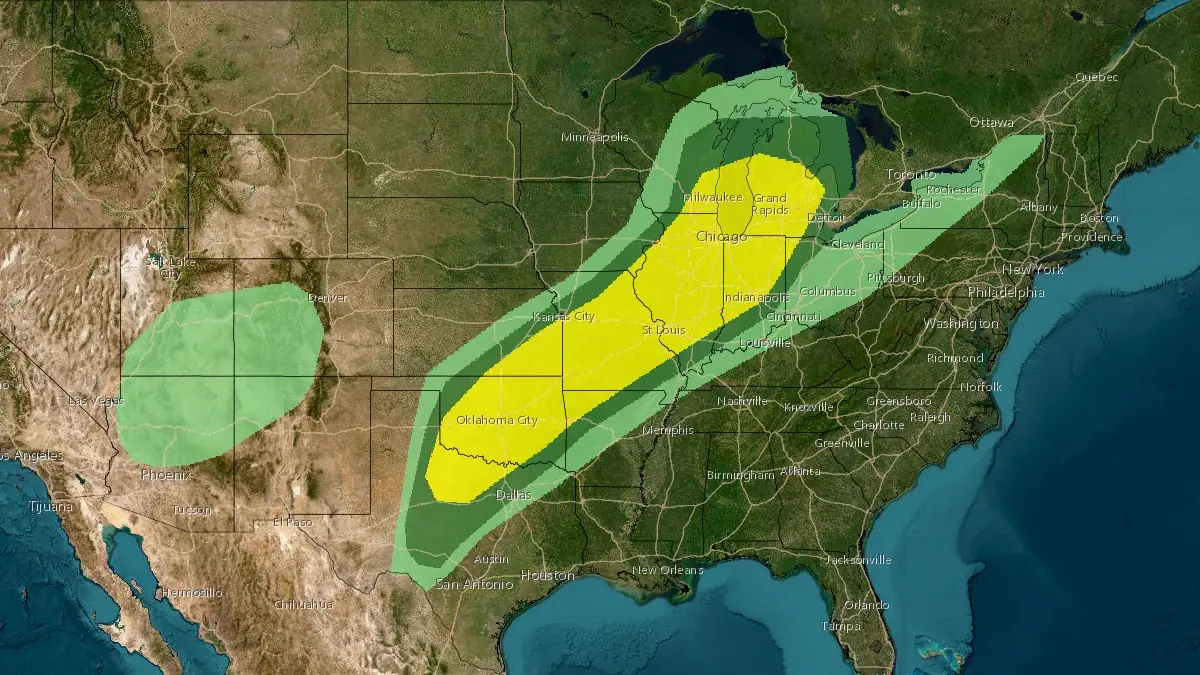
Convective outlook for Friday, April 18, 2025. Image credit: NWS
A prolonged period of heavy rains triggered by an upper-level trough is forecast to impact the region between lower Michigan and the Midwest starting Friday, April 18, and continuing through the weekend.
Repeating rounds of thunderstorms will bring 60 to 100 mm (2 to 4 inches) of rainfall from eastern Oklahoma to central Missouri through Friday.
The heavy rains could lead to flash flooding, and the National Weather Service Weather Prediction Center (WPC) has issued a Moderate Risk for heavy rainfall across the region.

A larger Slight Risk for severe thunderstorms has been issued from the Southern Plains to lower Michigan by the Storm Prediction Center.
Large hail, heavy rains, and a few possible tornadoes are forecast across the region. The risk zone covers an area of over 725 000 km2 (280 000 mi2), affecting nearly 40 million people.

Severe weather conditions are expected to persist through the weekend, with the risk zone shifting southward on Saturday, April 19, extending from central Texas to southern Missouri.
The flash floods will be exacerbated due to the saturated soil in the region following repeated severe weather events over the past months. Citizens across the region have been advised to prepare for the severe weather conditions and flooding through the weekend.

References:
1 Day 2 convective outlook – SPC – April 17, 2025

Rishav Kothari is Editor-in-Chief of The Watchers, where he runs the newsroom and covers earthquakes, volcanoes, severe weather and space weather.
Published in the last 24 hours
- Strong El Niño reinforces above-normal winter precipitation outlook across southern and eastern U.S.
- Scientists directly observe how submarine landslides unfold in western Canada Epicenter
- Odisha evacuated 983,642 people before Phailin crossed near Gopalpur on 12 October 2013 with winds of 200-210 km/h gusting to 220, and 44 died, against 9,885 in the 1999 super cyclone. Cyclone Akvan crossed the same coast on 20 November 2026. Epicenter
- Lava fountains reached 1,900 feet (580 m) at Kīlauea Iki in 1959, the highest ever recorded at Kīlauea, as USGS forecasts episode 57 fountaining at Halemaʻumaʻu for November 22-26. Epicenter
