
Major atmospheric river (AR) event possible over the U.S. West Coast next week
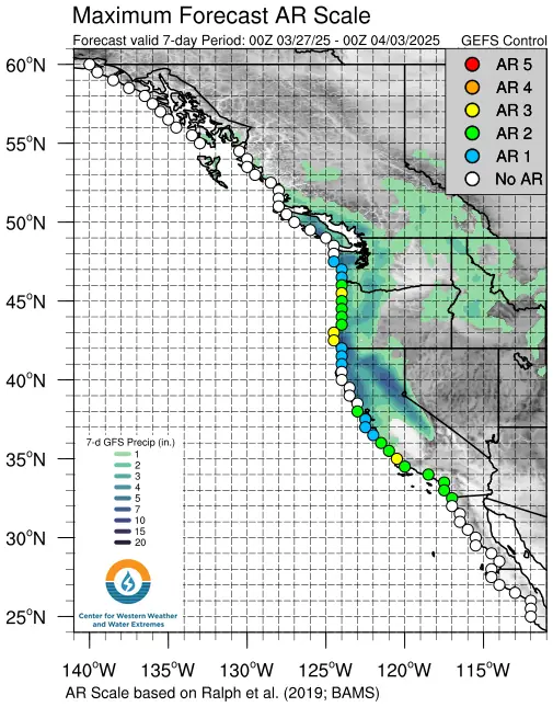
U.S. weather models, including NCEP and GEFS, project an over 80% chance of a strong atmospheric river making landfall in northern and central California from April 1 to 2, 2025. Outlooks from the NWS Climate Prediction Center (CPC) indicate wetter-than-normal conditions and a moderate risk of heavy rain and mountain snow between March 31 and April 4.
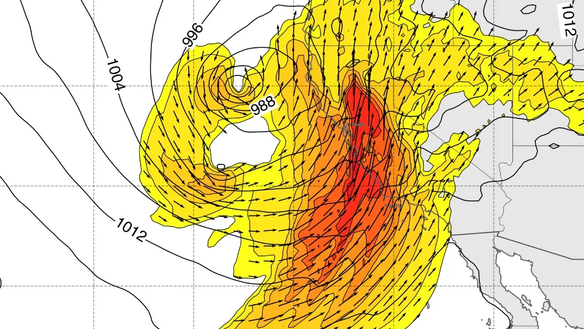
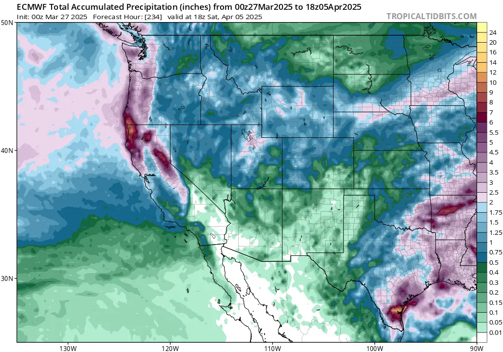
NCEP GFS Vertically Integrated Water Vapor Transport (IVT) valid 18:00 UTC on April 2, 2025. Image credit: CW3E, The Watchers
A major atmospheric river (AR) is forecasted to make landfall over northern and central California from Tuesday, April 1, to Wednesday, April 2, 2025, with a high likelihood exceeding 80%, according to the National Centers for Environmental Prediction (NCEP) model guidance.
The Global Ensemble Forecast System (GEFS) has consistently indicated a strong signal for this landfalling AR since last Friday.
The National Weather Service (NWS) Climate Prediction Center’s recent outlooks also suggest a greater than 60% probability of wetter-than-normal conditions between March 31 and April 4, with a moderate risk of heavy precipitation and mountain snow on April 2, extending from southern Oregon to central California.
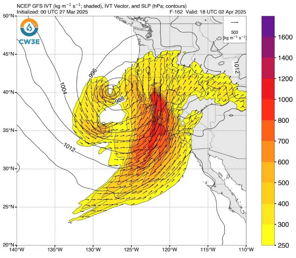
Although confidence is high, the event is still 5 to 6 days out, and while the Global Forecast System (GFS) consistently signals a strong atmospheric river, the European Centre for Medium-Range Weather Forecasts (ECMWF) presents a somewhat less impactful scenario, leading to some uncertainty.
The NCEP and GEFS models predict significant precipitation totals in northern and central California during April 1–3, while the ECMWF model anticipates the development of a ridge west of California during this period, resulting in lower confidence for an impactful AR and forecasting lesser precipitation amounts.
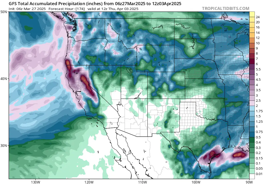
The NWS Weather Prediction Center (WPC) forecasts at least 100–180 mm (4–7 inches) of precipitation over the Olympic Peninsula, Oregon, and the Northern California Coast Ranges with the initial AR. For the subsequent AR, the GFS model forecasts over 250 mm (10 inches) of precipitation across the Sierra Nevada, while the ECMWF model projects 50–100 mm (2–4 inches) over the Northern Sierra Nevada and parts of Oregon and Northern California Coast Ranges.
The NWS Northwest River Forecast Center forecasts that three gauges in Oregon may exceed minor flood stage, and one gauge could surpass moderate flood stage over the next 10 days.
Additionally, the NWS WPC has issued a marginal risk Excessive Rainfall Outlook (ERO) for coastal regions of Washington, Oregon, and Northern California on March 27 and 28, indicating a 5% chance of flash flood conditions.
Residents in the affected areas are advised to prepare for heavy rainfall, potential flooding, and significant mountain snowfall, and to monitor updates from local authorities for the latest information and guidance.
Update
21:07 UTC, March 28
CW3E’s earlier outlook indicated a potential high-impact atmospheric river in California next week, with model disagreement between NCEP and ECMWF. The latest 12:00 UTC NCEP model now aligns with ECMWF, suggesting a weaker event.
While a major AR is now unlikely, an unsettled pattern will still bring precipitation to the western US through mid-next week. Between March 30 and April 2, 50–130 mm (2–5 inches) of rain are forecast in the Klamath Mountains, Shasta County, and Northern Sierra Nevada.
The NWS WPC has issued a marginal excessive rainfall risk for parts of Northern California from March 31 to April 1.
References:
1 Pair of Atmospheric Rivers Forecast to Impact the US West Coast – CW3E – March 26, 2025
2 Forecast Update on Potential Atmospheric River Event Next Week – CW3E – March 28, 2025
I'm a dedicated researcher, journalist, and editor at The Watchers. With over 20 years of experience in the media industry, I specialize in hard science news, focusing on extreme weather, seismic and volcanic activity, space weather, and astronomy, including near-Earth objects and planetary defense strategies. You can reach me at teo /at/ watchers.news.
Commenting rules and guidelines
We value the thoughts and opinions of our readers and welcome healthy discussions on our website. In order to maintain a respectful and positive community, we ask that all commenters follow these rules.