
Prolonged atmospheric river event to bring heavy rainfall and snow to Northern and Central California
An extended period of landfalling atmospheric river (AR) activity will bring heavy precipitation to Northern and Central California starting January 31, 2025, and continuing into the following week. The event is expected to cause significant hydrologic impacts, with heavy rain, high-elevation snow, and potential flooding.

Image credit: NOAA/GOES-West, RAMMB/CIRA, The Watchers. Acquired at 19:40 UTC on January 30, 2025
- The atmospheric river event will begin on January 31, 2025, and continue into the following week, bringing prolonged heavy precipitation to Northern and Central California.
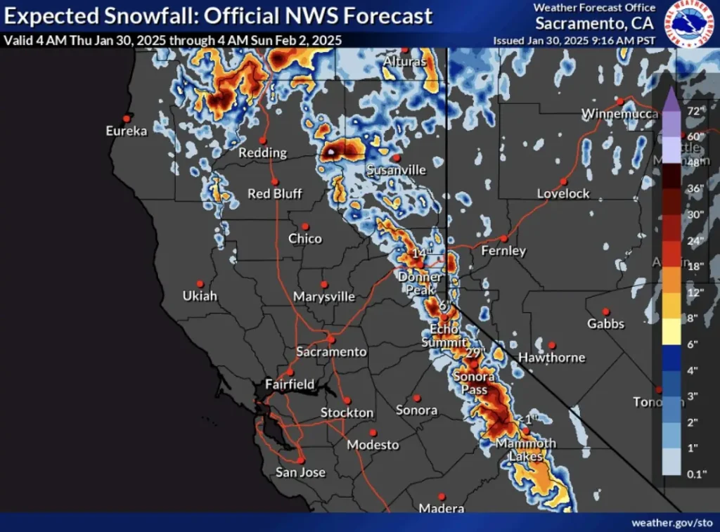
- Forecasts indicate that the Northern California Coast Ranges and the Sierra Nevada could receive between 180 and 380 mm (7 and 15 inches) of precipitation over the next seven days.
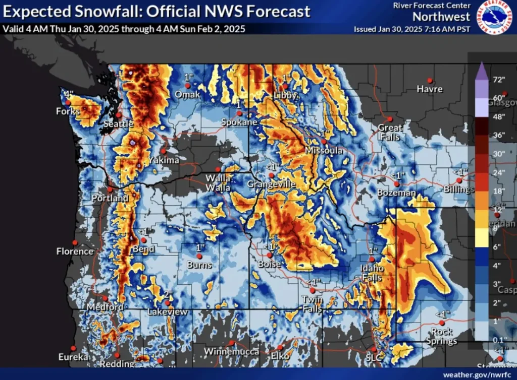
- Snowfall accumulations of more than 30 cm (12 inches) are expected in the highest elevations of the Sierra Nevada, while the Olympic Mountains and Cascades could receive between 30 and 91 cm (12 and 36 inches) of snow.
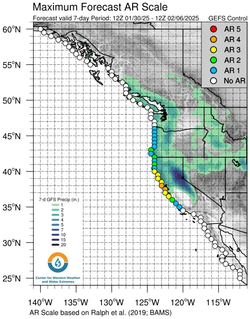
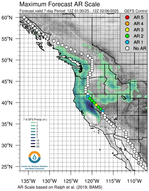
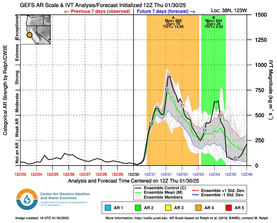
The first AR will make landfall late today (LT), January 30, bringing weak-to-moderate conditions to western Oregon and Northern California, according to the Center for Western Weather and Water Extremes (CW3E).
As the first AR moves south, a stronger AR with a robust tropical moisture export is forecast to approach the US West Coast and stall over Northern California. Forecast models differ on how the second AR will evolve after February 2, but it is expected to bring prolonged precipitation to the region.
The probability of AR 4 conditions (on the Ralph et al. 2019 AR Scale of 1 – 5) exceeds 50% in Marin County, with AR 3 conditions likely between Santa Cruz and Mendocino Counties.
The National Weather Service (NWS) forecasts 180 – 380 mm (7 – 15 inches) of precipitation over the next week in the Northern California Coast Ranges and Sierra Nevada, with some areas receiving more than 25% of their normal annual precipitation from this event.
Persistent heavy rainfall could result in flooding risks for parts of Northern California, including the Bay Area, Sacramento Valley, and Sierra Nevada foothills.
The Weather Prediction Center has issued a slight risk (≥ 15%) of excessive rainfall for these areas between February 1 and 4.
Freezing levels will remain quite high in California, but over 30 cm (12 inches) of snowfall is expected in the highest elevations of the Sierra Nevada by the morning of February 2.
In the Pacific Northwest, 30 – 91 cm (12 – 36 inches) of snow is forecast for the Olympic Mountains and Cascades, leading to moderate-to-major winter storm impacts.
Residents are urged to stay informed by following official weather forecasts and alerts from the National Weather Service and local authorities. Avoid flooded areas, prepare for possible power outages, and drive with caution in affected regions. Those in flood-prone areas should have an emergency plan in place and be ready to evacuate if necessary.
References:
1 Quick Look at Major Atmospheric River Event in California – CW3E – January 30, 2025
I'm a dedicated researcher, journalist, and editor at The Watchers. With over 20 years of experience in the media industry, I specialize in hard science news, focusing on extreme weather, seismic and volcanic activity, space weather, and astronomy, including near-Earth objects and planetary defense strategies. You can reach me at teo /at/ watchers.news.
Commenting rules and guidelines
We value the thoughts and opinions of our readers and welcome healthy discussions on our website. In order to maintain a respectful and positive community, we ask that all commenters follow these rules.