
Tropical Cyclone “Jasper” makes landfall over the Far North Queensland coast, Australia
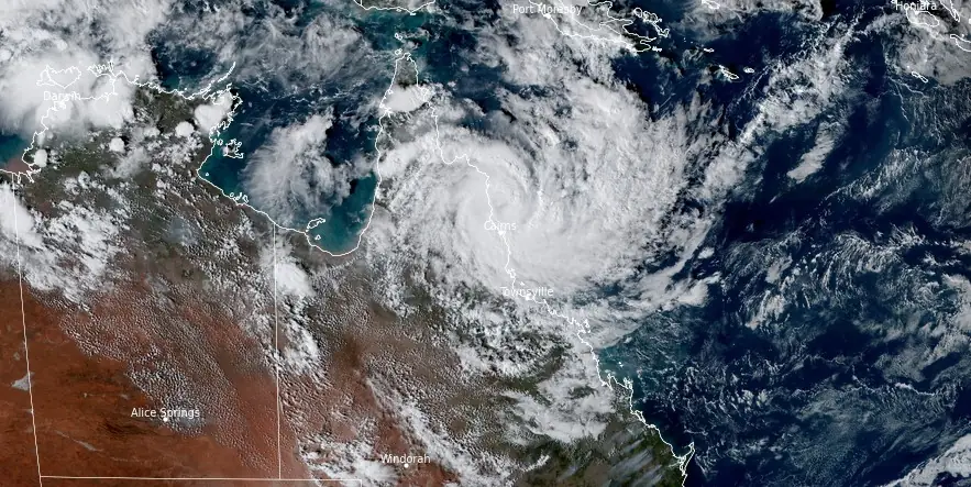
Featured image: Tropical Cyclone "Jasper" at 06:30 UTC on December 13, 2023. Credit: JMA/Himawari-9, RAMMB/CIRA, The Watchers
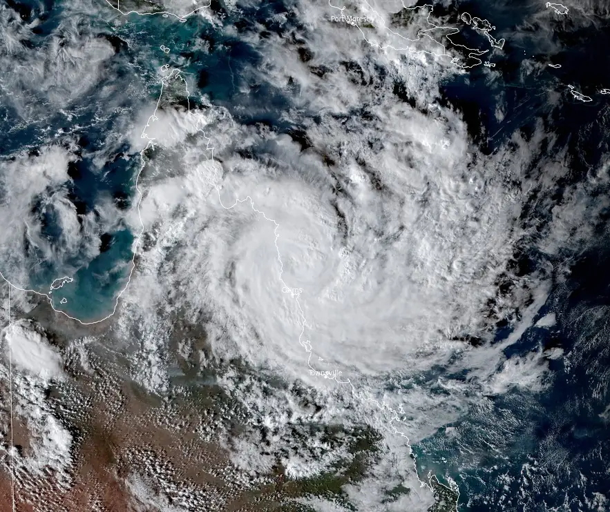
Category 2 Tropical Cyclone “Jasper” made landfall over the Far North Queensland coast, Australia at around 07:00 UTC on December 13, 2023, with sustained winds near the center of 100 km/h (62 mph) and gusts to 140 km/h (85 mph).
“Tropical Cyclone Jasper, category 2 cyclone is making landfall over the Far North Queensland coast,” the Australian Bureau of Meteorology said at 18:06 AEST (07:06 UTC) today.
“Damaging to destructive wind gusts are occurring on the Far North Queensland coast as Jasper slowly crosses the coast in the vicinity of Wajal Wajal, just north of Cape Tribulation. Jasper is expected to weaken as it moves inland tonight.”
There is a moderate chance that the cyclone could redevelop in the Gulf of Carpentaria during the weekend or closer to the eastern Top End coast early next week.
There is also a chance that it may even move closer to the northern or western Top End by mid-next week, where there is a moderate chance of it redeveloping into a tropical cyclone.
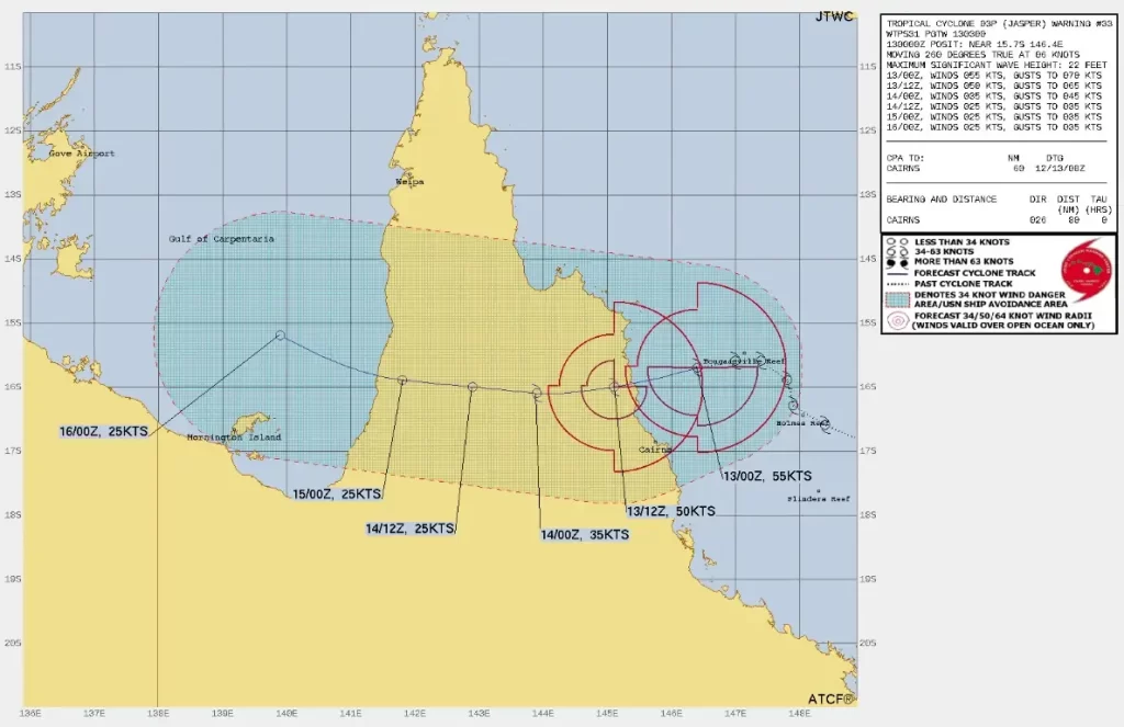
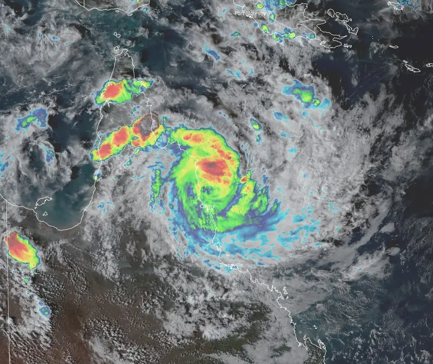
Locally intense rainfall which may lead to dangerous and life-threatening flash flooding is forecast to develop from tonight along the coast and adjacent ranges between Cooktown and Port Douglas as well as areas near the center of Jasper. Isolated six-hourly rainfall totals between 250 to 300 mm (9.8 – 11.8 inches) are likely with 24-hourly totals between 400 to 500 mm (15.7 – 19.7 inches) possible.
Heavy rainfall which may lead to flash flooding is also forecast to develop between Cape Flattery and Ingham. Six-hourly rainfall totals between 100 to 150 mm (4 – 6 inches) are likely, with isolated falls up to 250 mm (10 inches) along the coast and adjacent ranges. 24-hour rainfall totals between 150 to 250 mm (6 – 10 inches) are likely, with isolated falls up to 350 mm (14 inches) possible.
Destructive wind gusts of up to 140 km/h (87 mph) are expected near and to the south of the track between Wujal Wujal and Port Douglas.
Gales with damaging wind gusts of up to 120 km/h (75 mph) are occurring along the coast south of Cooktown, including Cairns.
Damaging wind gusts are expected to extend further along the coast and adjacent ranges between Cooktown and Innisfail in the evening. Damaging wind gusts to 90 km/h (55 mph) are possible further south to Cardwell and north to Cape Melville, and then extending inland to the Atherton Tablelands and as far as Palmerville and Chillagoe tonight, after the cyclone has crossed the coast.
Along the track of the cyclone, the damaging wind gusts may temporarily ease to lighter winds as the eye of the cyclone passes over.
A flood warning is current for the North Tropical Coast, parts of the Cape York Peninsula and Gulf Country.
A storm tide is expected along the north Queensland coast on the high tide during Thursday morning with total waters generally expected to approach or marginally exceed the Highest Astronomical Tide level. Large waves may produce minor flooding along the foreshore.
References:
1 Tropical Cyclone “Jasper” – BOM – December 13, 2023 at 05:04 AEST
2 Tropical cyclone forecast – Tropical Cyclone Jasper 02U – BOM – December 13, 2023 at 06:06 AEST
I'm a dedicated researcher, journalist, and editor at The Watchers. With over 20 years of experience in the media industry, I specialize in hard science news, focusing on extreme weather, seismic and volcanic activity, space weather, and astronomy, including near-Earth objects and planetary defense strategies. You can reach me at teo /at/ watchers.news.
Commenting rules and guidelines
We value the thoughts and opinions of our readers and welcome healthy discussions on our website. In order to maintain a respectful and positive community, we ask that all commenters follow these rules.