
Another powerful western system will bring heavy snow to low elevations across the West, with blizzard conditions in the Sierra Nevada mountains, U.S.
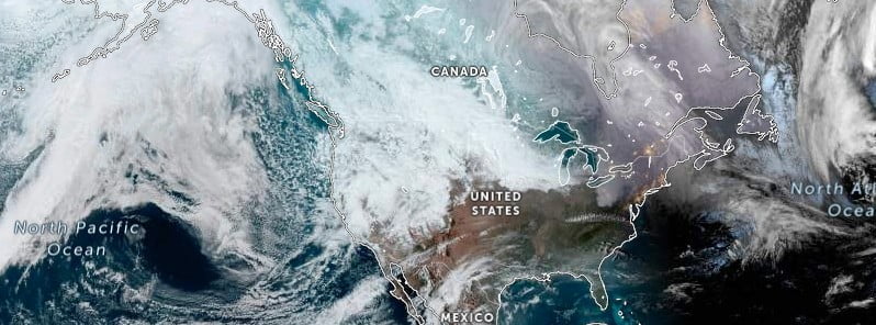
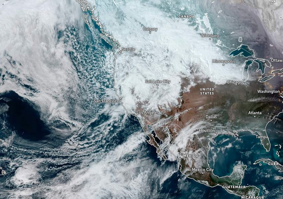
Image credit: NOAA/NESDIS/STAR, Zoom Earth, The Watchers. Acquired at 22:10 UTC on February 28, 2023
The western United States is bracing for yet another powerful winter storm system, with heavy snow predicted for low elevations and blizzard conditions in the Sierra Nevada Mountains. The Upper Midwest is also set to see heavy snowfall from a clipper system, while the Northeast is expected to experience heavy snow from a system moving through the area. Southern and interior Alaska will also face heavy snow and blizzard conditions from two powerful systems.
- The winter storm system currently impacting the Sierra Nevada and Southern California ranges is expected to continue through March 1 before moving over the Southwest U.S. on Wednesday and Thursday.
- The Sierra Nevada and Southern California ranges are predicted to see snowfall rates of 5 to 8 cm (2 to 3 inches) per hour, while blizzard conditions could make travel impossible.
- Meanwhile, heavy snow with rates of 2.5 to 5 cm (1 to 2 inches) per hour is predicted for the high terrain of the southern Great Basin and southern Rockies through Thursday, with hazardous travel conditions expected. Some mountain ranges may even see avalanches.
- If you plan on traveling through mountain passes in California or the Southwest until Wednesday, be prepared for rapidly changing conditions and have winter driving supplies on hand.
The National Weather Service has warned that hazardous weather conditions will affect nearly all of the Lower 48 over the next few days.
Another strong storm is set to move southeastward along the west coast, affecting the Southwest on Wednesday, March 1, and Thursday before heading eastward into the Southern High Plains by Thursday evening.
The storm is expected to bring up to 61 cm (24 inches) of snow through the Sierra and into Southern California, with record-cold high temperatures expected to be as much as 11 to 14 °C (20 to 25 °F) below average on Wednesday.
On Thursday, the storm will move into the Southern High Plains, bringing heavy snow to northeast New Mexico, southeast Colorado, and western Kansas. Critical fire weather conditions are also expected across southeast New Mexico into Southwest to West Texas, where windy and dry conditions are predicted.
On the other hand, record warmth is expected from the Gulf Coast northeastward into the Ohio Valley on Wednesday, with high temperatures predicted to be 11 to 16 °C (20 to 30 °F) above average. However, the west-to-east oriented frontal boundary between the much above-average temperatures across the southern tier of the nation and cooler temperatures farther to the north will become the focus for heavy rains, isolated flash flooding, and severe thunderstorms from portions of the Lower Mississippi Valley into the Tennessee Valley late Wednesday into Thursday.
The storm system that brought widespread heavy snows across the Northeast over the past 24 hours is expected to wind down on Tuesday night as it moves through New England and into the Canadian Maritimes.
A new area of heavy snow potential will then develop upstream across the Northern Plains from Tuesday afternoon into Tuesday night, spreading eastward into the Upper Mississippi Valley and Upper Lakes region on Wednesday.
Snowfall accumulation of 10 to 20 cm (4 to 8 inches) is predicted from southern North Dakota, far northern South Dakota, across central to northern Minnesota, northern Wisconsin, and across the U.P. of Michigan. Northern New England may also see additional snow accumulation of 10+ cm (4+ inches).
References:
1 Short Range Forecast Discussion – NWS Weather Prediction Center College Park MD – 235 PM EST Tue Feb 28 2023
The Watchers team and our contributors bring the latest on extreme weather, earthquakes, volcanic eruptions, space weather, and all things science. We're all about making sense of the natural world and keeping you informed on what’s happening. Got a tip or a question? Hit us up using the form at newstips!
Commenting rules and guidelines
We value the thoughts and opinions of our readers and welcome healthy discussions on our website. In order to maintain a respectful and positive community, we ask that all commenters follow these rules.