
Major winter storm to bring heavy snow across the United States
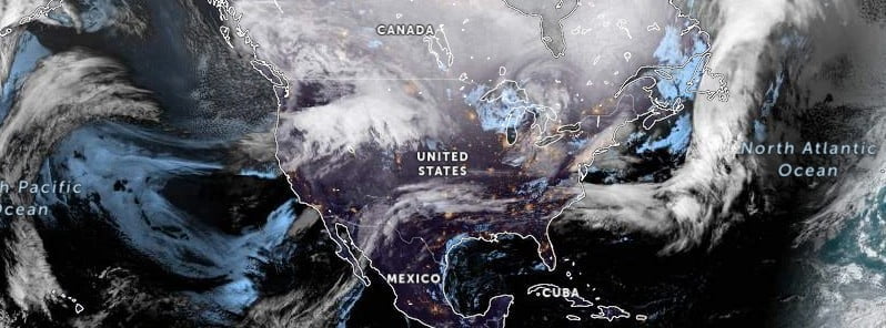
Image credit: NOAA/GOES-East and West, Zoom.Earth, The Watchers
A major winter storm is set to bring heavy snowfall from the West Coast to the Northeast over the next few days. The National Weather Service’s Weather Prediction Center has warned of multiple hazards across the country, including widespread heavy snow, blizzard conditions, a zone of sleet and freezing rain, high winds, severe thunderstorms and record low and high temperatures.
- An energetic, amplifying upper-level pattern will bring numerous weather hazards and significantly anomalous temperatures coast-to-coast this week with almost all of the country experiencing some form of notable weather.
- Heavy snow rates of 2.5 – 5 cm (1-2 inches) per hour and gusty winds producing areas of blowing snow will lead to treacherous, potentially impossible travel conditions and possible power outages in some areas.
- A heavy wintry mix of snow, sleet, and freezing rain is expected along the southern end of the snow axis across the Upper Mississippi Valley and into the Lower Great Lakes. Ice accumulations of 0.25 – 0.64 cm (0.1 – 0.25 inches), locally higher, are possible.
The storm is expected to spread south and eastward across the West and the northern tier of the country on Tuesday and Wednesday, February 21 and 22, fueled by ample moisture from the Pacific and the Gulf. Snow totals of 30 – 60 cm (12 – 24 inches), locally higher, are expected for most of the mountain ranges across the West. The heavy accumulating snow should be limited to higher elevations in the mountains, with a lighter rain and snow mix for the interior valleys.
In addition to the snow, the storm will also bring widespread, very strong, gusty winds of 80 – 97 km/h (50 – 60 mph), locally as high as 130 km/h (80 mph) in favorable terrain locations. These winds will lead to blizzard conditions for portions of the Northern/Central Rockies and High Plains, areas of blowing dust, and an elevated risk of fire weather on Tuesday in the Southern High Plains.
An axis of heavy snow is expected to expand eastward across the Northern Plains and into the Upper Midwest/Great Lakes and Interior Northeast/New England on Tuesday and Wednesday. There is a high probability of snow totals over 20 cm (8 inches) from South Dakota eastward through southern Minnesota, northern Wisconsin, and the Upper Peninsula/northern Lower Peninsula of Michigan. Heavy snow rates of 2.5 – 5 cm (1-2 inches) per hour and gusty winds producing areas of blowing snow will lead to treacherous, potentially impossible travel conditions and possible power outages.
Heavier snow totals of 20 – 30 cm (8 – 12 inches) are also likely for higher elevations in the Interior Northeast, including the Adirondacks and the Green and White Mountains, with lighter accumulations of around 5 – 10 cm (2 – 4 inches) at lower elevations across Upstate New York and central New England. A heavy wintry mix of snow, sleet, and freezing rain is expected along the southern end of the snow axis across the Upper Mississippi Valley and into the Lower Great Lakes. Ice accumulations of 0.25 – 0.64 cm (0.1 – 0.25 inches), locally higher, are possible.
Widespread showers and thunderstorms are forecast to develop across the Midwest and Plains late Tuesday night into Wednesday, with intense low-level and upper-level dynamics as well as increased moisture spreading northward from the Gulf. There is a Slight Risk of Excessive Rainfall from northeast Missouri into northern Illinois, northern Indiana, and southern Michigan, where there may be a few scattered instances of flash flooding. Strong low-level and deep-layer shear and sufficient CAPE values have also prompted a Slight Risk of severe weather from central Oklahoma northeastward through central Missouri, for the chance of some damaging winds.
Beyond the numerous weather hazards expected this week, another major story will be the significantly anomalous warm temperatures for February over the East and cold temperatures over the West. Many record-tying/breaking highs are possible, particularly for the Ohio/Tennessee Valleys, where temperatures will be around 21+ °C (70 °F), and closer to the Gulf Coast/Florida, where highs will be up to 26 °C (80 °F) or more.
Many record-tying/breaking minimum high temperatures will also be possible over the West, with highs from -1 to 4 °C (30 – 40 °F) for the Pacific Northwest and around 10 °C (50 °F) for California. Bitterly cold wind chills from -28 to -34 °C (-20 to -30 °F) are expected for the Northern Plains. These highly anomalous temperatures are forecast to continue later into the week.
Residents in the affected areas are advised to prepare for potential power outages, travel disruptions, and hazardous driving conditions. It is advisable to avoid all non-essential travel during this storm, and to monitor the latest weather forecasts and warnings from local authorities.
References:
1 Short Range Forecast Discussion – NWS Weather Prediction Center College Park MD – 310 AM EST Tue Feb 21 2023
I'm a dedicated researcher, journalist, and editor at The Watchers. With over 20 years of experience in the media industry, I specialize in hard science news, focusing on extreme weather, seismic and volcanic activity, space weather, and astronomy, including near-Earth objects and planetary defense strategies. You can reach me at teo /at/ watchers.news.
Commenting rules and guidelines
We value the thoughts and opinions of our readers and welcome healthy discussions on our website. In order to maintain a respectful and positive community, we ask that all commenters follow these rules.