
Multi-day severe weather episode expected late this week into early next week, U.S.
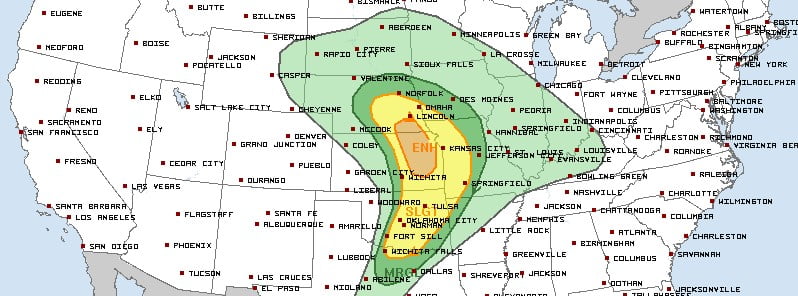
Image credit: NWS/SPC
A multi-day severe weather episode is expected across the central U.S. late this week into early next week. Damaging gusts, large hail, and tornadoes are all a concern.
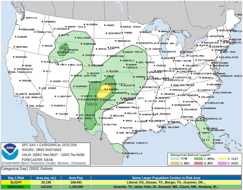
Isolated severe wind gusts and some severe hail will be possible this afternoon and evening, April 27, 2022, from western Kansas and southeast Colorado southward to the Trans-Pecos of Texas, and also across eastern Idaho and western Wyoming, the NWS Storm Prediction Center warns.
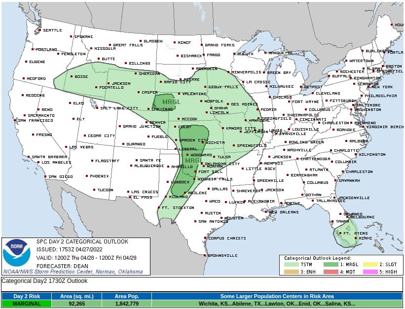
A severe thunderstorm or two may develop late Thursday afternoon or evening, April 28 from northwest Texas into western Oklahoma and western/central Kansas. Other isolated severe storms are possible across western Nebraska later Thursday night, with large hail and strong wind gusts the primary threats.
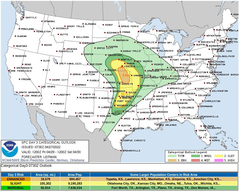
The worst is expected on Friday, April 29, when severe thunderstorms capable of all hazards are possible across portions of the southern and central Plains into the lower Missouri Valley.
Meanwhile, a coastal storm is expected to produce rain and elevation snow across northern New England through the end of the week.
Northern Maine in particular is expected to see the most impacts associated with snowfall, as accumulations add up to around 10 – 20 cm (4 to 8 inches) with locally higher amounts in the highest elevations, leading to minor potential winter storm impacts (level 2/5) per the WPC WSSI.
This coastal storm will be slow to exit as the associated upper-trough closes off and gets stuck beneath a blocking high near Greenland.
Accordingly, breezy northwesterly winds and snow showers will linger through at least late Friday over northern New England.
The chilly northwesterly flow will also aid in much of the Northeast and Mid-Atlantic experiencing below-average temperatures over the next several days. In fact, below-average temperatures will continue to stretch into the Midwest and northern Plains thanks to a strong high pressure system building southward from Ontario.
I'm a dedicated researcher, journalist, and editor at The Watchers. With over 20 years of experience in the media industry, I specialize in hard science news, focusing on extreme weather, seismic and volcanic activity, space weather, and astronomy, including near-Earth objects and planetary defense strategies. You can reach me at teo /at/ watchers.news.
Commenting rules and guidelines
We value the thoughts and opinions of our readers and welcome healthy discussions on our website. In order to maintain a respectful and positive community, we ask that all commenters follow these rules.