
Tropical cyclone developing near the coast of Queensland, Australia
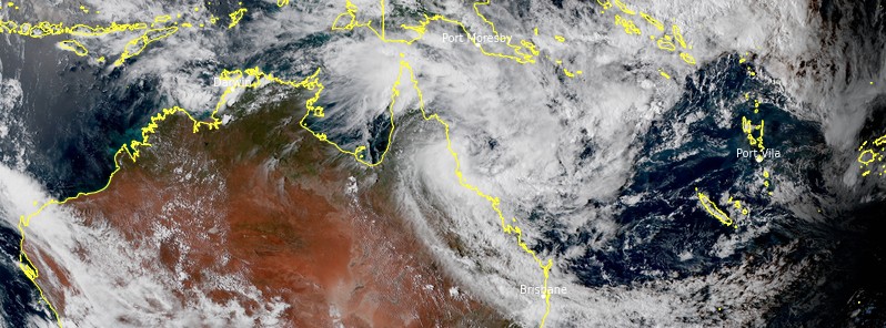
Featured image: Tropical low near the north tropical coast of Queensland, Australia at 06:00 UTC on March 1, 2021. Credit: JMA/Himawari-8, RAMMB/CIRA, TW
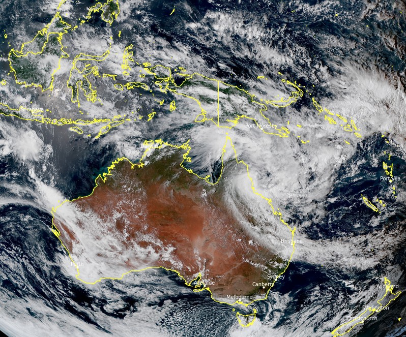
A near-stationary tropical low positioned off the north Queensland coast, Australia is expected to intensify into a tropical cyclone on Tuesday morning (LT), March 2, 2021, and be named Niran.
At 08:00 UTC on March 1, the center of the tropical low was located about 100 km (62 miles) ENE of Cairns and 130 km (81 miles) NNE of Innisfail.
The storm had sustained winds near the center of 65 km/h (40 mph), gusts to 110 km/h (68 mph), and was moving NW at 13 km/h (8 mph), the Australian Bureau of Meteorology (BOM) said in a technical bulletin released 08:43 UTC.
"The cyclone is expected to remain fairly slow-moving at first, and although it's not forecast to make landfall, it is expected to bring hazardous conditions to coastal areas," BOM meteorologists said.
Tropical low near the north tropical coast of Queensland, Australia at 06:00 UTC on March 1, 2021. Credit: JMA/Himawari-8, RAMMB/CIRA, TW
Heavy rainfall, flash flooding, damaging winds, and abnormally high tides are all a risk and a cyclone Watch is current from Cape Flattery to Lucinda.
"It's important for people within the affected region to start activating their cyclone plans now," BOM said.
The amount of rainfall and potential flooding is highly dependent to the movement and intensity of the system, however, widespread daily totals of 50 – 100 mm (2 – 4 inches) are expected right along the northern Queensland coast, with isolated daily totals above 200 mm (7.9 inches).
Abnormally high tides and large waves may cause flooding near the foreshore. People likely to be affected should take measures to protect their property as much as possible and be prepared to help their neighbors.
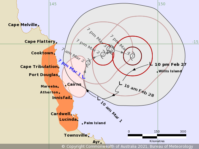
The low is expected to gradually intensify to tropical cyclone strength tonight or into early Tuesday, March 2.
The coastal crossing is not expected, however, the system is likely to continue to cause gales about the coastal and island communities tonight and on Tuesday.
I'm a dedicated researcher, journalist, and editor at The Watchers. With over 20 years of experience in the media industry, I specialize in hard science news, focusing on extreme weather, seismic and volcanic activity, space weather, and astronomy, including near-Earth objects and planetary defense strategies. You can reach me at teo /at/ watchers.news.
Commenting rules and guidelines
We value the thoughts and opinions of our readers and welcome healthy discussions on our website. In order to maintain a respectful and positive community, we ask that all commenters follow these rules.