
Elevated activity at Raung volcano, Indonesia

Featured image: Raung volcano on February 9, 2021. Credit: Copernicus EU/Sentinel-2, Pierre Markuse
Eruption at Raung volcano continues at elevated levels, with several strong explosions ejecting ash up to 5.5 km (18 000 feet) above sea level over the past 3 days.
Raung Volcano Observatory said non-harmonic tremors are present at the volcano since January 20, when the Alert Level was raised to 2. The tremor is followed by deep volcanic earthquakes, accompanied by changes in the height of the ash and gas column, and its color.
The public and visitors/tourists are advised to stay away 2 km (1.2 miles) from the crater.
The last VONA issued by the observatory was on February 10 when volcanic ash reached up to 5.3 km (17 500 feet) a.s.l. or about 2 km (1.2 miles) above the summit.
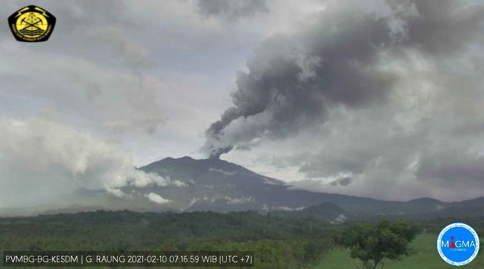
Image credit: PVMBG
PVMBG reported that daily gray ash plumes rose as high as 1 km (3.3 feet) above Raung’s summit and drifted S and E from February 3 to 6.
Ash plumes rose 1.2 – 2 km (3 900 – 6 500 feet) above the summit from February 7 to 9, drifting SE and E.
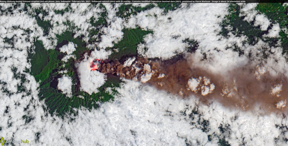
Raung volcano on February 9, 2021. Credit: Copernicus EU/Sentinel-2, Pierre Markuse
Incandescence from the crater was often seen reflected in the emissions, and rumbling and roaring was sometimes heard.
This episode started at 22:18 UTC on January 20, prompting authorities to raise the Alert Level to 2 and the Aviation Color Code to Orange.
At 00:30 UTC on January 21, ash was rising about 3.7 km (12 000 feet) above sea level and drifting east. This is some 500 m (1 640 feet) from the top of the volcano.
The Aviation Color Code was raised to Orange and the Alert Level to 2 (on a scale of 1 – 4). It was on level 1 since November 27, 2020.
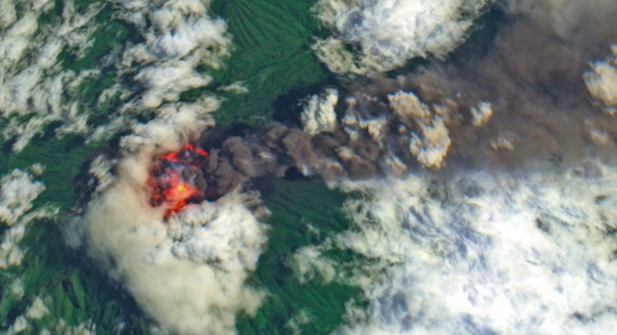
Raung volcano on February 9, 2021. Credit: Copernicus EU/Sentinel-2, Antonio Vecoli, ADAM Platform
Geological summary
Raung, one of Java’s most active volcanoes, is a massive stratovolcano in easternmost Java that was constructed SW of the rim of Ijen caldera.
The unvegetated summit is truncated by a dramatic steep-walled, 2 km (1.2 miles) wide caldera that has been the site of frequent historical eruptions.
A prehistoric collapse of Gunung Gadung on the W flank produced a large debris avalanche that traveled 79 km (49 miles), reaching nearly to the Indian Ocean.
Raung contains several centers constructed along a NE-SW line, with Gunung Suket and Gunung Gadung stratovolcanoes being located to the NE and W, respectively. (GVP)
I'm a dedicated researcher, journalist, and editor at The Watchers. With over 20 years of experience in the media industry, I specialize in hard science news, focusing on extreme weather, seismic and volcanic activity, space weather, and astronomy, including near-Earth objects and planetary defense strategies. You can reach me at teo /at/ watchers.news.
Commenting rules and guidelines
We value the thoughts and opinions of our readers and welcome healthy discussions on our website. In order to maintain a respectful and positive community, we ask that all commenters follow these rules.