
Powerful Nor’easter knocks out power to more than 250 000 in New England, U.S.
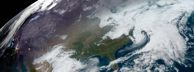
Image credit: NOAA/GOES-East, RAMMB/CIRA. Acquired 15:00 UTC on December 5.
More than 250 000 customers were left without power in New England as the season's first Nor'easter rolled through the northeast U.S. over the weekend, December 5 and 6. Strong winds and heavy snow hit several areas, with inland Maine, Massachusetts, and New Hampshire receiving more than 0.3 m (1 foot) of snow.
Maine felt the brunt of the storm as more than 230 000 customers were affected at some point this weekend, the Central Maine Power reported. Workers reported damage from fallen trees and limbs, hampering repairs, the company added.
According to poweroutage.us, as of Monday morning, December 7, more than 83 000 people are still affected by outages in Maine.
The highest snowfall total recorded was 0.5 m (1.5 feet) in Carrabassett Valley, Maine- a town of fewer than 1 000 residents. In Cape Cod, peak wind gusts reached more than 117 km/h (73 mph).
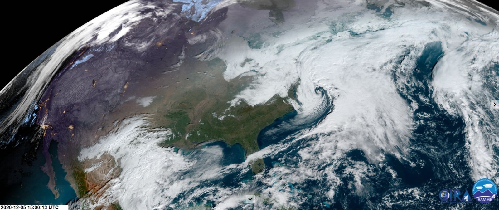
Image credit: NOAA/GOES-East, RAMMB/CIRA. Acquired 15:00 UTC on December 5.
On Saturday, the National Weather Service (NWS) warned that the combination of strong winds and heavy snowfall from the powerful storm would result in dangerous travel conditions and whiteout visibilities.
"A lot of the storms' precipitation initially fell as heavy rain but it quickly changed to snow once the cold air ushered in behind it. Strong winds accompanied the heavy, wet snow that fell," said meteorologist Derek Van Dam.
"Not an ideal situation considering the treacherous conditions that have been left in the storms' wake." He continued, "This nor'easter was a significant snow, wind, and rain event but could have been debilitating if temperatures were just a few degrees cooler at the start of the storm."
Observed snowfall from the December 5-6, 2020 nor'easter. pic.twitter.com/PTi6Jn23Gz
— NWS Eastern Region (@NWSEastern) December 6, 2020
Here's a look at snowfall and wind gust reports from the Nor'easter that impacted New England yesterday into this morning. Over a foot of snow fell across portions of Massachusetts, New Hampshire, and Maine. A wind gust of 73 mph was measured on Cape Cod. pic.twitter.com/fc0UxOsaI1
— NWS Weather Prediction Center (@NWSWPC) December 6, 2020
The first nor’easter of the season brought heavy snow and gusty winds across parts of New England.
Footage captured heavy snowfall covering roadways and reducing visibility for motorists in New Hampshire and Connecticut. https://t.co/Rao3LvjtOb pic.twitter.com/HhsNKtuvpa
— ABC News (@ABC) December 6, 2020
The NWS forecasts that a potent upper level through is forcing an area of low pressure to form off the Southeast coast on Monday morning. "This quick-moving storm system is making for a damp start to the week from the Carolinas to Florida."
"East of the Mississippi River, a more winter-like temperature regime is entrenched along the East Coast." NWS added, "Temperatures moderate to more seasonal levels up and down the East Coast on Wednesday (December 9)."
Blizzard conditions are forecast for a portion of southwest Alaska later today into tonight and flash flooding remains possible in the northern inner channels.
Commenting rules and guidelines
We value the thoughts and opinions of our readers and welcome healthy discussions on our website. In order to maintain a respectful and positive community, we ask that all commenters follow these rules.