
Tropical Storm “Gamma” to make landfall in Yucatan Peninsula, Mexico
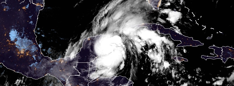
Featured image: Tropical Storm "Gamma" at 06:40 UTC on October 3, 2020. Credit: NOAA/GOES-16, RAMMB/CIRA
Tropical Storm "Gamma" formed at 00:00 UTC on October 3, 2020, as the 24th named storm of the 2020 Atlantic hurricane season. Gamma is the earliest forming 24th named Atlantic storm, breaking the previous record set on October 27, 2005. The biggest threat from this large and slow-moving storm is the potential for heavy rainfall and flooding, particularly near and over mountainous terrain.
- Gamma is expected to produce heavy rainfall that could result in life-threatening flash flooding over portions of the Yucatan Peninsula, far western Cuba and well away from the center in the Mexican states of Campeche, Tabasco, and northern Chiapas, NHC warns.
- Tropical storm conditions are expected in portions of the Yucatan Peninsula on Saturday, where a Tropical Storm Warning is in effect.
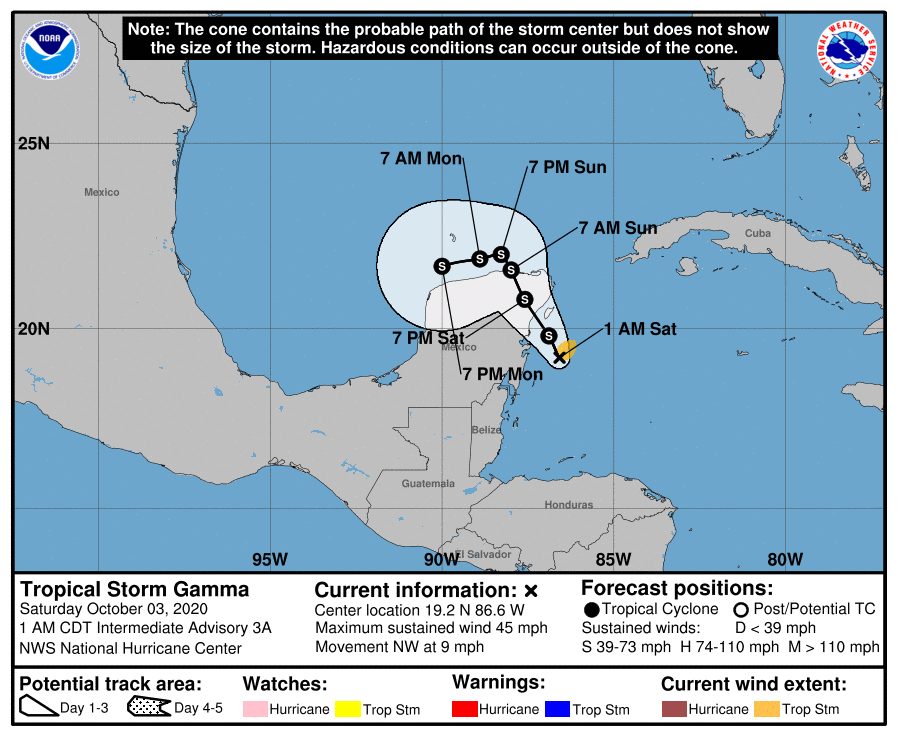
Gamma continued strengthening as it moved closer to the Yucatan Peninsula overnight (UTC). At 06:00 UTC on October 3, its center was located about 135 km (85 miles) SSE of Cozumel, Mexico. The storm had maximum sustained winds of 70 km/h (45 mph) and minimum central pressure of 996 hPa. It was moving NW at 15 km/h (9 mph).
A Tropical Storm Warning is in effect for Punta Herrero to Cabo Catoche, Mexico, and a Tropical Storm Watch south of Punta Herrero to Puerto Costa Maya, Mexico and west of Cabo Catoche to Dzilam, Mexico.
NHC expects a slower NW motion during the next couple of days, followed by a turn to the W or WSW.
On the forecast track, the center of Gamma should be near the NE Yucatan Peninsula later today.
Additional strengthening is expected before the system moves inland over the NE Yucatan Peninsula later today (LT).
After landfall, slight weakening or little change in strength is expected.
Gamma is expected to exit into the Caribbean Sea on Sunday, October 4, turn W and move along the coast of the Yucatan Peninsula through Monday.
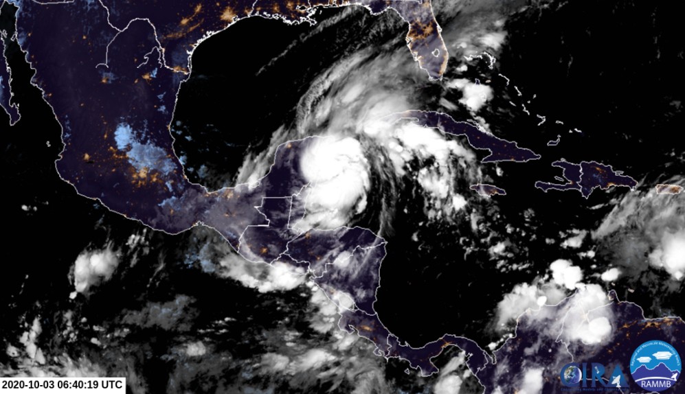
Tropical Storm "Gamma" at 06:40 UTC on October 3, 2020. Credit: NOAA/GOES-16, RAMMB/CIRA
"The tropical storm is expected to remain on the western periphery of a subtropical high during the next couple of days, and that should cause the storm to move slowly northwestward during that time period," NHC forecaster Cangialosi noted.
This track should take Gamma across the northern Yucatan Peninsula and perhaps over the extreme south-central Gulf of Mexico this weekend. By early next week, a mid-level ridge is expected to build to the north of the storm while another low pressure area is forecast to develop to the east of Gamma, Cangialosi said.
This change in the steering pattern is expected to cause the storm to make a sharp left turn toward the Bay of Campeche, but continue to move at a fairly slow forward speed.
Environmental conditions appear generally favorable for additional strengthening until the cyclone reaches the Yucatan Peninsula on Saturday, and the NHC intensity forecast shows a slightly higher landfall intensity there.
Once the system moves over the Yucatan Peninsula and the extreme southern Gulf of Mexico, the combination of land interaction, an increase in shear, and drier air should limit the amount of strengthening into next week.
I'm a dedicated researcher, journalist, and editor at The Watchers. With over 20 years of experience in the media industry, I specialize in hard science news, focusing on extreme weather, seismic and volcanic activity, space weather, and astronomy, including near-Earth objects and planetary defense strategies. You can reach me at teo /at/ watchers.news.
Commenting rules and guidelines
We value the thoughts and opinions of our readers and welcome healthy discussions on our website. In order to maintain a respectful and positive community, we ask that all commenters follow these rules.