
Significant storm system impacting the United States — heavy rain, snow and severe thunderstorms

Image credit: NWS
A significant storm system will bring a plethora of weather impacts to the central U.S. into Friday, March 20, 2020. Heavy snow and strong winds will cause hazardous travel from the Rockies to portions of the northern Plains. Heavy rainfall and severe thunderstorms will be common from the southern Plains to the Mississippi Valley and Midwest. Some of the storms could contain damaging winds, tornadoes, and hail, the National Weather Service (NWS) warns.
The first full day of Spring will offer both wintry and very warm weather conditions along either side of a strong front pressing southeastward across the Ohio Valley, Mid to Lower Mississippi Valley and into portions of the Northeast, NWS forecaster Oravec noted.
A heavy snow threat will be shifting northeastward Friday into portions of the Upper Great Lakes as the storm that brought Blizzard conditions to portions of the Central Rockies and Central Plains reorganizes early Friday across the Great Lakes into southeast Canada.
This system is fast-moving which should keep any heavy snow threat short-lived across the Upper Great Lakes Friday.
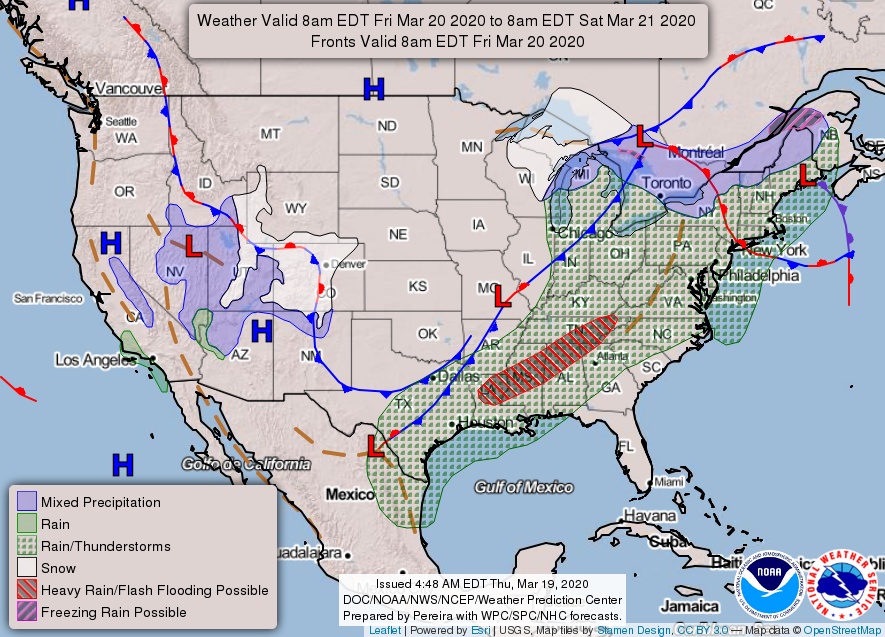
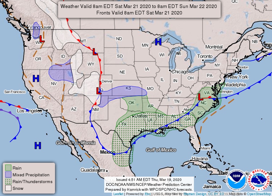

Image credit: NOAA/GOES-16. Acquired 07:20 UTC, March 20, 2020
The strong front pushing southeastward Friday across the Ohio Valley, Lower Mississippi Valley into portions of the northeast will be the dividing line between potentially record high temperatures from the Nations Capital southward into Florida and much below-average temperatures across the midsection of the nation.
High temperatures Friday will be 5 – 11 °C (10 to 20 °F) above average from the Mississippi River to the east coast and 5 – 11 °C (10 to 20 °F) below average through all of the Plains.
This cold air will be pressing eastward by the beginning of the weekend, bringing much cooler temperatures Saturday from New England into the Mid-Atlantic.
The strong frontal boundary will also be the focus for potentially heavy rains and flash flooding from east Texas into the Lower Mississippi Valley on Friday.
The combination of much above average moisture levels along this front and strong upper level forcing will support the heavy rain potential across these areas.
I'm a dedicated researcher, journalist, and editor at The Watchers. With over 20 years of experience in the media industry, I specialize in hard science news, focusing on extreme weather, seismic and volcanic activity, space weather, and astronomy, including near-Earth objects and planetary defense strategies. You can reach me at teo /at/ watchers.news.
Commenting rules and guidelines
We value the thoughts and opinions of our readers and welcome healthy discussions on our website. In order to maintain a respectful and positive community, we ask that all commenters follow these rules.