
Major multi-hazard storm forecast to impact the Southern Plains and Midwest this Friday, shifting to the East Coast over the weekend
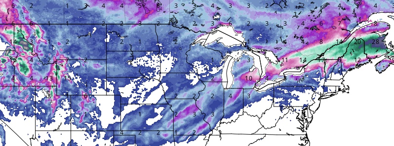
Image credit: GFS, TropicalTidbits
A major multi-hazard storm is forecast to impact the Southern Plains and Midwest this Friday, January 10, 2020, shifting to the East Coast by Sunday, January 12, NWS warns. Meanwhile, severe thunderstorms with damaging winds and tornadoes are forecast in parts of the South, heavy rain with a threat flooding is possible from the Mississippi Valley into the Ohio and Tennessee Valleys while snow and ice are possible from the Midwest to the Northeast.
"Residents and visitors will need to be extra vigilant, as many people may not think about severe weather in January," AccuWeather Meteorologist Ryan Adamson said ahead of the storm expected to affect as many as 11 states.
The threat zone will include major metro areas such as Dallas, Houston, New Orleans and Nashville, likely leading to travel headaches. AccuWeather meteorologists warn that some of the most hazardous weather could occur after dark.
A low pressure system is forecast to track across the Northern Rockies to Northern Plains today, moving into the Upper Midwest on Thursday, January 9, NWS forecaster Tate noted.
This will sweep a cold front across the western and central U.S. ahead of an upper-level trough.
Today, snow is likely for the Northwest, with some lower elevation rain continuing for the Pacific Northwest.
Tonight into Thursday, another surface low will move southeastward into California, helping cause additional lower elevation rain and higher elevation snow in much of the West.
Snowfall totals over the next two days could approach 30 cm (1 foot) in the Cascades, Northern Rockies, and into the Tetons/Wind River Mountains.
Avalanche Warnings are in place for northern Idaho and far northwestern Montana due to the recent high snow totals.
Lighter precipitation is forecast for California, the Great Basin, and the Southwest.
As the cold front progresses into the central U.S. on Thursday, showers and thunderstorms will begin ramping up ahead of the front as moisture returns from the Gulf of Mexico. Some locations from the Lower/Middle Mississippi Valley to the Ohio Valley could receive up to an inch of rain through Friday morning, but heavier precipitation will continue into the weekend.
The cold front will lead to cooler than average temperatures for the West Coast to the Rockies by Thursday.
Much warmer than average temperatures are forecast in the Central/Southern Plains and Middle/Lower Mississippi Valley both today and Thursday, and the Upper Midwest to Great Lakes region should warm up significantly on Thursday after a chilly day today.
Farther east, a frontal system is expected to pass through the Lower Great Lakes to Northeast, leading to some snow there today. Snow totals should remain light.
Elsewhere, fire weather conditions are expected to be elevated across portions of the Southern/Central Plains today and Thursday with gusty winds and dry conditions.
I'm a dedicated researcher, journalist, and editor at The Watchers. With over 20 years of experience in the media industry, I specialize in hard science news, focusing on extreme weather, seismic and volcanic activity, space weather, and astronomy, including near-Earth objects and planetary defense strategies. You can reach me at teo /at/ watchers.news.
Commenting rules and guidelines
We value the thoughts and opinions of our readers and welcome healthy discussions on our website. In order to maintain a respectful and positive community, we ask that all commenters follow these rules.