
Powerful winter storm in the Four Corners will move across the Plains to the Upper Midwest this weekend
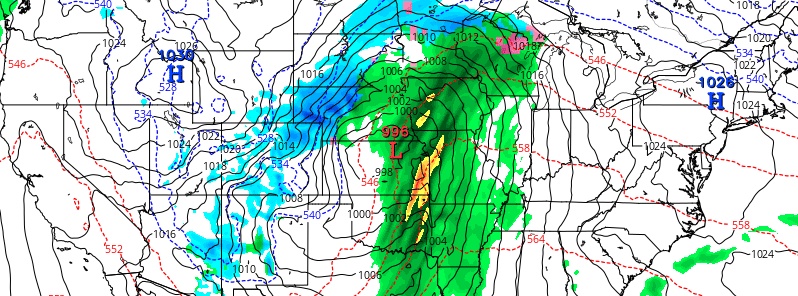
Image credit: GFS, TropicalTidbits
A potent winter storm will swing from the Four Corners Friday, December 27, 2019, across the Central Plains to the Upper Midwest this weekend. Areas of heavy snow, blowing snow and freezing rain are forecast on the cold side of the storm. On the warm side, isolated severe thunderstorms may occur Saturday across parts of east Texas into the lower Mississippi Valley. Freezing rain is also possible Friday in New England.
"A potent shortwave trough situated over the Desert Southwest Friday morning will support a surface low pressure system that will track eastward to the western High Plains by Saturday morning," NWS forecaster Hamrick noted.
The low is expected to develop further as it lifts towards the northeast through early Sunday and become a powerful winter storm from eastern Colorado to Minnesota.
Winter storm watches are now in effect across these areas, with the potential of 15 – 30 cm (6 to 12 inches) of windblown snow from northern Nebraska to southeastern North Dakota. Blizzard conditions are likely for some of these areas.
Heavy snow is also expected for the central Rockies.
Farther to the southeast, a corridor of freezing rain and sleet is expected from eastern Nebraska to northern Wisconsin.
The potential exists for significant ice accretion owing to a prolonged period of freezing rain, perhaps greater than a 6 mm (0.25 inches) of ice.
Mainly rain is expected farther east in the warm sector of the storm, with rainfall up to an inch possible across parts of the Midwest states with locally higher amounts.
I'm a dedicated researcher, journalist, and editor at The Watchers. With over 20 years of experience in the media industry, I specialize in hard science news, focusing on extreme weather, seismic and volcanic activity, space weather, and astronomy, including near-Earth objects and planetary defense strategies. You can reach me at teo /at/ watchers.news.
Commenting rules and guidelines
We value the thoughts and opinions of our readers and welcome healthy discussions on our website. In order to maintain a respectful and positive community, we ask that all commenters follow these rules.