
Rare snowfall in Los Angeles County, Las Vegas had 5th February snow day, first since 1949
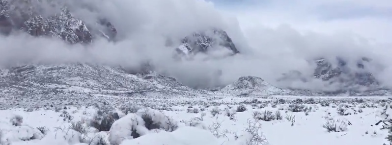
Featured image: Winter scenery just outside of Las Vegas, NV at Red Rock Canyon State Park. Credit: Aaron Ruppert via Reed Timmer/AccuWeather
A winter storm named Quiana by The Weather Channel dumped heavy snowfall on parts of the Southwest and brought rare wintry precipitation to parts of Los Angeles County. Snow fell on Las Vegas for the 5th time this month on February 21 – this was the first time since 1949 that Las Vegas saw 5 days of snow in February. The cold system is now shifting from the Southwest to the southern Rockies, creating blizzard conditions and causing travel problems over the mountains of Arizona and New Mexico. This vigorous storm will impact the Eastern two-thirds of the country this weekend.
Thunderstorms, snow, hail, sleet, and graupel were all in the mix across Southern California, NWS said.
While the storm caused big problems in northern Arizona, in Greater Los Angeles area the precipitation on February 21 was spotty but the snow did fall at elevations as low as 300 m (1 000 feet), according to NWS meteorologist Kristen Stewart.
In most cases the NWS was unable to confirm actual snow fell, Stewart said, adding it was likely hail or graupel.
Snowfall was confirmed in Satna Monica Mountains above Malibu, less than 8 km (5 miles) from the beach, and nearby communities such as Westlake Village, Thousand Oaks and Calabasas. In most cases, however, it lasted just a few minutes.
Here's the satellite view of our snow, sleet, hail storm. Center of the low is located near the CA/NV border. Shower activity will quickly diminish around sunset this evening. #CAwx #LArain pic.twitter.com/ySiPCl9uab
— NWS Los Angeles (@NWSLosAngeles) February 21, 2019
Snow in the mountains over Thousand Oaks today. pic.twitter.com/GVflnNR6Uc
— Tylar Nichols (@Tnichols_horn) February 21, 2019
As of 1250hrs, snow is falling at the 1500’ level in the Santa Monica Mountains above Malibu, CA. Roads will be slippery. Please drive safely! #LAweather @NWSLosAngeles @CHPWestValley @CaltransDist7 pic.twitter.com/jrgxlGg4Vr
— LACoFireAirOps (@LACoFireAirOps) February 21, 2019
Snow, or something like it, was even spotted in lower lying areas like Beverly Grove and Pasadena, according to the Curbed.
NWS meteorologist Keily Delerme said the agency has received anecdotal reports, but no official confirmation, of snowfall in the Pasadena area.
The last time it snowed in downtown Los Angeles was in January 1962, according to Los Angeles Public Library archives. During that storm, heavy snow fell in the mountains and high deserts and dusted parts of downtown and West Los Angeles. Most of the city snow, however, melted quickly, the Los Angeles Times reminded. Snow has dusted portions of Los Angeles County over the years, most recently in 2007, it said.
Snow-dusted cars rolling into Los Angeles following Antelope Valley snow overnight… #abc7eyewitness pic.twitter.com/c9e4dHyDrc
— Marc Cota-Robles (@abc7marccr) February 21, 2019
It just sleeted and started to snow in Los Angeles!!!! If you use this video give me credits. This video was taken on sunset blvd in West Hollywood! pic.twitter.com/ZDE3eLDE3k
— Laurie (@LaurieBea1) February 21, 2019
Graupel 25th east between Q and M Palmdale, 1403pm @NWSLosAngeles pic.twitter.com/wDGBdPRrqR
— MadMike (@MadStormChasing) February 21, 2019
#Snow in #ThousandOaks?! Students from Century HS, the medical department, and ESL all emerged from clasrooms to marvel at this unexpected phenomenon. #CAwx pic.twitter.com/3biHepXhQK
— Amy Buss (@USArmyVeteran17) February 21, 2019
"This is probably the coldest storm system I've seen in my time in California," NWS meteorologist David Sweet told the LA Times. "We've had cold mornings and freeze conditions, but I don't remember seeing anything quite this cold."
An unusually chilly storm system that originated in Alberta, Canada, was lingering over Nevada and had already blanketed Las Vegas with snow early Thursday, February 21, LA Times reports. Before daybreak, snow was falling in parts of the Southland, dusting Palmdale and the Lucerne Valley.
More than 15 cm (6 inches) of snow fell in some Las Vegas suburbs, according to the TWC.
At McCarran International Airport, measurable snow was reported for the first time since December 2008. By the time the snow stopped falling, the airport officially reported 2 cm (0.8 inches) of accumulations.
Thursday, February 21 was the 5th snow day in Las Vegas this month, the first time there have been that many snow days in any February since 1949, according to the NWS.
BREATH-TAKING winter scenery just outside of Las Vegas, NV at Red Rock Canyon State Park from storm chaser Aaron Ruppert @AJinOK @accuweather #nvwx pic.twitter.com/QYgqSqXiF5
— Reed Timmer (@ReedTimmerAccu) February 21, 2019
Due to the high likelihood of ice in the morning, we anticipate a late opening on Friday. The Scenic Drive will open as soon as it is safe for both staff and our visitors, so check back after 8am! pic.twitter.com/U9ulAbThVQ
— Red Rock Canyon LV (@RedRockCynLV) February 22, 2019
Clark County is urging drivers to be especially cautious Thursday night through 9 a.m. Friday as we continue to feel the effects of the winter storm. Drivers should be particularly cautious over bridges & overpasses, which may be coated with ice #Vegas #VegasSnow @ClarkCountyFD pic.twitter.com/y9EGSVFA8t
— Clark County Nevada (@ClarkCountyNV) February 22, 2019
The Clark County School District canceled all school and after-school activities planned for February 22 due to reports of potential freezing conditions on the roads that would be unsafe for school buses during the morning commute.
By early Thursday, afternoon, it was snowing across Southern California and winter weather had forced the closure of the Interstate 5 at Grapevine, a high pass along the key route between Los Angeles and San Francisco.
I-5 and Grapevine is now officially shutdown until further notice. #Grapevine #CHP #snow #District6 #OperationSnowflake pic.twitter.com/Dy0OZN8t2M
— CHP Central Division (@CHPCentralDiv) February 21, 2019
An upper-level trough is forecast to move eastward through the Four Corners region on Friday and into the Plains on Saturday, February 23, NWS forecaster Tate noted 07:58 UTC (02:58 EST), February 22.
At the surface, a low pressure system will slowly move across the Southwest on Friday and Friday night, then rapidly through the Plains and Middle Mississippi Valley on Saturday while strengthening.
The cold temperatures and the lift (rising motion of the air) in association with these features will create more winter weather.
Additional snow of 15 – 25 cm (6 to 10 inches) is forecast for higher elevations of the Mogollon Rim and the Southern and Central Rockies on Friday.
As the low tracks east and then northeast, winter weather will spread to the Northern/Central Plains on Friday and into the Upper Midwest by Friday night.
A swath of 15 – 20 cm (6 to 8 inches) of snow is forecast for the Central Plains, with higher totals of 20 – 30 cm (8 to 12 inches) in the Middle/Upper Mississippi Valley through Sunday morning, February 24.
Additionally, freezing rain is expected to accumulate in these areas, with over a tenth of an inch of ice currently forecast for parts of Iowa, Wisconsin, and northern Michigan. Hazardous travel conditions are likely.
By Sunday morning, the deep low pressure system will bring strong winds and heavy snow to the Upper Great Lakes region.
I'm a dedicated researcher, journalist, and editor at The Watchers. With over 20 years of experience in the media industry, I specialize in hard science news, focusing on extreme weather, seismic and volcanic activity, space weather, and astronomy, including near-Earth objects and planetary defense strategies. You can reach me at teo /at/ watchers.news.
Commenting rules and guidelines
We value the thoughts and opinions of our readers and welcome healthy discussions on our website. In order to maintain a respectful and positive community, we ask that all commenters follow these rules.