
Strombolian explosions resume at Villarrica volcano, Chile
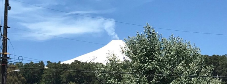
Image credit: Cecilia Metzger
Strombolian activity has resumed at Chilean Villarrica volcano on January 3, 2019. The Alert Level for the volcano remains at Green (1 of 4). Its last major eruption took place in 2015.
According to the Villarrica Volcano Observation Project (POVI), strombolian explosions have now resumed after 5 weeks of break.
Lava fountains are currently reaching up to 30 m (98 feet) above the crater rim and light ashfall was reported on the eastern flank of the volcano.
On July 24, 2018, POVI reported the vent in Villarrica’s summit crater was about 10 – 15 m (33 – 50 feet) in diameter and 90 – 100 m (300 – 330 feet) below the crater rim. Minor explosions and weak fumarolic emissions were noted.
On July 29, a break in the cloud cover revealed more significant incandescence emanating from the summit than in the previous few days, and the largest thermal anomaly since August 2015 was identified in satellite images on July 30. Ash and lapilli deposits on the E edge of the crater were also visible on July 30.
#VolcanVillarrica, jueves 3 de enero: luego de un periodo de pausa de 5 semanas, esta magrugada se reanudaron las explosiones estrombolianas. Las fuentes de lava se proyectan hasta unos 30 metros de altura sobre los bordes del cráter. Caída de piroclastos hacia el este. pic.twitter.com/gwmWCp8fgm
— P.O.V.I. (@povi_cl) January 4, 2019
#VolcanVillarrica – En exclusiva les mostramos la evolución del pozo de lava durante 2018. La lava ascendió en julio. Desde noviembre que no se observan cambios geomorfológicos. POVI agradece a sus fieles colaboradores y seguidores en las RRSS y les desea un prospero 2019! pic.twitter.com/AoxhKjE8wq
— P.O.V.I. (@povi_cl) December 29, 2018
Hola,buen día y también buenas ideas …slds musicales con señales del #Villarrica… imponente pic.twitter.com/HV7CTal5Tj
— Cecilia Metzger (@huethuet) January 4, 2019
Increased seismicity, crater incandescence and explosions increased at the volcano on February 6, 2015, leading to intense and continuous strombolian activity at the beginning of March. This was followed by ejection of a large volume of material, 1.5 km (0.93 miles) tall lava fountains and large lava flows. The eruptive plume rose up to 8 km (26 250 feet) above the crater and drifted 400 km (250 miles) ENE. The Alert Level was raised to Red (the highest level on a four-color scale).
According to ONEMI, about 3 600 people were evacuated from a 10 km (6.2 miles) radius of the volcano.
The exclusion zone around to volcano was reduced to 5 km (3.1 miles) on March 4. The Alert Level was lowered to Orange on March 6 and to Yellow on June 8.
Geological summary
Glacier-clad Villarrica, one of Chile's most active volcanoes, rises above the lake and town of the same name. It is the westernmost of three large stratovolcanoes that trend perpendicular to the Andean chain.
A 6-km-wide (3.7 miles) caldera formed during the late Pleistocene. A 2-km-wide (1.24 miles) caldera that formed about 3 500 years ago is located at the base of the presently active, dominantly basaltic to basaltic-andesitic cone at the NW margin of the Pleistocene caldera.
More than 30 scoria cones and fissure vents dot the flanks. Plinian eruptions and pyroclastic flows that have extended up to 20 km (12.4 miles) from the volcano were produced during the Holocene.
Lava flows up to 18 km (11.2 miles) long have issued from summit and flank vents.
Historical eruptions, documented since 1558, have consisted largely of mild-to-moderate explosive activity with occasional lava effusion. Glaciers cover 40 km2 (15.4 mi2) of the volcano, and lahars have damaged towns on its flanks. (GVP)
I'm a dedicated researcher, journalist, and editor at The Watchers. With over 20 years of experience in the media industry, I specialize in hard science news, focusing on extreme weather, seismic and volcanic activity, space weather, and astronomy, including near-Earth objects and planetary defense strategies. You can reach me at teo /at/ watchers.news.
Commenting rules and guidelines
We value the thoughts and opinions of our readers and welcome healthy discussions on our website. In order to maintain a respectful and positive community, we ask that all commenters follow these rules.