
Typhoon “Kong-rey” rapidly intensifies into 6th super typhoon of 2018 Pacific season

Featured image: Super Typhoon "Kong-rey" at 05:10 UTC on October 2, 2018. Credit: JMA/Himawari-8, RAMMB/CIRA
Typhoon "Kong-rey," known in the Philippines as Queenie, rapidly intensified into 6th super typhoon of the 2018 Pacific typhoon season.
Kong-rey attained typhoon status at 03:00 UTC on September 30. It continued strengthening and became a Category 4-equivalent super typhoon at 18:00 UTC on October 1. Early October 2, Kong-rey strengthened into a Category 5 super typhoon.
At 00:00 UTC on October 2, its center was located about 1 109 km (689 miles) south-southeast of Okinawa, Japan. Its 10-minute sustained winds were 195 km/h (120 mph), 1-minute sustained winds were 260 km/h (160 mph), with gusts up to 280 km/h (175 mph). The minimum barometric pressure was 915 hPa, and the system was moving west-northwestward at 17 km/h (10 mph).

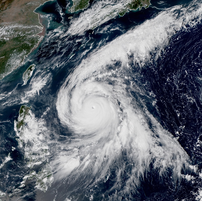

Super Typhoon "Kong-rey" at 05:10 UTC on October 2, 2018. Credit: JMA/Himawari-8, RAMMB/CIRA
Kong-rey's cloud tops have warmed slightly over the past six hours and the system has a 28 km (17 miles) wide eye.
"An eyewall replacement is possibly ongoing, based on a formative secondary eyewall and moat feature, which could lead to short-term weakening," JTWC forecasters said.

The system is forecast to maintain its current intensity until 12:00 UTC today and then begin to weaken. After 00:00 UTC on October 3, Kong-rey will move into an area of cooler sea surface temperatures and suboptimal ocean heat content that was churned up by the quasistationary period of Super Typhoon "Trami" several days ago, contributing to the weakening trend.
It's still too early to be sure where Kong-rey will head over the next five days, but JTWC's current track, placed on multimodel consensus, take the system near Okinawa early October 5 and toward Korean Peninsula on October 7.

Teo Blašković founded The Watchers in 2011 and edited it until 2026, covering seismic and volcanic activity, extreme weather, space weather and near-Earth objects. Articles on this page are his archive.
Published in the last 24 hours
- In April 2014, golden-winged warblers in the mountains of Tennessee, songbirds weighing about as much as four dimes, fled their breeding grounds a day or two before a tornado outbreak and flew hundreds of miles south, while the scientists tracking them sheltered in a Waffle House Epicenter
- After record Nordic heatwave, Swedish researchers to recreate indoor heat to study older adults Epicenter
- San Juan River cuts through 300-million-year-old rocks while retaining its winding course in Utah Epicenter
- Britain appointed a Minister for Drought in August 1976, and it rained so much afterward that by November MPs were calling him the Minister of Flood Epicenter
