
Typhoon “Nesat” slams into Taiwan, Haitang approaching from the south
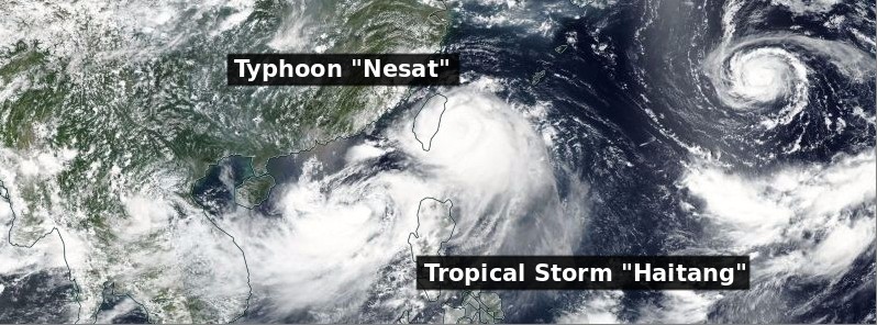
Featured image: Typhoon "Nesat" and Tropical Storm "Haitang" on July 29, 2017. Credit: NASA/NOAA Sumi NPP/VIIRS
Typhoon "Nesat" made landfall at Su'ao in the northeastern county of Yilan, Taiwan at 11:10 UTC (19:10 local time) on Saturday, July 29, 2017. The typhoon is being followed by Tropical Storm "Haitang," which formed earlier today and is now on its way toward SE Taiwan. Although Nesat is the first typhoon to hit Taiwan this year, this will be the first time in 50 years that Taiwan has been hit by two tropical cyclones simultaneously.
Nesat's maximum sustained winds at the time of landfall were around 130 km/h (81 mph), making it a Category 1 hurricane equivalent on the Saffir-Simpson scale. The system is expected to drop extremely heavy rain to southern Taiwan's Kaohsiung and Pingtung County from Saturday to Sunday, meteorologists warn, and leave Taiwan early Sunday morning (local time), heading toward SE China. Torrential rain is forecast for eastern Taiwan's Yilan, Hualien and Taitung counties, central Taiwan's Taichung, Nantou County and Yunlin County, and Chiayi County and Tainan in southern Taiwan
According to Taiwan's Central Weather Bureau, Nesat had maximum sustained winds of 144 km/h (89 mph) with gusts reaching 180 km/h (112 mph) at 12:00 UTC (20:00 local time), and was gaining strength.
Offices and schools across the island were closed ahead of the storm, and several parts of Taiwan announced continued office and school closures on Sunday. Traffic was severely disrupted, with many international flights canceled or delayed. Around 350 flights were canceled or delayed on Saturday.
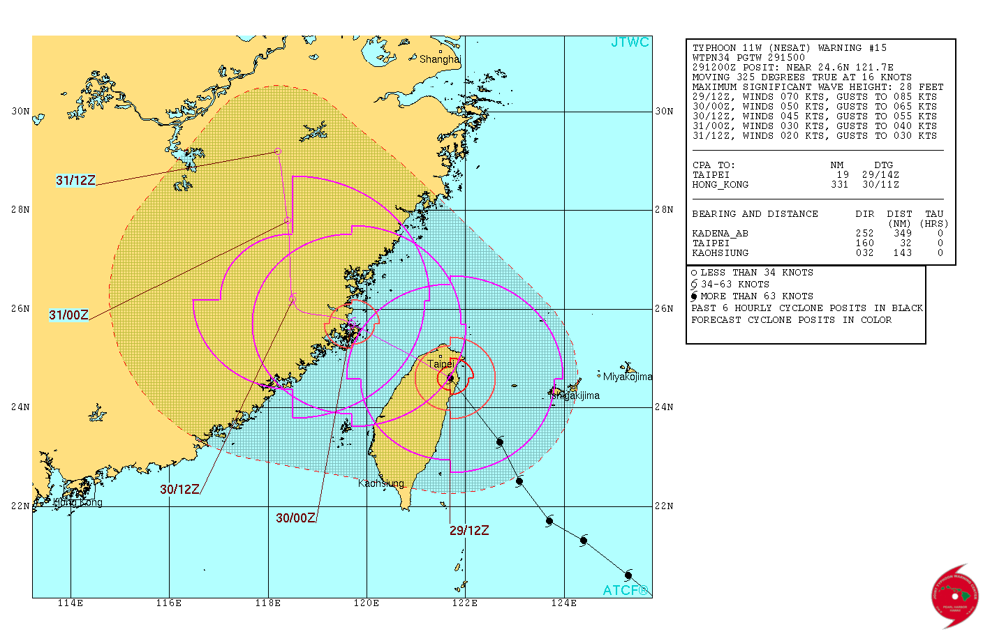
Typhoon "Nesat" forecast track by JTWC at 15:00 UTC on July 29, 2017
Nesat is being followed by Tropical Storm "Haitang," which formed earlier Saturday and is moving toward SE Taiwan, the bureau said and issued sea and land warnings for Haitang at 17:30 local time. As of 20:00 local time, the storm was centered 480 km (298 miles) southwest of Eluanbi, the southernmost tip of Taiwan, moving at a speed of 28 km/h (17.4 mph) in a northeasterly direction.
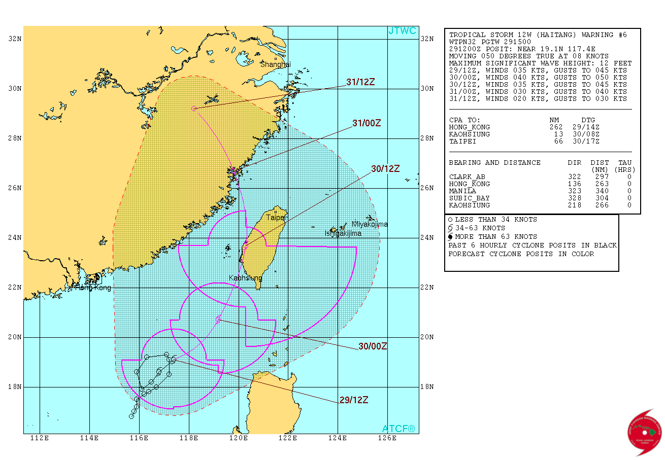
Tropical Storm "Haitang" forecast track by JTWC at 15:00 UTC on July 29, 2017
The storms are creating a "Fujiwhara effect," a term that describes the rotation of two tropical storms or hurricanes around a common center. Under the impact of Haitang, Nesat was moving on a path further north than previously expected, at a slower speed, the bureau said.
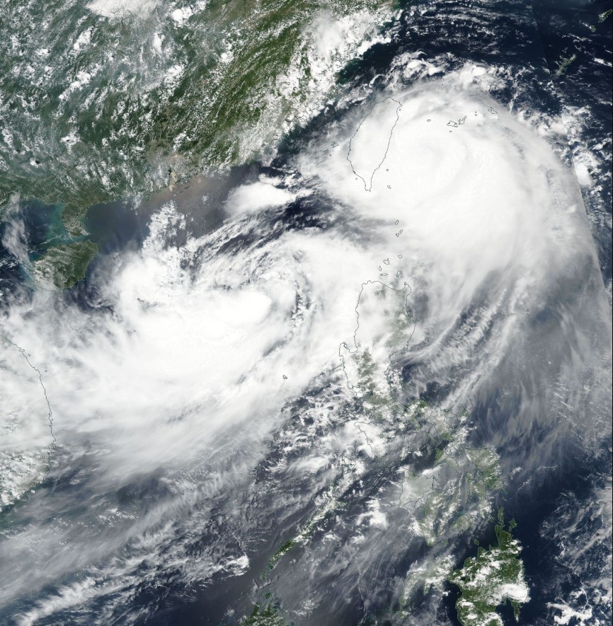
Typhoon Nesat and Tropical Storm Haitang creating Fujiwhara effect on July 29, 2017. Image credit: NASA/NOAA Suomi NPP/VIIRS
This will be the first time in 50 years that Taiwan has been hit by two tropical cyclones simultaneously, with sea and land warnings issued for each, Huang Chun-hsi, a section chief of the bureau's forecast department, said.
Afer moving over SE Taiwan, Haitang is expected to weaken and make another landfall over SE China.
I'm a dedicated researcher, journalist, and editor at The Watchers. With over 20 years of experience in the media industry, I specialize in hard science news, focusing on extreme weather, seismic and volcanic activity, space weather, and astronomy, including near-Earth objects and planetary defense strategies. You can reach me at teo /at/ watchers.news.
Commenting rules and guidelines
We value the thoughts and opinions of our readers and welcome healthy discussions on our website. In order to maintain a respectful and positive community, we ask that all commenters follow these rules.