
Tropical Cyclone “Cook” to slam into New Caledonia
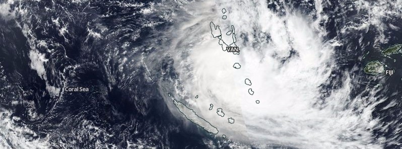
Featured image: Tropical Cyclone "Cook" on April 9, 2017. Credit: NASA/NOAA/DoD Suomi NPP/VIIRS
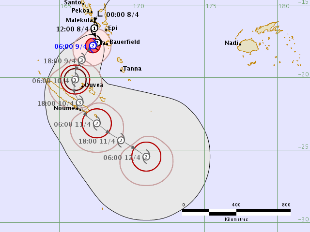
Tropical Cyclone "Cook" was named on April 8, 2017, just after it moved away from Vanuatu on its way toward New Caledonia. Cook is expected to reach New Caledonia and make landfall around 12:00 UTC on Monday, April 10 (23:00 local time).
At 03:00 UTC on April 9, the center of Tropical Cyclone "Cook" was located approximately 535 km (332 miles) north-northwest of Noumea, New Caledonia and has tracked southward at 7 km/h (4.6 mph) over the past 6 hours. At the time, Cook had maximum sustained winds of 111 km/h (69 mph), JTWC said.
The environmental analysis shows a very favorable environment with radial outflow, low vertical wind shear, and sea surface temperatures near 29 °C (84.2 °F). Currently, Cook is tracking southward along the western periphery of a deep-layered ridge positioned to the east.
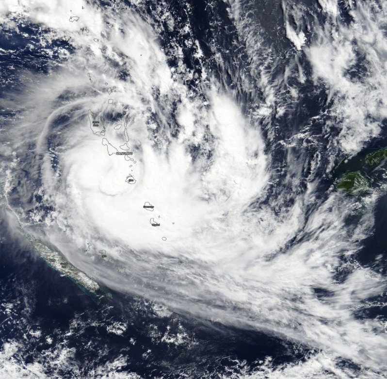
Tropical Cyclone "Cook" on April 9, 2017. Credit: NASA Terra/MODIS
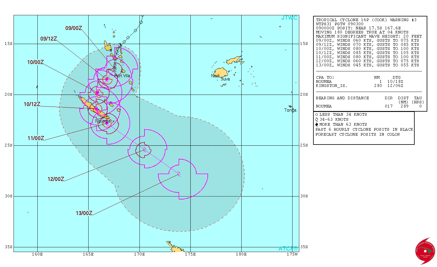
Tropical Cyclone "Cook" forecast track by JTWC on April 9, 2017
The system is expected to reach a peak intensity of 157 km/h (97.8 mph) before it makes landfall around 12:00 UTC on April 10. This would make it a Category 2 hurricane equivalent on the Saffir-Simpson wind scale. Cyclones of this strength can cause extensive damage. Well-constructed frame homes could sustain major roof and siding damage. Many shallowly rooted trees will be snapped or uprooted, blocking numerous roads. Near-total power loss can be expected with outages that could last from several days to weeks.
According to GDACS, the vulnerability for this event is medium. Approximately 200 000 people might be affected by winds stronger than 140 km/h (86.9 mph).
The calculated storm surge for New Caledonia is 0.6 to 1 m (2 – 3.3 feet), as of April 10, 2017 at 12:00 UTC.
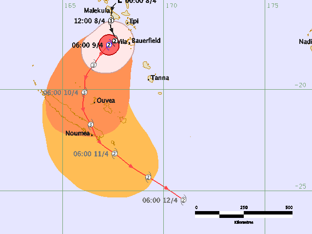
Tropical Cyclone "Cook" threat map. Credit: RSMC Nadi, Fiji. Note: RSMC Nadi is not using Saffir-Simpson wind scale.
Tropical Cyclone "Cook" forecast track. Credit: RSMC Nadi, Fiji. Note: RSMC Nadi is not using Saffir-Simpson wind scale.
JTWC expects the system to transition into an extratropical system on April 13.
I'm a dedicated researcher, journalist, and editor at The Watchers. With over 20 years of experience in the media industry, I specialize in hard science news, focusing on extreme weather, seismic and volcanic activity, space weather, and astronomy, including near-Earth objects and planetary defense strategies. You can reach me at teo /at/ watchers.news.
Commenting rules and guidelines
We value the thoughts and opinions of our readers and welcome healthy discussions on our website. In order to maintain a respectful and positive community, we ask that all commenters follow these rules.