
Very Severe Cyclonic Storm “Vardah” about to make landfall
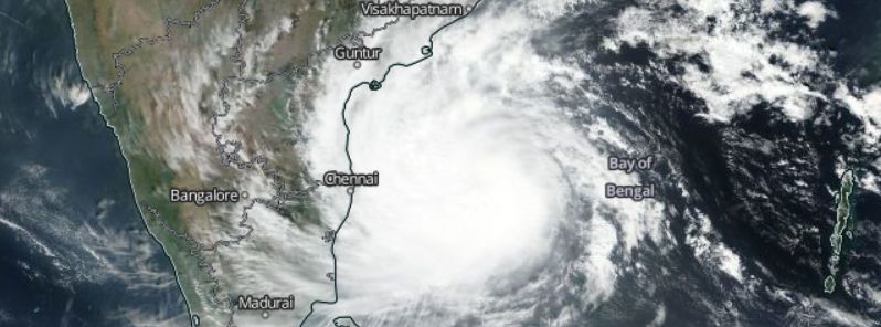
Featured image: Very Severe Cyclonic Storm "Vardah" on the way to make landfall in India, December 11, 2016. Image credit: NASA/Suomi NPP/VIIRS
Very Severe Cyclonic Storm "Vardah" is moving toward Tamil Nadu and adjoining southern coast of Andhra Pradesh. The system will make landfall over the next 24 hours. Although it will weaken down somewhat prior to landfall, local flooding, damage to crops, trees, power and communication lines is anticipated. Residents should remain on alert.
Vardah was located approximately 1 190 km (739 miles) south-southwest of Calcutta, India, and moving westward at 9.3 km/h (5.8 mph) on December 11, 2016, at 15:00 UTC, according to the Joint Typhoon Warning Center (JTWC). The system was packing maximum sustained winds of 138.9 km/h (86.3 mph) with gusts up to 166.7 km/h (103.6 mph) while its minimum central pressure was estimated at 970 hPa.
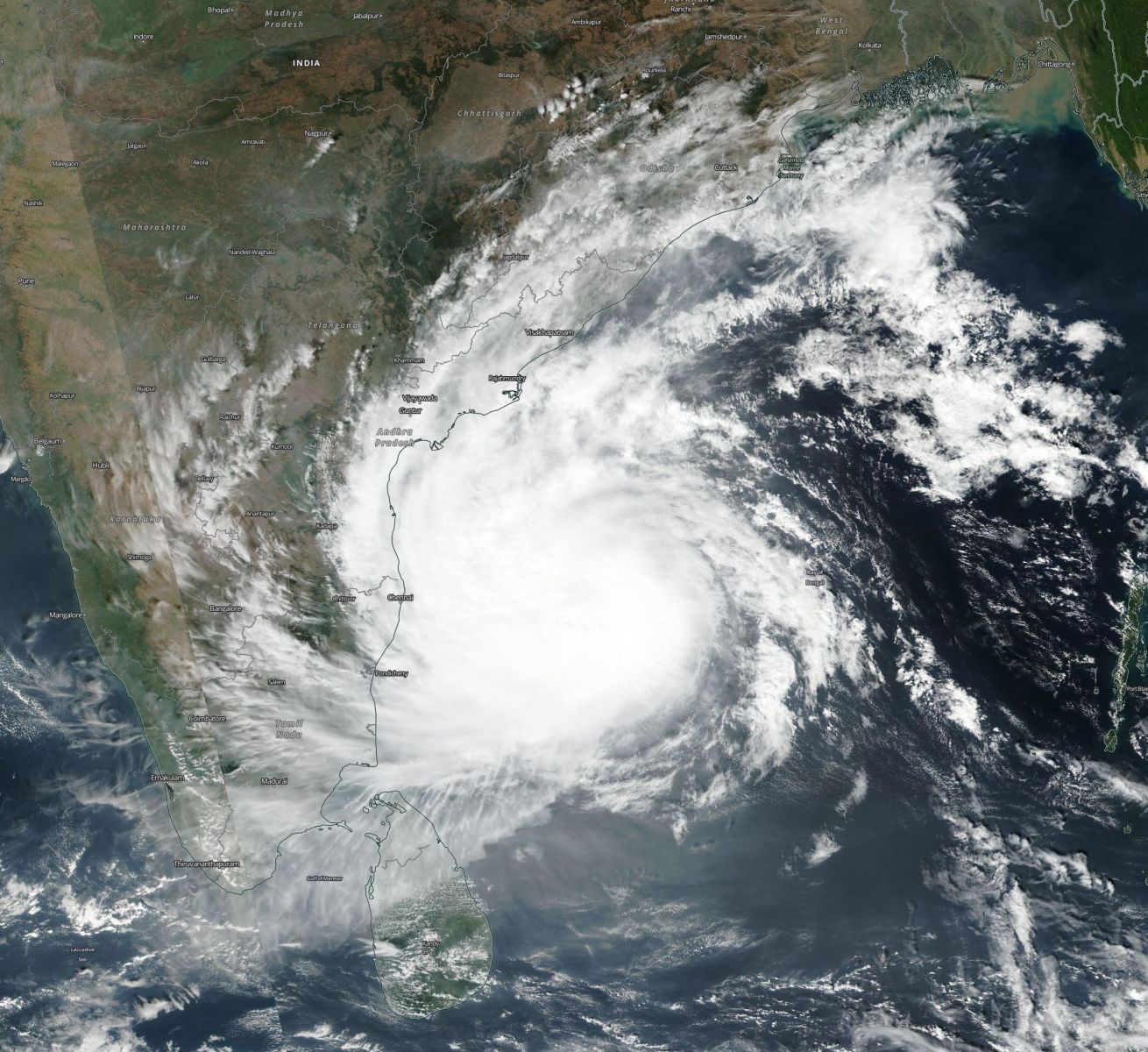
Very Severe Cyclonic Storm "Vardah", December 11, 2016. Image credit: NASA/NOAA/DoD Suomi NPP/VIIRS
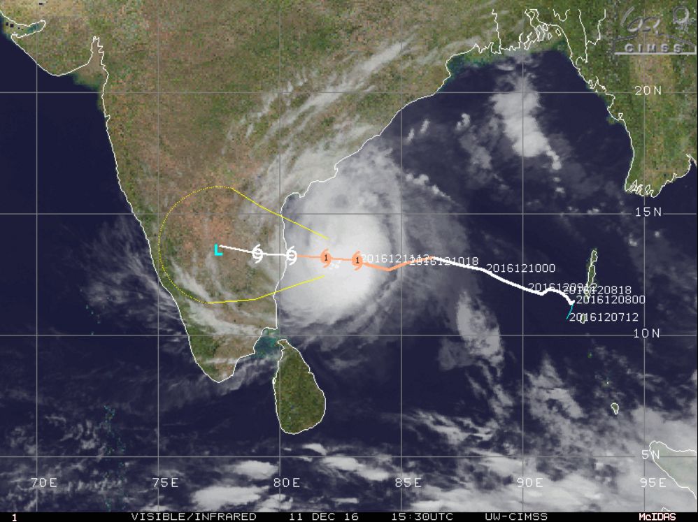
Very Severe Cyclonic Storm "Vardah", December 11, 2016, 15:30 UTC. Image credit: UW-CIMSS
The very severe cyclonic storm, now equivalent to a Category 1 hurricane on the Saffir-Simpson hurricane scale will continue moving westward toward north Tamil Nadu and adjoining south Andhra Pradesh coasts while gradually weakening.
According to the India Meteorological Department (IMD), the system will likely make landfall by the afternoon of December 12 (local time) with winds between 80 and 90 km/h (49.7 and 55.9 mph) with gusts reaching up to 100 km/h (62.2 mph). Vardah will dissipate over land in the next 48 hours.
According to Philip Klotzbach, a meteorologist at CSU, Vardah is the first hurricane strength tropical cyclone to form in the North Indian Ocean in 2016.
Tropical cyclone #Vardah has intensified to 75 mph, making it the 1st hurricane-strength TC in the North Indian Ocean in 2016. pic.twitter.com/aZaOGBh5Xs
— Philip Klotzbach (@philklotzbach) December 10, 2016
The IMD predicted isolated heavy to very heavy rainfall over south coastal Andhra Pradesh, north coastal Tamil Nadu and Puducherry over the next 36 hours. Between 7 and 19 cm (2.8 and 7.5 inches) of precipitation is expected across several locations. Chennai, Thiruvallur, and Kanchipuram districts of Tamil Nadu and Nellore, and Prakasam districts of Andhra Pradesh will receive up to 20 cm (7.9 inches) of rainfall at isolated locations.
Winds between 40 and 50 km/h (24.9 and 31 mph) with gusts up to 60 km/h (37.3 mph) will affect the regions along and off Andhra Pradesh and adjoining Tamil Nadu coasts over the next 36 hours. The winds will gradually increase to 80 – 90 km/h (49.7 – 55.9 mph), with gusts reaching 100 km/h (62.2 mph) at the time of landfall along and off Chennai, Thiruvallur and Kanchipuram districts of Tamil Nadu, Puducherry, and Nellore, and Prakasam districts of Andhra Pradesh.
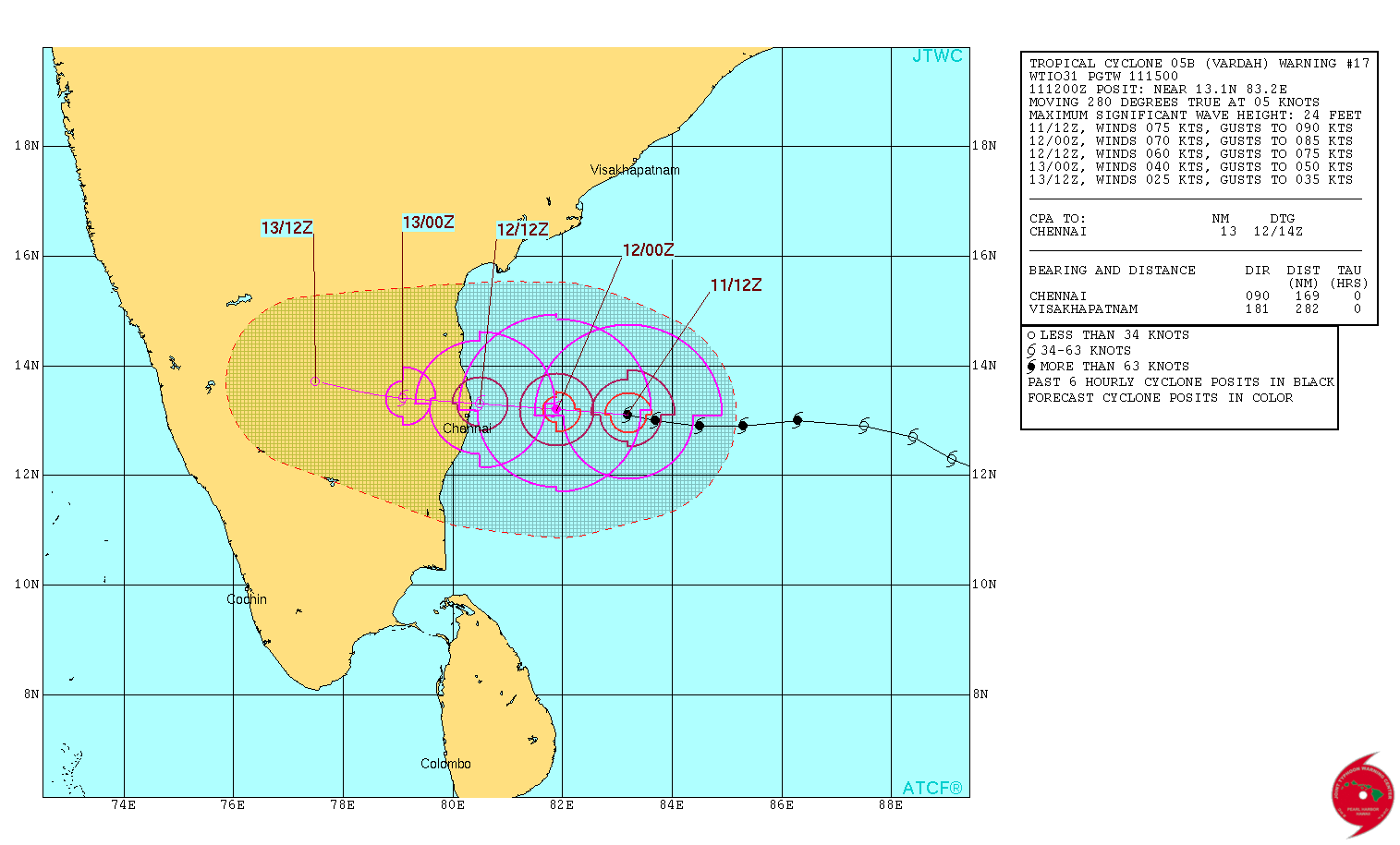
Very Severe Cyclonic Storm "Vardah" 3-day forecast track. Image credit: JTWC
Rough to very rough seas are expected along and off Andhra Pradesh and north Tamil Nadu coasts. Very high seas are anticipated as of the morning of December 12 (local time). Tidal wave up to 1 m (3.3 feet) high above the astronomical tide will likely inundate the low-lying regions in Chennai, Thiruvallur and Kanchipuram districts of Tamil Nadu, and Nellore districts of Andhra Pradesh during the cyclone's landfall. Damage to power and communication lines, crops, and trees is expected.
The fishermen are urged not to venture into sea along and off south Andhra Pradesh, north Tamil Nadu, and Puducherry coasts over the next 36 hours.
Commenting rules and guidelines
We value the thoughts and opinions of our readers and welcome healthy discussions on our website. In order to maintain a respectful and positive community, we ask that all commenters follow these rules.