
Rare M5.2 earthquake hits near Halls Creek, Western Australia
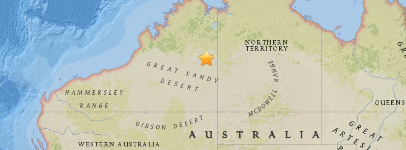
Image credit: USGS
A rare earthquake registered by the Geoscience Australia hit near Halls Creek, Western Australia at 09:54 UTC on November 6 ,2016. The agency is reporting a depth of 20 km (12.4 miles). USGS is reporting M4.8 at a depth of 10.6 km (6.6 miles). EMSC is reporting M4.8 at a depth of 5 km (3.1 miles).
According to the USGS, the epicenter was located 103.3 km (64.2 miles) SSE of Halls Creek (population 1 209), 621.5 km (386 miles) E of Broome (population 12 766), Australia.
Geoscience Australia said the quake could have caused some damage up to 16 km (9.9 miles) from the epicenter. The quake could have been felt by people up to 206 km (128 miles).
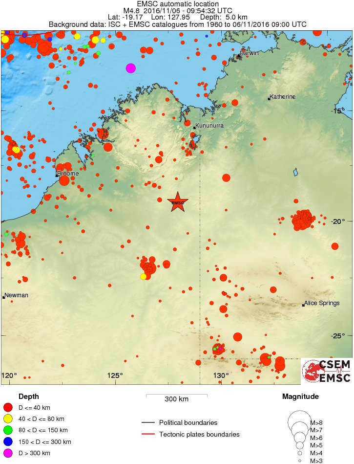
Historical seismicity since 1960/4 – depth and magnitude. Credit: ISC, EMSC
Below is a list of significant earthquakes in Western Australia since 1906:
| Western Australia | Indian Ocean | November 19, 1906 | 7.6 | Bottles fell off shelves in Carnarvon, 500 km (311 miles) away. | Felt at Albany, Western Australia, 1 700 km (1 056 miles) away. Strongest earthquake recorded in an Australian territory. |
| Western Australia | Meeberrie | April 29, 1941 | 7.2 | Severe shaking, burst water tanks and cracked ground at Meeberrie homestead. Minor damage reported in Perth, 500 km (311 miles) away. | Strongest onshore earthquake recorded in Australia. |
| Western Australia | Gabalong | August 30, 1955 | 5.8 | Felt in Perth | Epicentre near Gabalong, about 30 km (18.6 miles) east of Moora and 200 km (124 miles) NNE of Perth. |
| Western Australia | Meckering | October 14, 1968 | 6.9 | 20 injuries, no deaths. 60 buildings destroyed. Minor damage in Perth. Total damage $5 million. | In Perth, 130 km (81 miles) away, buildings were reported to have swayed for up to 3 minutes following the quake, which is the second strongest onshore earthquake recorded in Australia. The quake was felt up to 700 km (435 miles) from the epicenter. |
| Western Australia | Calingiri | March 10, 1970 | 5.9 | No damage reported | This quake was significant in that it was one of only five earthquakes recorded in Australia to have caused surface faulting. It was believed at the time to be related to the 1968 Meckering earthquake, but no connection has yet been demonstrated. |
| Western Australia | Canning Basin | March 24, 1970 | 6.7 | Little damage due to the remoteness of the area | Part of a sequence of c. 25 quakes of magnitude 5.0 or greater in the Canning Basin area of northern Western Australia between 1970 and 1982. |
| Western Australia | Canning Basin | July 16, 1971 | 6.4 | Part of a sequence of c. 25 quakes of magnitude 5.0 or greater in the Canning Basin area of northern Western Australia between 1970 and 1982. | |
| Western Australia | Canning Basin | October 3, 1975 | 6.2 | Part of a sequence of c. 25 quakes of magnitude 5.0 or greater in the Canning Basin area of northern Western Australia between 1970 and 1982. | |
| Western Australia | Cadoux | June 2, 1979 | 6.1 | No injuries. 25 buildings in Cadoux were damaged. Damage cost $3.8 million. | Perth, 180 km (112 miles) away experienced some swaying of tall buildings but no damage was reported. This was one of the largest onshore earthquakes recorded in Australia. |
| Western Australia | Collier Bay | August 10, 1997 | 6.3 Mw | No major damage | Felt from Broome to Halls Creek and Kununurra. Strongest earthquake recorded in Australia since the 1988 Tennant Creek earthquake. |
| Western Australia | Indian Ocean, Northwest of Western Australia | 11 October 11, 2000 | 5.5 | Offshore | This quake occurred approximately 230 km (143 miles) northwest of Exmouth. |
| Western Australia | Southern Ocean, south of Western Australia | December 25, 2000 | 5.7 | Offshore | This quake occurred approximately 860 km (534 miles) south ofAlbany |
| Western Australia | Burakin | September 28, 2001 | 5.1 | No damage reported | This quake occurred 20 km (12 miles) from Burakin, approximately 190 km (118 miles) northeast of Perth |
| Western Australia | Southern Ocean south of Western Australia | December 12, 2001 | 7.0 Mw | Offshore, felt in Albany and Esperance | 1 020 km (634 miles) south of Esperance |
| Western Australia | Kalgoorlie-Boulder | April 20, 2010 | 5.0 | In the earthquake numerous buildings damaged, mainly in Boulder, two people were injured. | Strongest earthquake in the Goldfields region of Western Australia for 50 years. |
| Western Australia | Indian Ocean, west of Western Australia | April 17, 2011 | 5.2 | Offshore | 522 km (324 miles) west of Port Hedland. |
| Western Australia | Indian Ocean, northwest of Western Australia | December 6, 2011 | 5.1 | Offshore | 370 km (229 miles) north-north-east of Carnarvon. |
| Western Australia | 50 km (31 miles) east ofNorseman | May 29, 2016 | 5.2 | No damage or injuries were reported. | A magnitude 4.9 earthquake was recorded about an hour before the 5.2 earthquake, which was then followed by two aftershocks measuring 3.0 and 3.2. |
The Watchers team and our contributors bring the latest on extreme weather, earthquakes, volcanic eruptions, space weather, and all things science. We're all about making sense of the natural world and keeping you informed on what’s happening. Got a tip or a question? Hit us up using the form at newstips!
Commenting rules and guidelines
We value the thoughts and opinions of our readers and welcome healthy discussions on our website. In order to maintain a respectful and positive community, we ask that all commenters follow these rules.