
Unusually large M5.7 earthquake hits Western Australia
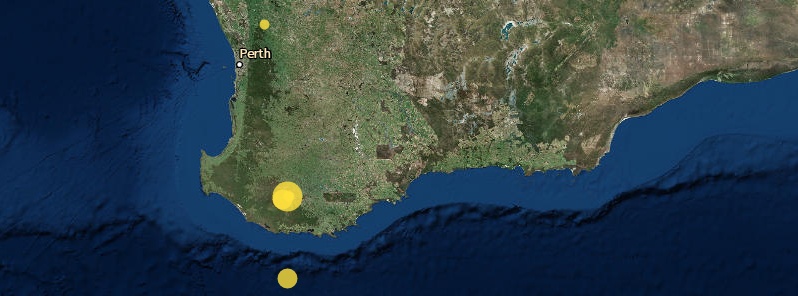
Image credit: GA
A strong and shallow earthquake registered by the Geoscience Australia as M5.7 hit near Frankland River, Western Australia at 04:56 UTC on September 16, 2018 (12:56 local time). The USGS registered it as M5.3 at a depth of 10 km (6.2 miles). The quake was initially reported by Geoscience Australia as M5.6 but the agency revised the magnitude on September 17.
The epicenter was located 59.3 km (36.8 miles) SSW of Kojonup (population 1 257), 119.5 km (74.3 miles) NW of Albany (population 33 650), and 279.8 km (173.9 miles) SSE of WA capital Perth (population 1 896 000).
The USGS received 168 "I felt it' reports by 12:00 UTC on September 17.
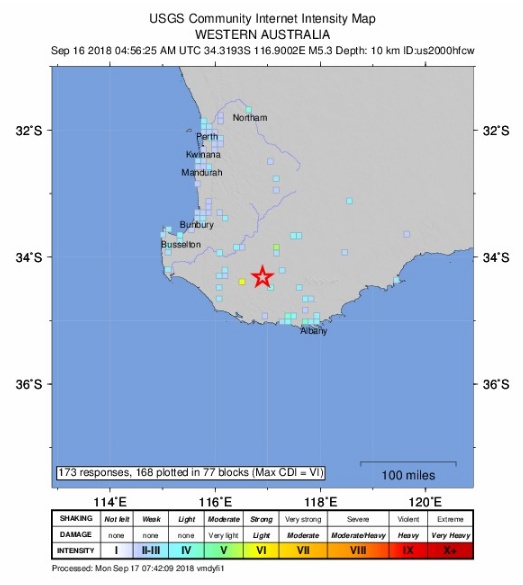
Officials said there were wall cracks at two homesteads in the Lake Muir region (near the epicenter), adding that there were no other initial reports of damage.
Senior Geoscience Australia seismologist Phil Cummins said it was an uncommonly large earthquake and the second quake to hit the region in a week, ABC reports. A 3.5-magnitude earthquake hit off the coast of Albany on September 12 and a 3.4-magnitude hit Walpole on September 13.
"The M5.7 quake occurred roughly between Walpole and Kojonup on the south coast and was felt all the way from Albany up to Perth," he said. "It is quite a large earthquake, it is large enough to cause damage but it's unlikely to have done so because it occurred in a relatively remote area."
"You would expect to get a 5.6 (magnitude) maybe once every couple of years throughout Australia," Cummins said.
Locals described the quake as short and very violent.
"We were having lunch when everything began violently shaking," one resident of Modalup, close to the epicenter, said. "It really felt like a bomb went off under your feet. It just kept echoing through the ground for nearly 40 seconds, maybe up to a minute."
Others said they did not feel the quake but were rattled by a loud noise.
Geoscience Australia registered 2 aftershocks over the next 12 hours – M2.8 at 05:23 UTC and M2.6 at 07:07 UTC on September 16.
The strongest quake in Australia is M6.6 of January 22, 1988 with the epicenter near Tennant Creek, Northern Territory. There were no injuries reported but the quake warped the natural gas pipeline and opened a 35 km (21.7 miles) long fault scarp, with a step of 2 m (6.6 feet).
The largest quake in Western Australia is M6.3 of April 29, 1941. It is still Australia's fifth-largest quake.
The second-most damaging earthquake in WA's recorded history is M6.1 of June 2, 1979. It injured one person and damaged 25 buildings in Cadoux, about 165 km (102 miles) NE of Perth. This quake opened a 15 km (9.3 miles) long fault.
Only about 12 earthquakes in Australia’s modern history have caused the ground to rupture.
I'm a dedicated researcher, journalist, and editor at The Watchers. With over 20 years of experience in the media industry, I specialize in hard science news, focusing on extreme weather, seismic and volcanic activity, space weather, and astronomy, including near-Earth objects and planetary defense strategies. You can reach me at teo /at/ watchers.news.
Commenting rules and guidelines
We value the thoughts and opinions of our readers and welcome healthy discussions on our website. In order to maintain a respectful and positive community, we ask that all commenters follow these rules.