
Severe weather floods the Midwest and sprouts several tornadoes across the High Plains

Image credit: StormChasingVideo
Severe storms accompanied by strong winds swept the High Plains throughout June 14, 2016. Several tornadoes were reported in northeastern South Dakota while intense flooding hit parts of the Midwest.
Strong rainstorms produced several tornadoes across the affected areas. One of them touched down near the Webster town around 14:30 (local time) while the second one was observed around 15:30 south of Waubay. It was unclear whether the event was, in fact, the same twister or they were separate. No damage was reported, according to the Day County Emergency Management.
Severe weather conditions induced flooding in Minnesota and Iowa. The wind gusts up to 82 km/h (51 mph) were recorded, and several trees were knocked over in Worthington. Another tornado was reported near Pipestone, Minnesota. However, it's still unknown if the touchdown caused any significant damage in the area. Street flooding was observed in parts of the Mankato, following the heavy rainfall.
Video credit: StormChasingVideo
Video credit: Breaking Disaster
Wind gusts up to 117.5 km/h (73 mph) were recorded near the Estherville town where several trees, power lines, and some roofs suffered damage.
The South also experienced strong wind gusts, and trees and power lines were damaged west of Savannah, Georgia. Intense hail, the size of golf balls, was reported near Toccoa in North Georgia, as well.
Strong thunderstorms already caused severe floods across parts of the Plains throughout the weekend of June 11, disrupting traffic and prompting road closures, emergency rescues, and evacuations in Texas and Oklahoma. A state of emergency was declared for Caddo, Carter, Comanche, Cotton, Garvin, Grady, McClain, Murray and Stephens Counties in Oklahoma on June 14.
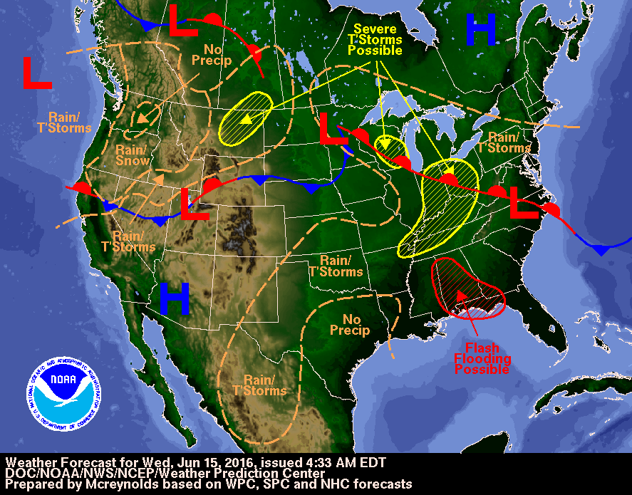
Image credit: DOC/NOAA/NWS/NCEP/Weather Prediction Center
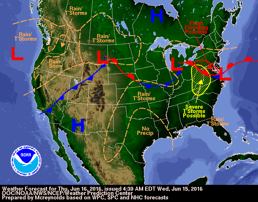 Image credit: DOC/NOAA/NWS/NCEP/Weather Prediction Center
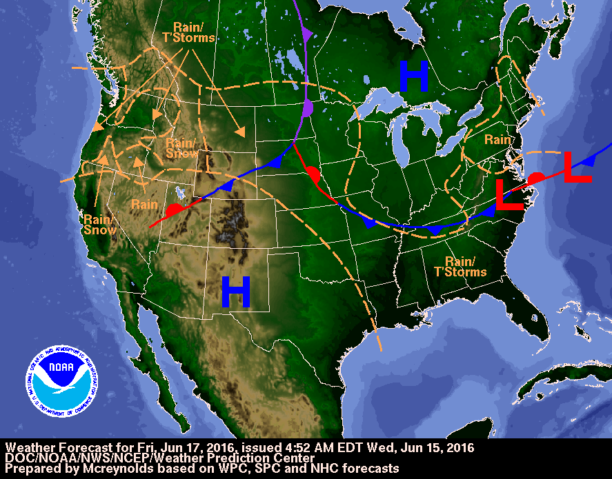 Image credit: DOC/NOAA/NWS/NCEP/Weather Prediction Center
The National Weather Service has forecast the scattered showers and thunderstorms will continue until the end of the week across the Upper/Middle Mississippi valley to the central Appalachians/Mid-Atlantic. Heavy rainfall may cause localized flash flooding and an excessive rainfall outlook has been issued for parts of the Pennsylvania, Maryland, and Virginia. The area of an increased threat for severe storms is expected to shift to the central Appalachians and surrounding areas on June 16 while coastal Mid-Atlantic will remain under an elevated risk for heavy rain. The northern Mid-Atlantic can expect between 25.4 and 50.8 mm (1 and 2 inches), and locally higher amounts of precipitation through the morning of June 18.
Commenting rules and guidelines
We value the thoughts and opinions of our readers and welcome healthy discussions on our website. In order to maintain a respectful and positive community, we ask that all commenters follow these rules.