
Tropical Cyclone “Chapala” to bring heavy rains and strong winds to Yemen and Oman
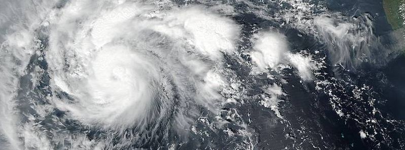
Featured image: The VIIRS instrument aboard NASA-NOAA's Suomi NPP satellite captured a visible image of Tropical Storm 22W Chapala in the Arabian Sea, October 29, 08:30 UTC. Image credit: NASA/NOAA/NRL
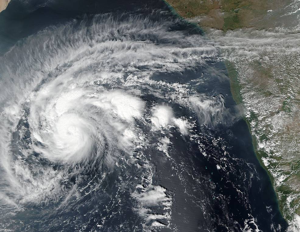
Another tropical system has formed in the Arabian Sea, the Joint Typhoon Warning Center (JTWC) reported. Tropical Cyclone "Chapala" developed on October 28, 2015 and became a hurricane only 24 hours afterward. Chapala is currently approaching Yemen at 14.8 km/h (9.2 mph) and is expected to slam into land by November 2.
Tropical Cyclone "Chapala" developed in the Arabian Sea on October 28, and rapidly intensified into a system of hurricane strength by October 29, thus becoming the fourth tropical depression in the Northern Indian Ocean basin this year.
The VIIRS instrument aboard NASA-NOAA's Suomi NPP satellite captured a visible image of Tropical Storm 22W Chapala in the Arabian Sea on October 29 at 08:30 UTC. Image credit: NASA/NOAA/NRL
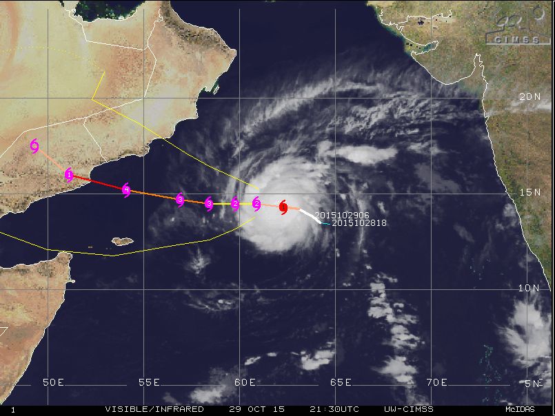
Tropical Cyclone "Chapala" movement track, October 29, 21:30 UTC. Image credit: UW-CIMSS
Chapala was located 772.3 km (479.9 miles) south-southeast of Masirah Island, moving westward at 14.8 km/h (9.2 mph) on October 29, 21:00 UTC, according to the JTWC. The system was packing maximum sustained winds of 139 km/h (86.4 mph) with wind gusts reaching 167 km/h (104 mph).
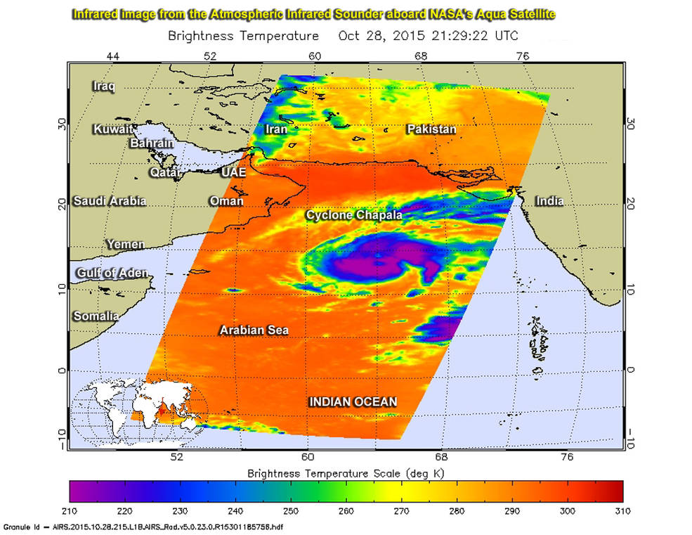
Infrared imagery NASA's Aqua satellite showed strong storms within Cyclone Chapala had cold cloud tops near -63F/-53C (purple), October 28, 21:29 UTC. Image credit: NASA/JPL, Ed Olsen
The system will continue tracking westward intensifying over the next 72 hours, when winds are expected to pack speeds of 213 km/h (132 mph) with gusts up to 259 km/h (161 mph).
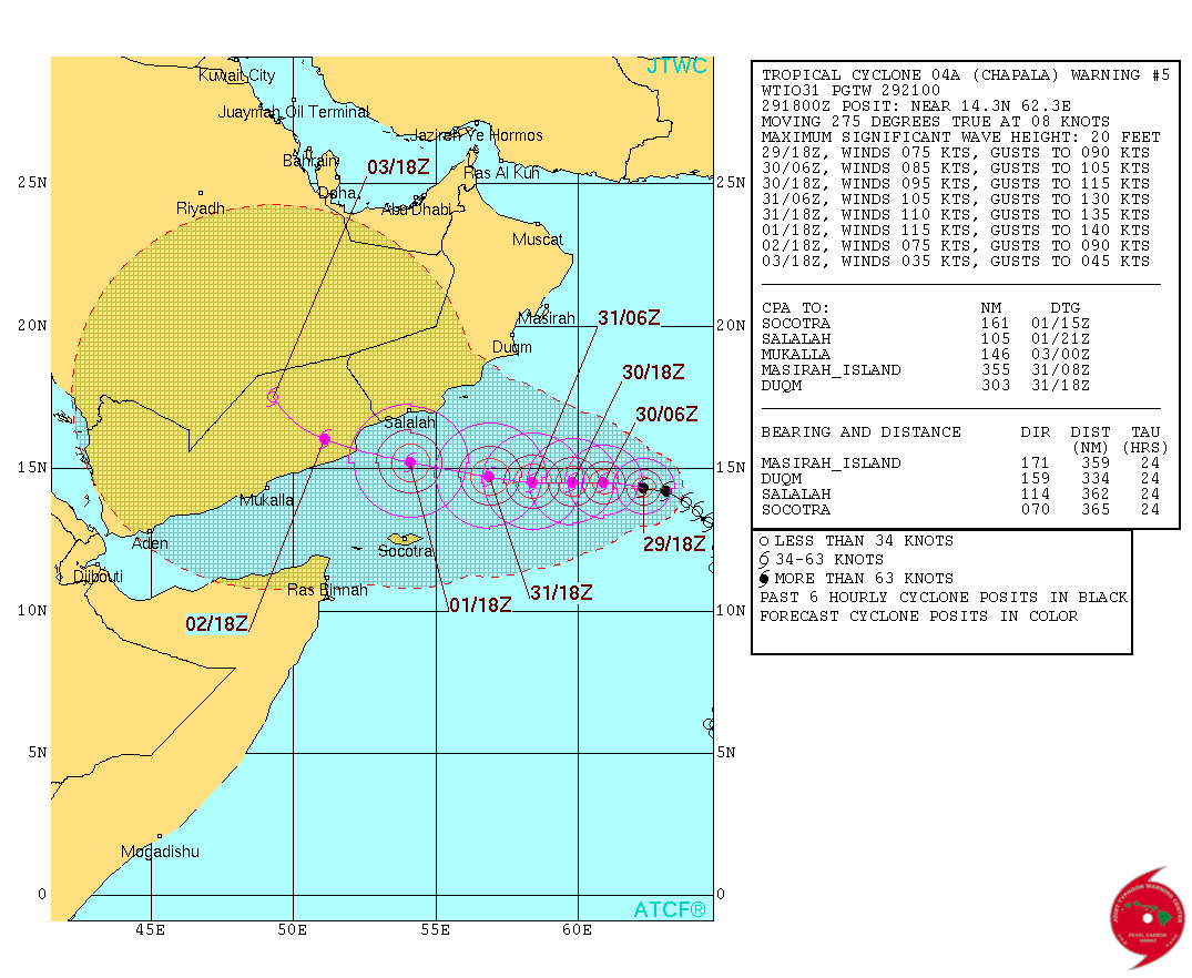
Tropical Cyclone "Chapala" 5-day forecast track. Image credit: JTWC
Tropical Cyclone "Chapala" is expected to make landfall with hurricane intensity in northeast Yemen, south of the border between Yemen and Oman on November 2.
The system is forecast to bring strong winds and potentially historic amounts of rainfall across the affected areas and citizens of Yemen and Oman should therefore carefully track its further development.
Commenting rules and guidelines
We value the thoughts and opinions of our readers and welcome healthy discussions on our website. In order to maintain a respectful and positive community, we ask that all commenters follow these rules.