
Typhoon “Soudelor” to make direct hit to Saipan, Mariana Islands

Featured image: Typhoon "Soudelor" on August 2, 2015. Image credit: NASA Terra/MODIS.
Tropical Storm 13W formed on July 30, 2015 about 1 045 km (649 miles) northeast of Chuuk in the Northwestern Pacific Ocean. It continued strengthening and was named Soudelor on July 31.
Early August 2, UTC time, Soudelor reached typhoon strength, and is now moving on a track that will take it directly over Saipan, Mariana Islands on the evening of August 2, local time.
At 15:00 UTC on July 31, Tropical Storm "Soudelor" had maximum sustained winds near 62 km/h (40 mph). It was centered about 1 076 km (668 miles) east of Saipan, and was moving to the west at 14.8 km/h (9.2 miles). A typhoon watch was in effect in Agrihan, Pagan, Alamagan, Saipan and Tinian in the Mariana Islands.

Typhoon "Soudelor" forecast track by JTWC on August 2, 2015. Image credit: JTWC/ATCF.
JTWC forecasters expect Soudelor to continue strengthening over the next couple of days on its west-northwesterly track through the Mariana Islands. Soudelor is expected to peak at 222 km/h (138 mph) around August 3 before a weakening trend commences.
At 07:00 UTC on August 2, NHC Guam said Soudelor is approaching Tinian and Saipan as a typhoon. A typhoon warning is in effect there as the system is expected to pass directly over them. Tropical storm warning is in effect for Rota.

Typhoon "Soudelor" on August 2, 2015. Image credit: NASA Terra/MODIS.
At the same time, the storm was located about 96 km (60 miles) ESE of Saipan, 112 km (70 miles) ESE of Tinian and 168 km (105 miles) ENE of Rota.
Its maximum sustained winds were 120 km/h (75 mph). Soudelor is moving toward the W at 22.5 km/h (14 mph).

The system is expected to continue moving in a general WNW direction for the next few days and further intensify.
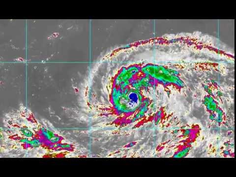
Satellite animations
- Storm-Centered Infrared (MTSAT2; NOAA/SSD)
- Storm-Centered Infrared (Aviation Color Enhancement) (MTSAT2; NOAA/SSD)
- Storm-Centered Water Vapor (MTSAT2; NOAA/SSD)
- Storm-Centered Visible (MTSAT2; NOAA/SSD)
- Storm-Centered Visible (Colorized) (MTSAT2; NOAA/SSD)
- Storm-Centered Infrared (MTSAT2; CIMSS)
- Storm-Centered Enhanced Infrared (MTSAT2; CIMSS)
- Storm-Centered Water Vapor (MTSAT2; CIMSS)
- Storm-Centered Visible (MTSAT2; CIMSS)
- Tropical West Pacific Infrared (MTSAT2; NOAA)
- Tropical West Pacific Enhanced Infrared (MTSAT2; NOAA)
- Tropical West Pacific Water Vapor (MTSAT2; NOAA)
- Tropical West Pacific Visible (MTSAT2; NOAA)

Teo Blašković founded The Watchers in 2011 and edited it until 2026, covering seismic and volcanic activity, extreme weather, space weather and near-Earth objects. Articles on this page are his archive.
Published in the last 24 hours
- Cyclone Akvan weakens after landfall near Gopalpur; more than 300 000 evacuated in Odisha, India
- Male toads abandoned a pond in Italy five days before a deadly 2009 earthquake, while a scientist was counting them Epicenter
- An asteroid was spotted 19 hours before it exploded over Sudan in 2008, and students picked its pieces off the desert Epicenter
- A wave up to 3 m (10 feet) high rose out of Lake Michigan on a sunny June morning in 1954 and swept fishermen off Chicago’s piers, and when a second came 10 days later, warnings had cleared the shore Epicenter



