
Hagupit on the track to become super typhoon, Philippines on alert
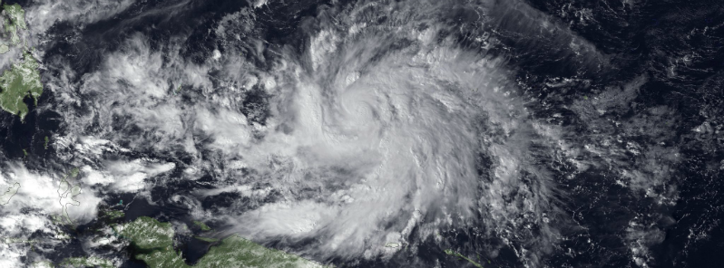
Featured image: MTSAT IR satellite image close up taken at 05:30 UTC on December 2, 2014. At that time Hagupit already reached Category 1 typhoon status. (Credit: NOAA/MTSAT)
Tropical Storm Hagupit strengthened into a typhoon early on December 2, 2014 with maximum sustained winds of 130 km/h (80 mph). Hagupit rapidly intensified, and is now Category 2 typhoon with maximum sustained winds of 160 km/h (100 mph), gusting up to 195 km/h (120 mph).
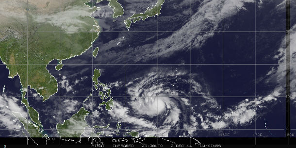
MTSAT IR satellite image taken at 23:30 UTC on December 2, 2014. (Credit: NOAA/UW-CIMSS)
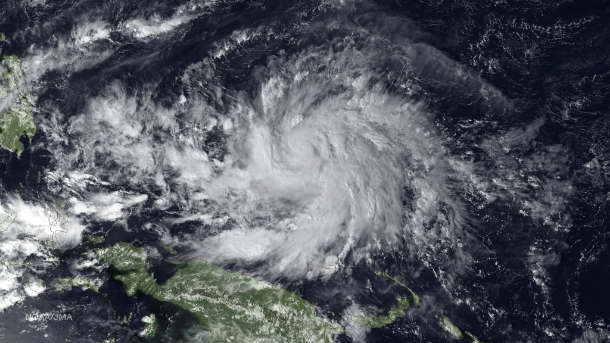
MTSAT IR satellite image close up taken at 05:30 UTC on December 2, 2014. (Credit: NOAA/MTSAT)
The forecast track takes the center of Hagupit between Palau and Yap on December 3 and toward the Philippines thereafter.
Hagupit will bring torrential rain, damaging winds and dangerously rough surf to Palau and Yap residents during the December 3.
About 32 000 people live on those islands. A Typhoon Warning is in effect for Woleai in Yap State with other portions of the state under a Typhoon Watch or Tropical Storm Warning. A Typhoon Warning is in effect for Koror and Kayangel in the Republic of Palau.
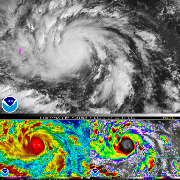
MTSAT composite satellite imagery showing center of Typhoon Hagupit at 23:32 UTC on December 2, 2014. (Credit: NOAA/MTSAT)
Hagupit is expected to gain enough fuel to reach super typhoon intensity over the waters of the Philippine Sea during the next few days. Very high sea surface temperatures, along with continually low vertical wind shear will allow the system to further intensify. Hagupit is expected to reach super typhoon status by December 5.
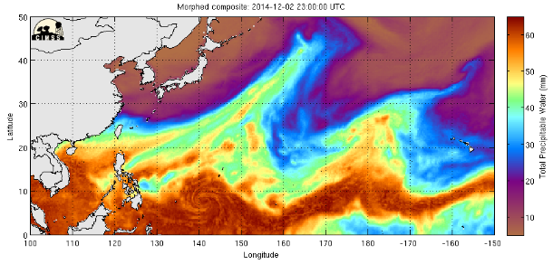
Total Precipitable Water map – West Pacific (Credit: CIMSS/SSMI/SSMIS/TMI)
If the system chooses more westerly track – toward southern or central Philippines, the impacts will be potentially very severe with extreme widespread flooding, damaging winds, storm surge and pounding surf. Mudslides would also be a serious concern.
JMA is forecasting Hagupit to make landfall in Leyte, Philippines early on December 6 with winds around 150 km/h (93 mph), gusting up to 200 km/h (125 mph).
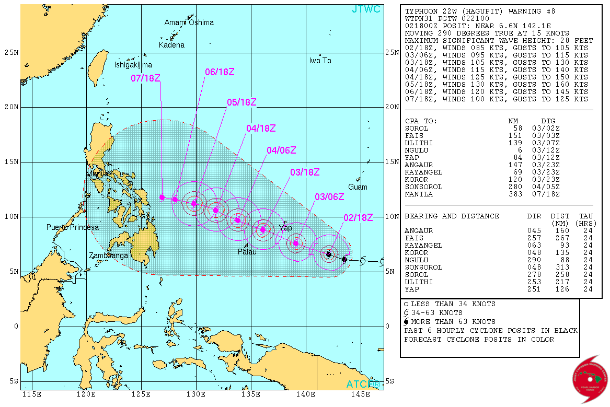
Forecast track by JTWC. (Credit: JTWC)
As the storm tracks inland it will be moving at a very slow pace, thus heavy rainfall and a severe flood threat will be high. Residents along the east coast of Visayas, NE Mindanao and Southern Luzon should be making preparations for typhoon landfall and life-threatening conditions.
Satellite animations
- Storm-Centered Infrared (MTSAT; NOAA/SSD)
- Storm-Centered Infrared (Aviation Color Enhancement) (MTSAT; NOAA/SSD)
- Storm-Centered Water Vapor (MTSAT; NOAA/SSD)
- Storm-Centered Visible (MTSAT; NOAA/SSD)
- Storm-Centered Visible (Colorized) (MTSAT; NOAA/SSD)
- Storm-Centered Infrared (MTSAT2; CIMSS)
- Storm-Centered Enhanced Infrared (MTSAT2; CIMSS)
- Storm-Centered Water Vapor (MTSAT2; CIMSS)
- Storm-Centered Visible (MTSAT2; CIMSS)
- Tropical West Pacific Infrared (MTSAT2; NOAA)
- Tropical West Pacific Enhanced Infrared (MTSAT2; NOAA)
- Tropical West Pacific Water Vapor (MTSAT2; NOAA)
- Tropical West Pacific Visible (MTSAT2; NOAA)
Commenting rules and guidelines
We value the thoughts and opinions of our readers and welcome healthy discussions on our website. In order to maintain a respectful and positive community, we ask that all commenters follow these rules.