
Pavlof eruption intensifies, ash cloud reaching 9.1 km a.s.l.
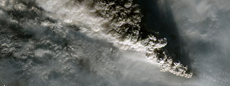
Featured image: Pavlof eruption on November 15, 2014. Image credit: Landsat 8 - OLI
The eruption of Pavlof Volcano that began on November 12, 2014 has intensified, Alaska Volcano Observatory reported at 20:35 UTC today. Ash cloud height at 20:00 UTC was estimated at 7 620 meters (25 000 ft) above sea level. Thus, the Aviation Color Code has been raised to RED and the Volcano Alert Level to WARNING.
The intensity of seismic tremor has increased significantly over the past 6 hours. As of 20:00 UTC ash cloud is moving towards the northwest and extends for about 200 km (125 miles) downwind.
Update: Pilot reports though 21:30 UTC indicate that the ash cloud height has increased to 9 144 meters (30 000 ft) above sea level. Satellite, pilot reports, and wind data show the ash cloud moving towards the northwest over the Bering Sea.

Pavlof in eruption as viewed from Cold Bay on the evening of November 12, 2014. Photographer: Damberg, Carol
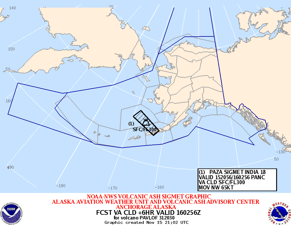
Aviation users should refer to the National Weather Service for updated SIGMETs on the ash cloud hazard: http://aawu.arh.noaa.gov/
No reports of ash fallout on nearby communities have been reported, and AVO called observers to contact them should it occur: https://www.avo.alaska.edu/
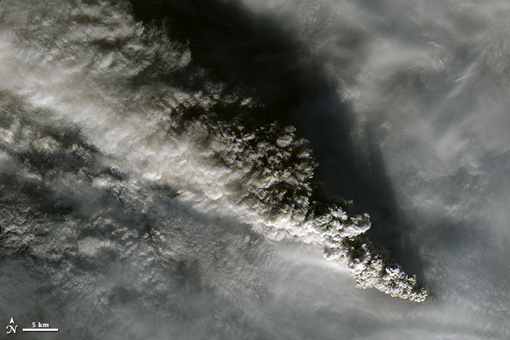
Pavlof eruption on November 15, 2014. Image credit: Landsat 8 – OLI
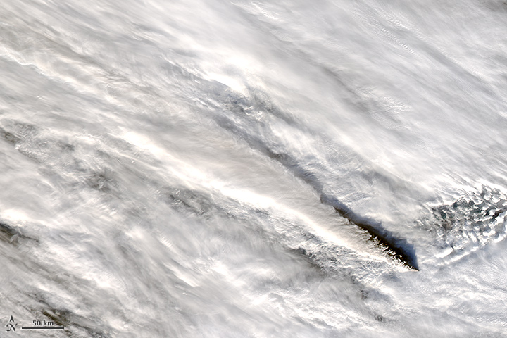
Pavlof eruption on November 15, 2014. Image credit: NASA Aqua/MODIS
Update, November 17, 2014 @ 22:07 UTC:
AVO reported that seismic activity at Pavlof remains at low levels since the sharp decrease on the evening of Saturday, November 15. The eruption has paused or is greatly diminished in intensity. Elevated surface temperatures on the volcano's upper northwest flank are consistent with a flow of lava and/or hot debris. Views of the volcano from the Cold Bay webcam are currently obscured by clouds.
Pauses of days to weeks are common during eruptive episodes at Pavlof and increased activity could occur with little warning.
Geologic summary
The most active volcano of the Aleutian arc, Pavlof is a 2519-m-high Holocene stratovolcano that was constructed along a line of vents extending NE from the Emmons Lake caldera. Pavlof and its twin volcano to the NE, 2142-m-high Pavlof Sister, form a dramatic pair of symmetrical, glacier-covered stratovolcanoes that tower above Pavlof and Volcano bays. A third cone, Little Pavlof, is a smaller volcano on the SW flank of Pavlof volcano, near the rim of Emmons Lake caldera.
Unlike Pavlof Sister, Pavlof has been frequently active in historical time, typically producing Strombolian to Vulcanian explosive eruptions from the summit vents and occasional lava flows. The active vents lie near the summit on the north and east sides. The largest historical eruption took place in 1911, at the end of a 5-year-long eruptive episode, when a fissure opened on the N flank, ejecting large blocks and issuing lava flows.
Source: AVO
I'm a dedicated researcher, journalist, and editor at The Watchers. With over 20 years of experience in the media industry, I specialize in hard science news, focusing on extreme weather, seismic and volcanic activity, space weather, and astronomy, including near-Earth objects and planetary defense strategies. You can reach me at teo /at/ watchers.news.
Commenting rules and guidelines
We value the thoughts and opinions of our readers and welcome healthy discussions on our website. In order to maintain a respectful and positive community, we ask that all commenters follow these rules.