
Extreme drought in California
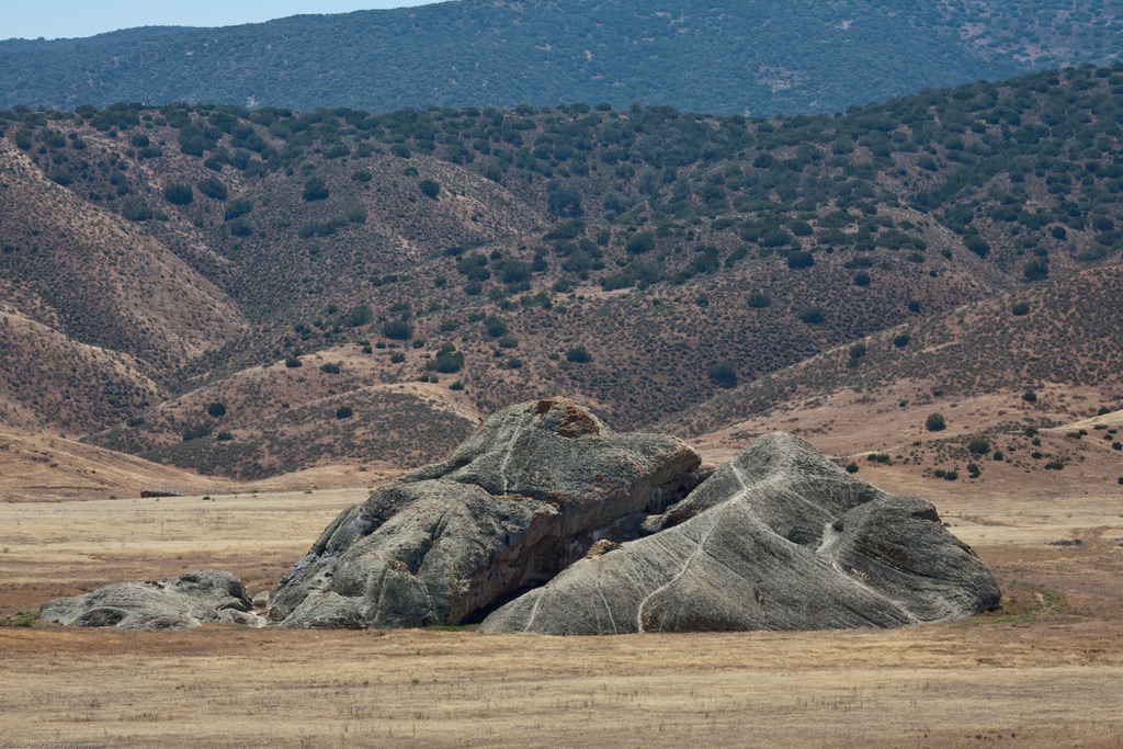
Image credit: Pictographs on Painted Rock at the Carrizo Plain National Monument, on BLM property near Soda Lake. by http://www.flickr.com/photos/72825507@N00/3580948356
On January 17, 2014, amid California's driest year on record, Governor Jerry Brown declared a drought emergency in the state. Rivers and water reservoirs in California are dangerously low after the driest years on record.
"Today I'm declaring a drought in the state of California. We're facing perhaps the worst drought California has ever seen since records began being kept about 100 years ago." Governor Jerry Brown
Many municipalities have imposed severe water restrictions and Governor Brown asked the people to cut their water use by 20 percent.
According to US Drought Monitor, the drought in January reached Extreme Drought Conditions or D3 Level. (D4 or Exceptional Drought is the highest alert on scale). Almost 99% of California is considered abnormally dry or worse; almost two-thirds of the state is in extreme drought.
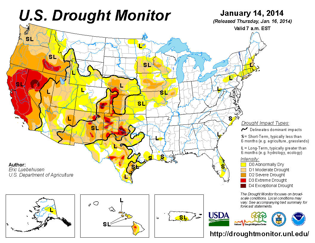
US Drought Monitor map from January 14, 2014. (Credit: USDM/UNL)
NASA MODIS satellite images bellow show California from the Los Angeles area north to the Oregon border recorded once in January last year and again this year. The lack of precipitation has allowed vegetation to dry to critical levels in many areas, increasing the potential for wildfires. The warm and dry weather has also reduced the availability if range land grasses for livestock.
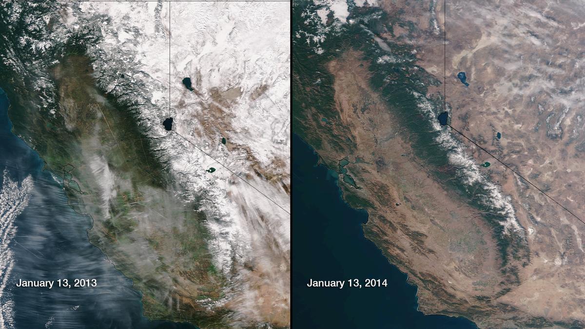
MODIS satellite images of part of california on January 13th, 2013, and on January 14th, 2014. (Credit: LANCE Rapid Response/MODIS)
The Pacific Decadal Oscillation and a weak to neutral and persistent La Niña pattern (“La Nada”) are to blame. A massive high-pressure zone off the West Coast has been blocking Pacific storms for over a year. The zone acts like a mountain range, blocking storm systems from striking land. Storms are pushed instead north into Canada and Alaska, contributing to the extreme cold weather seen in recent weeks across much of the Midwest and Northeast.
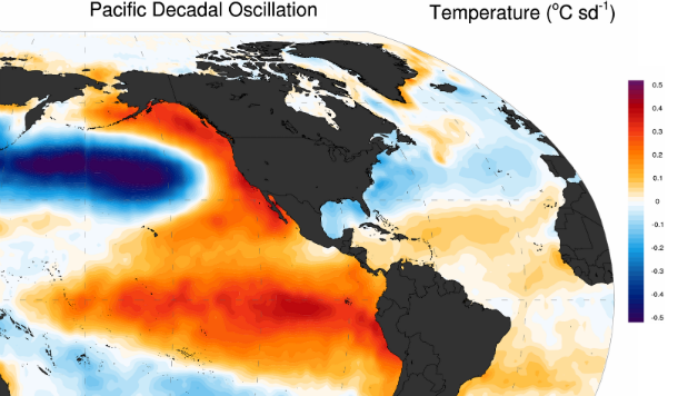
Pacific Decadal Oscillation acts like a barrier, blocking the tropical system impacting landmass. (Credit: HadISST/Wikimedia)
Droughts also are persisting or intensifying elsewhere in the U.S. Eleven states including Colorado, New Mexico, Nevada, Kansas, Texas, Utah, Arkansas, Hawaii, Idaho, Oklahoma and California have already been designated primary natural disaster areas by federal inspectors due to the drought. Large portions of Colorado and Wyoming are abnormally dry, while ranchers on the plains of southeastern Colorado have severe drought conditions.
The latest US Seasonal Drought Outlook calls for drought conditions to persist or intensify through March 2014.
Did you notice that in your snow-pack comparison photo, in the 2013 image there is MASSIVE, SYSTEMATIC GEOENGINEERING SPRAY visible, covering the Pacific in systematic bands. This, along with energy and frequencies from HAARP and other EMF facilities, like radars, is what is CAUSING the drought. It's planned.
The nano-particulate materials in the spray not only poison us, they soak up the water in the air and carry it over and away from the coast.
Jason, forgive me for targeting your state, there is hope for our country, we don't have to go the way of Ishi. You are right this Nation once had Jesus Christ and all of the U.S. is suffering extreme weather. The Lord is calling the Americans to return to their Christian heritage. America still has a purpose to become a Christian Nation to fulfill prophecy. The Christian pilgrim Ethan Smith (no relation to mormonism cult)wrote about the fulfillment of the Americas in the book: View of the Hebrews Chapter 4. Here is a link
http://olivercowdery.com/texts/ethn1825.htm#pg227a
A good radio interview with Yoshi Shimatsu on the drought and weather manipulation (to keep radiation away from California's military hardware)
http://beforeitsnews.com/environment/2014/01/did-the-us-manipulate-cali-drought-because-of-fukushima-radiation-video-2491088.html
Are you sure this isn't all caused by HAARP and not religion? I'm praying for rain that's for sure!
Thank You lord Donovan ! I have lived here most my life ( 45 years ) and first off ; No Ca did not ever want Our Lord Christ , and also if you do REALLY have Our Lord , you have him . OUR USA had the blessing of our Lord at one time and unless you leave outside of the states…YOU TO ARE RIP . Jeremiah 5o and Revelation 19 tells of want will happen to ALL OF US SOON !
This is only the beginning! California wants the Lord Jesus Christ out of their lives, they are reaping what they are sowing. At one time they worshipped the Lord Jesus Christ with zeal and they were a Blessed state, way more Blessed than all the others, now it's on a spiral downward and they are too blind to realize that they have forsaken their first love. California R.I.P.
This is not a surprise. The planet has been under pressure a lot with the line up of the solar system and the core of the galaxy. The peak line up shifted the magnetic poles in different directions and has caused the north pole and south pole to melt a lot. This all causes the planet to warm up and therefore weather channels to change. Unheard of weather has been occuring for the past ten years or so.