
M 6.3 earthquake hit Kepulauan Barat Daya, Indonesia
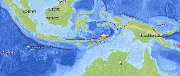
Image credit: Leaflet/USGS
Shallow M 6.3 earthquake (USGS/EMSC) hit Kepulauan Barat Daya, Indonesia at 01:24 UTC on December 1, 2013. Epicenter was located 343km (213mi) WNW of Saumlaki, Indonesia and 351km (218mi) ENE of Dili, East Timor at depth of 10 km (6.2 miles). There were no reports of any damage.
.jpg)
USGS shake intensity map (Credit: USGS)
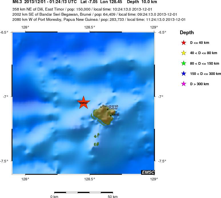
EMSC local epicenter view (Credit: EMSC)
Commenting rules and guidelines
We value the thoughts and opinions of our readers and welcome healthy discussions on our website. In order to maintain a respectful and positive community, we ask that all commenters follow these rules.