
Tropical Storm Chantal weakened as it started to impact Hispaniola
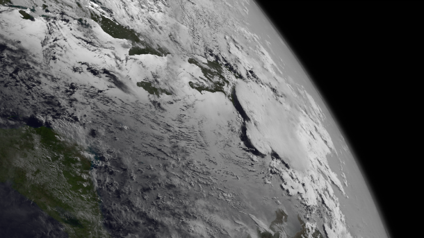
Featured image: GOES West satellite image taken at 12:00 UTC on July 10, 2013. (Credit: NOAA/GOES)
Tropical Storm Chantal is moving west-northwestward across the Caribbean. The system will impact Haiti and the Dominican Republic late on July 10, 2013. Chantal or its remnants will move between eastern Cuba and Jamaica overnight and emerge over the Florida Straits around July 11, 2013.
Already, Tropical Storm Chantal started to interact with Hispaniola. Possible mudslides and flash flooding over mountainous areas will be the main reason for concern. Forecasted strong westerly shear and interactions with land over the next couple of days should cause further weakening of the storm as it transitions back into a tropical wave.
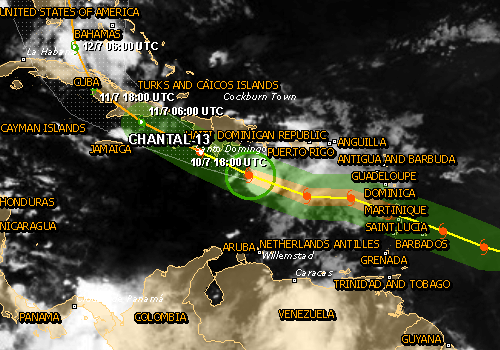
According to latest public advisory by US national Hurricane Center (NHC), issued at 15:00 UTC on July 10, 2013, the center of Tropical Storm Chantal was located near latitude 16.5N and longitude 72.0W, about 335 miles (535 km) ESE of Kingston, Jamaica and about 145 miles (235 km) S of Port au Prince, Haiti. Chantal is moving westward near 29 mph (46 km/h).
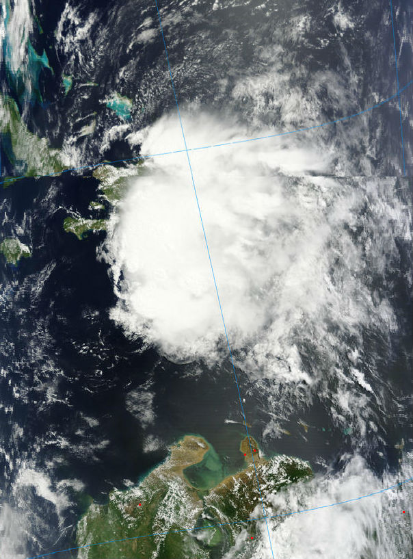
Terra MODIS visible satellite image captured TS Chantal moving over Hispaniola at 15:20 UTC n July 10, 2013 (Credit: MODIS/LANCE Rapid Response)
Maximum sustained winds are near 45 mph (75 km/h) with higher gusts. These winds are confined to the north and east of the center. Tropical storm force winds extend outward up to 105 miles (165 km) to the north and east of the center. The estimated minimum central pressure is 1011 mb (29.85 inches).
.png)
Chantal is forecast to weaken to a tropical depression or degenerate into a tropical wave during the next 24 hours. A turn toward the west-northwest and northwest with a gradual decrease in forward speed is expected during the next 48 hours. Chantal or its remnants will move between eastern Cuba and Jamaica overnight and emerge over the Florida Straits around July 11, 2013.
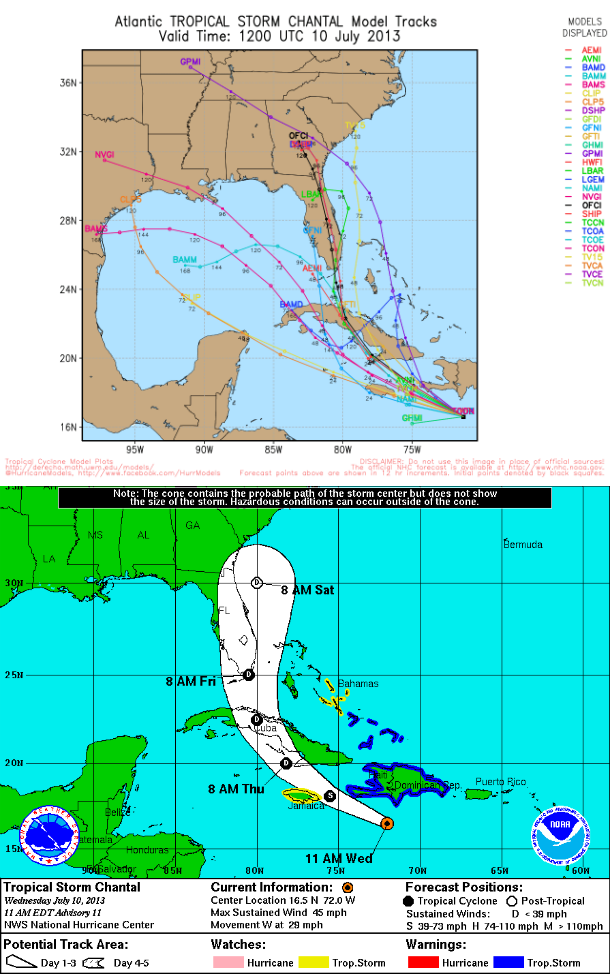
A Tropical Storm Warning is in effect for entire coast of the Dominican Republic, entire coast of Haiti, Turks and Caicos, southeastern Bahamas. A tropical storm watch is in effect for central Bahamas and Jamaica.
A storm surge accompanied by dangerous waves will raise water levels by as much as 1 to 2 feet in the Tropical Storm Warning area. Chantal is expected to produce total rain accumulations 2 to 4 inches over Hispaniola, central and eastern Cuba and the southeastern Bahamas. Isolated maximum amounts of 6 inches are possible across southern portions of Hispaniola.
Satellite Animations
- Storm-Centered Infrared (GOES 13; NOAA/SSD)
- Storm-Centered Infrared (Aviation Color Enhancement) (GOES 13; NOAA/SSD)
- Storm-Centered Water Vapor (GOES 13; NOAA/SSD)
- Storm-Centered Visible (GOES 13; NOAA/SSD)
- Storm-Centered Visible (Colorized) (GOES 13; NOAA/SSD)
- Caribbean and Gulf of Mexico Infrared (GOES 13; NOAA/SSD)
- Caribbean and Gulf of Mexico Infrared (Aviation Color Enhancement) (GOES 13; NOAA/SSD)
- Caribbean and Gulf of Mexico Water Vapor (GOES 13; NOAA/SSD)
- Caribbean and Gulf of Mexico Visible (GOES 13; NOAA/SSD)
- Caribbean and Gulf of Mexico Visible (Colorized) (GOES 13; NOAA/SSD)
Commenting rules and guidelines
We value the thoughts and opinions of our readers and welcome healthy discussions on our website. In order to maintain a respectful and positive community, we ask that all commenters follow these rules.