
Two new tropical disturbances formed in Indian Ocean
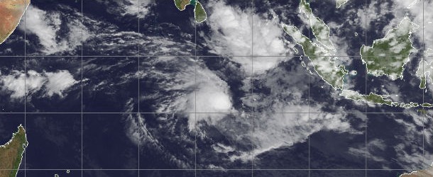
Featured image: Satellite view of tropical disturbances in Indian Ocean (Credit: METEOSAT7/CIMSS)
New tropical depression (System 94S) formed on May 8, 2013 and is about to become next tropical cyclone in Southern Indian Ocean – Tropical Cyclone 24S. The system is packing maximum sustained winds near 40 knots (46 mph/74 kmh) with gusts up to 50 knots, and is expected to strengthen over the next several days. The Joint Typhoon Warning Center expects Tropical Cyclone 24S to drift slowly to the southwest and then south over the next couple of days as it continues to intensify.

Multispectral satellite image shows the system on May 9, 2013 (Credit: JTWC/SATOPS)
According to latest report by Joint Typhoon Warning Center (JTWC), Tropical Cyclone 24s (TC 24S) is located approximately 774 nm east of Diego Garcia. The system is moving south-southeastward at speed of 4 knots over the past six hours. After the next 12 hours, vertical wind shear is forecast to relax, allowing for further consolidation and intensification. TC 24s should peak at about 65 knots by the next 72 hours then gradually weaken due to the infusion of cooler, drier air associated with the aforementioned high to the south.

TC 24S forecast track (Source: JTWC)
Animated multispectral satellite imagery depicts an exposed low-level circulation center with a large cluster of deep convection displaced over the western semi- Circle. TC 24s is located within a marginal environment with strong (30 to 40 knots) easterly vertical wind shear offset by favorable poleward outflow. Tc 24s is forecast to continue tracking southward along the western periphery of the subtropical steering ridge through the next 48 hours. Thereafter, the system should turn increasingly westward and accelerate as it transitions to the steering influence of a strong high anchored to the south.

Satellite view and forecast track of TC 24S (Credit: McIDAS)
There is another low pressure system ( System 92B) forming in the Northern Indian Ocean. On satellite images, System 92B appeared fragmented and disorganized, with scattered thunderstorms around its center and south of the center of circulation. Regardless of whether System 92B becomes a tropical cyclone, it will bring heavy rainfall over the Indian Ocean.

Current tropical systems in Indian Ocean (Source: JTWC/SATOPS)
Satellite Animations
- Storm-Centered Infrared (Meteosat 7; CIMSS)
- Storm-Centered Enhanced Infrared (Meteosat 7; CIMSS)
- Storm-Centered Water Vapor (Meteosat 7; CIMSS)
- Storm-Centered Visible (Meteosat 7; CIMSS)
- Meteosat 7 Infrared (Meteosat 7; CIMSS)
- Meteosat 7 Infrared (Color Background) (Meteosat 7; CIMSS)
- Meteosat 7 Infrared (NHC Color Enhancement) (Meteosat 7; CIMSS)
- Meteosat 7 Water Vapor (Meteosat 7; CIMSS)
- Meteosat 7 Water Vapor (Color Background) (Meteosat 7; CIMSS)
Commenting rules and guidelines
We value the thoughts and opinions of our readers and welcome healthy discussions on our website. In order to maintain a respectful and positive community, we ask that all commenters follow these rules.