
Red alert for wind impact in Bangladesh – Tropical Cyclone 01B developed in Bay of Bengal
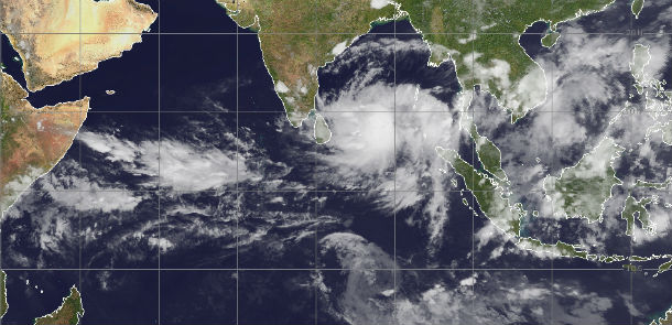
Image credit: MODIS
New tropical disturbance developed in Bay of Bengal and it's named Tropical Cyclone 01B. The current maximum wind speed is 157 km/h, equal to Category 2 storm. This tropical cyclone is expected to have a high humanitarian impact based on the storm strength and the affected population in the past and forecasted path. According to GDACS, up to 8.3 million people can be affected by wind speeds of cyclone strength or above. In addition, 1.9 million people people are living in coastal areas below 5m and can therefore be affected by storm surge.
Tropical Cyclone 01B developed from low pressure System 92B, formed near the northern tip of Sumatra. Forecasters at the Joint Typhoon Warning Center expect 01B to intensify into hurricane force and make landfall on May 14 or 15 in northwestern Myanmar and eastern Bangladesh.
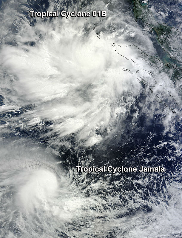
According to latest report by Joint Typhoon Warning Center (JTWC), Tropical Cyclone 01B is located approximately 880nm south of Chittagong, Bangladesh. The system is moving northwestward at speed of 11 knots over the past six hours. Animated multispectral satellite imagery depicts a large area of multiple banding features leading into a low- level circulation center which is currently being obscured by flaring deep central convection.
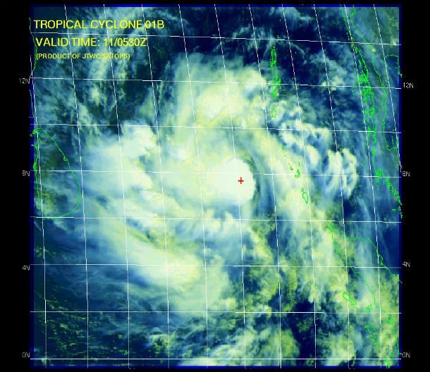
Upper-level analysis indicates that favorable diffluence aloft is assisting in the build up of deep convection while vertical wind shear has slightly relaxed to low to moderate levels (10 to 20 knots), overall resulting in a favorable environment. TC 01B is forecast to continue tracking northwestward through the next 36 hours along the western periphery of the subtropical ridge positioned over the northeastern Bay of Bengal. Thereafter, TC 01B is expected to slow and turn northeastward as the subtropical ridge weakens due to an approaching midlatitude shortwave trough currently over northern India and the northeastern Arabian Sea.
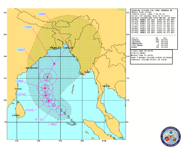
TC 01B should intensify to a peak of 85 knots in the days ahead as poleward outflow increases into the westerlies. The system will make landfall as a significant tropical cyclone and begin to weaken due to land interaction.
.jpg)
Satellite Animations
- Storm-Centered Infrared (MTSAT; NOAA/SSD)
- Storm-Centered Infrared (Aviation Color Enhancement) (MTSAT; NOAA/SSD)
- Storm-Centered Water Vapor (MTSAT; NOAA/SSD)
- Storm-Centered Visible (MTSAT; NOAA/SSD)
- Storm-Centered Visible (Colorized) (MTSAT; NOAA/SSD)
- Meteosat 7 Infrared (Meteosat 7; CIMSS)
- Meteosat 7 Infrared (Color Background) (Meteosat 7; CIMSS)
- Meteosat 7 Infrared (NHC Color Enhancement) (Meteosat 7; CIMSS)
- Meteosat 7 Water Vapor (Meteosat 7; CIMSS)
- Meteosat 7 Water Vapor (Color Background) (Meteosat 7; CIMSS)
Its confirm Mahasen attack Bangladesh.
If the cyclone hit chittagong, we'll be affected badly. whats the possibility tide or flood. we need recuperation for safety.