
M 6.0 earthquake struck east of Kuril Islands
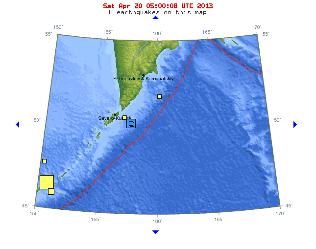
Image credit: USGS
Magnitude 6.0 earthquake (USGS) struck east of Kuril Islands on Friday, April 19, 2013 at 19:58:40 UTC. The epicenter was located 133 km (82 miles) SE of Severo-Kuril’sk and 333 km (206 miles) S of Vilyuchinsk, Russia at coordinates 49.938°N, 157.639°E. The depth of epicenter was 18.6 km (11.6 miles). EMSC recorded M 6.1 at depth of 10 km. This earthquake is considered to be strong aftershock of earlier M 7.2 that struck the area. There was no tsunami alert issued.
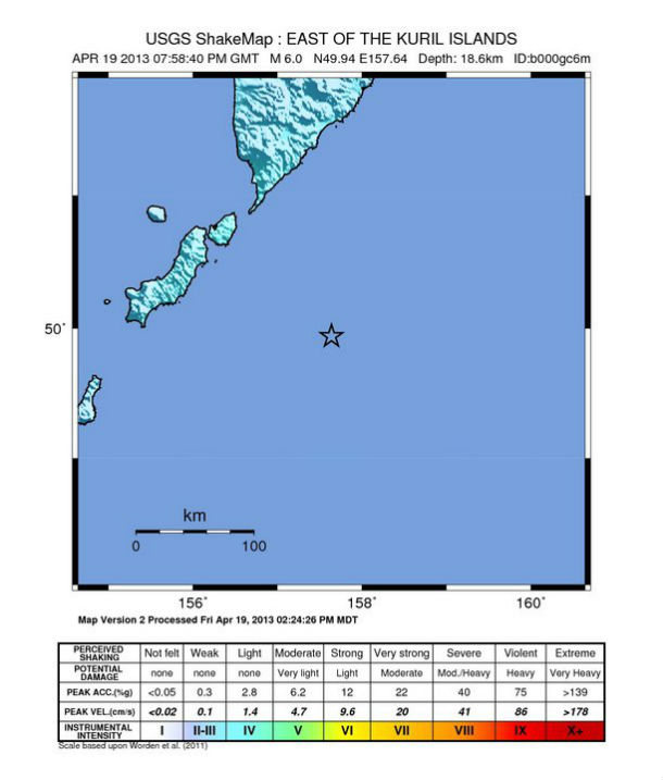 USGS shakemap
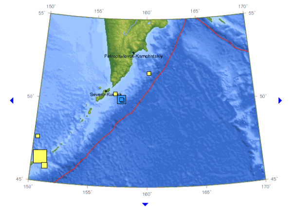 Recent seismic activity in the area (Credit: USGS)
| Magnitude | 6.0 |
|---|---|
| Date-Time |
|
| Location | 49.938°N, 157.639°E |
| Depth | 18.6 km (11.6 miles) |
| Region | EAST OF THE KURIL ISLANDS |
| Distances | 133 km (82 miles) SE of Severo-Kuril’sk, Russia 333 km (206 miles) S of Vilyuchinsk, Russia 349 km (216 miles) SSW of Petropavlovsk-Kamchatskiy, Russia 361 km (224 miles) S of Yelizovo, Russia |
| Location Uncertainty | horizontal +/- 14.4 km (8.9 miles); depth +/- 5.1 km (3.2 miles) |
| Parameters | NST=191, Nph=194, Dmin=350.7 km, Rmss=1.11 sec, Gp= 29°, M-type=teleseismic moment magnitude (Mw), Version=9 |
| Source |
|
| Event ID | usb000gc6m |
Commenting rules and guidelines
We value the thoughts and opinions of our readers and welcome healthy discussions on our website. In order to maintain a respectful and positive community, we ask that all commenters follow these rules.