
Tropical Cyclone 13S aiming Madagascar
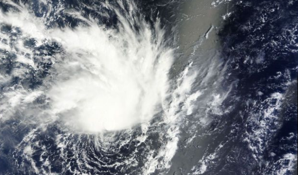
Image credit: TW
New tropical system is forming near La Reunion Islands. According to latest JTWC report, Tropical cyclone 13S was located approximately 590 nm northeast of La Reunion, and is moving west-southwestward at 11 knots. Animated multispectral satellite imagery reveals a partially exposed low-level circulation center with flaring deep convection sheared to the north. Tc 13S remains in a marginal environment with moderate vertical wind shear which is being offset by good poleward outflow into an upper-level low.
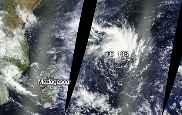 TC 13S captured by MODIS satellite on January 27, 2013 (Credit: LANCE/WorldView)
TC 13s is forecast to track westward under the steering influence of the deep subtropical ridge through the next three days, but will then turn poleward along the western periphery of subtropical ridge, which is forecast to re-orient as a deep midlatitude trough propagates toward Madagascar. TC 13s is expected to intensify slowly through the next 48 hours due to the marginal conditions but should intensify at a faster rate after that period as vertical wind shear decreases and poleward outflow increases into the midlatitude westerlies.
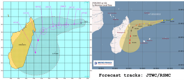
TC 13S is expected to move broadly west, gradually intensifying to hurricane force upon approach to Madagascar.
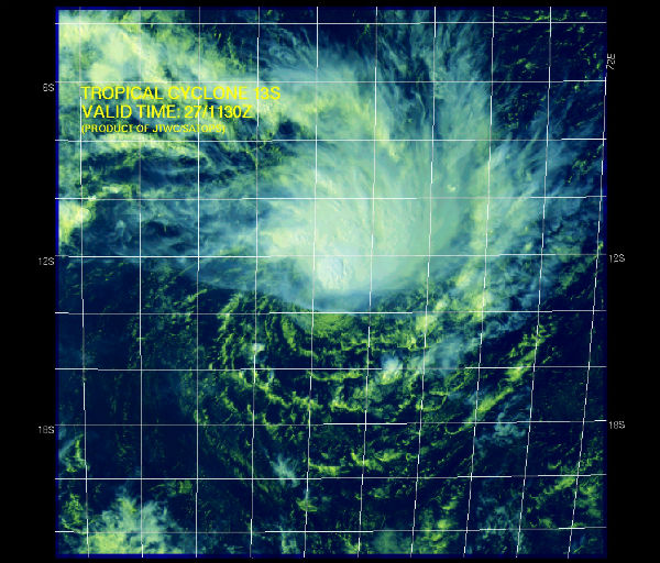 Multispectral satellite image (Credit: JTWC/SATOPS)
Meanwhile, the area of convection previously located near 19.8S 41.3E, is now located near 19.5S 40.1E, approximately 390 nm west of Antananarivo, Madagascar. The system is actually situated by the coast of Mozambique, which can be seen through the convection in the full image due to the use of the Chelys Satellite Rapid Response System (SRRS) “borders” feature.
Animated multispectral satellite imagery depicts an elongated low-level circulation center with isolated deep convection flaring over the west quadrant. An SSMI 37 ghz image indicates only weak, shallow convective banding wrapping loosely into the low-level circulation center. A ASCAT image shows an elongated circulation center with 20 to 25 knot winds; some stronger winds were indicated over the southern semi-circle but were surrounded by rain-flagged data. Upper-level analysis indicates a generally unfavorable environment with moderate (20 to 25 knots) vertical wind shear.
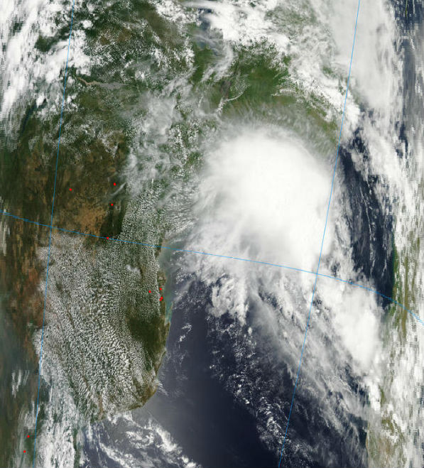 The area of convection off Madagascar coast seen by Aqua/MODIS satellite at 01:20 UTC on January 26, 2013 (Credit: LANCE/MODIS)
The system is located west of an anticyclone and is under diffluent, easterly flow. However, poleward and equatorward outflow remain limited. Maximum sustained surface winds are estimated at 20 to 25 knots. Minimum sea level pressure is estimated to be near 1005 mb. The potential for the development of a significant tropical cyclone within the next 24 hours remains low.
Satellite Animations
- Storm-Centered Infrared (Meteosat 7; CIMSS)
- Storm-Centered Enhanced Infrared (Meteosat 7; CIMSS)
- Storm-Centered Water Vapor (Meteosat 7; CIMSS)
- Storm-Centered Visible (Meteosat 7; CIMSS)
- Meteosat 7 Infrared (Meteosat 7; CIMSS)
- Meteosat 7 Infrared (Color Background) (Meteosat 7; CIMSS)
- Meteosat 7 Infrared (NHC Color Enhancement) (Meteosat 7; CIMSS)
- Meteosat 7 Water Vapor (Meteosat 7; CIMSS)
- Meteosat 7 Water Vapor (Color Background) (Meteosat 7; CIMSS)
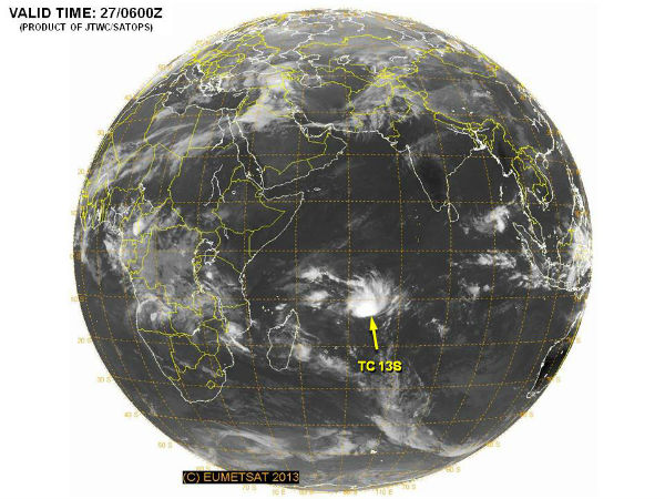 Position of TC 13S on January 27, 2013 (Credit: JTWC/SATOPS)
Sources: RSMC La Reunion, JTWC
Commenting rules and guidelines
We value the thoughts and opinions of our readers and welcome healthy discussions on our website. In order to maintain a respectful and positive community, we ask that all commenters follow these rules.