
Active volcanoes in the world: November 14 – November 20, 2012
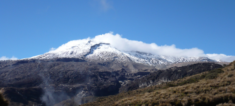
Featured image: Volcan Nevado del Ruiz Visto desde la carretera hacia Murillo, cerca de la Laguna negra. Credit: Edgar from Ibagué, Colombia.
New unrest has been noticed around 5 volcanoes, ongoing activity was reported for 6 volcanoes. This report covers active volcanoes in the world recorded from November 14 – November 20, 2012 based on Smithsonian/USGS criteria.
New activity/unrest: | Cleveland, Chuginadak Island | Kizimen, Eastern Kamchatka (Russia) | Reventador, Ecuador | Ruapehu, North Island (New Zealand) | Villarrica, Central Chile
Ongoing activity: | Karymsky, Eastern Kamchatka (Russia) | Kilauea, Hawaii (USA) | Nevado del Ruiz, Colombia | Rabaul, New Britain | Sakura-jima, Kyushu | Shiveluch, Central Kamchatka (Russia)
The Weekly Volcanic Activity Report is a cooperative project between the Smithsonian’s Global Volcanism Program and the US Geological Survey’s Volcano Hazards Program. Updated by 23:00 UTC every Wednesday, notices of volcanic activity posted on these pages are preliminary and subject to change as events are studied in more detail. This is not a comprehensive list of all of Earth’s volcanoes erupting during the week, but rather a summary of activity at volcanoes that meet criteria discussed in detail in the “Criteria and Disclaimers” section. Carefully reviewed, detailed reports on various volcanoes are published monthly in the Bulletin of the Global Volcanism Network.
*** Due to staff holiday schedules, this report was finalized a day early, missing the Tongariro eruption. It will be included in the next report. ***
New activity/unrest
CLEVELAND, Chuginadak Island
52.825°N, 169.944°W; summit elev. 1730 m
AVO reported that no new activity was observed in cloudy to mostly-cloudy satellite images and web-camera views during 14-15 November. Clouds completely obstructed views during 16-18 November. The Aviation Color Code remained at Orange.
Geologic summary: Symmetrical Mount Cleveland stratovolcano is situated at the western end of the uninhabited dumbbell-shaped Chuginadak Island in the east-central Aleutians. The 1,730-m-high stratovolcano is the highest of the Islands of Four Mountains group and is one of the most active in the Aleutians. Numerous large lava flows descend its flanks. It is possible that some 18th to 19th century eruptions attributed to Carlisle (a volcano located across the Carlisle Pass Strait to the NW) should be ascribed to Cleveland. In 1944 Cleveland produced the only known fatality from an Aleutian eruption. Recent eruptions from Mt. Cleveland have been characterized by short-lived explosive ash emissions, at times accompanied by lava fountaining and lava flows down the flanks.
KIZIMEN, Eastern Kamchatka (Russia)
55.130°N, 160.32°E; summit elev. 2376 m
KVERT reported that during 9-16 November moderate seismic activity at Kizimen was detected. Video and satellite images showed lava flows effusing from the summit and the E flank, summit incandescence, strong gas-and-steam activity, and hot avalanches on the S flank. A daily thermal anomaly was detected in satellite images. The Aviation Color Code remained at Orange.
Geologic summary: Kizimen is an isolated, conical stratovolcano that is morphologically similar to Mount St. Helens prior to its 1980 eruption. The summit of Kizimen consists of overlapping lava domes, and blocky lava flows descend the flanks of the volcano, which is the westernmost of a volcanic chain north of Kronotsky volcano. The 2,376-m-high Kizimen was formed during four eruptive cycles beginning about 12,000 years ago and lasting 2,000-3,500 years. The largest eruptions took place about 10,000 and 8300-8400 years ago, and three periods of longterm lava-dome growth have occurred. The latest eruptive cycle began about 3,000 years ago with a large explosion and was followed by lava-dome growth lasting intermittently about 1,000 years. An explosive eruption about 1,100 years ago produced a lateral blast and created a 1.0 x 0.7 km wide crater breached to the NE, inside which a small lava dome (the fourth at Kizimen) has grown. A single explosive eruption, during 1927-28, has been recorded in historical time.
PALUWEH, Lesser Sunda Islands (Indonesia)
8.32°S, 121.708°E; summit elev. 875 m
Based on analysis of satellite imagery, the Darwin VAAC reported that during 14-19 November ash plumes from Paluweh rose to altitudes of 2.4-3 km (8,000-10,000 ft) a.s.l. and drifted 45-150 km NW and W. A thermal anomaly was detected on 14 November.
Geologic summary: Paluweh volcano, also known as Rokatenda, forms the 8-km-wide island of Paluweh N of the volcanic arc that cuts across Flores Island. Although the volcano rises about 3,000 m above the sea floor, its summit reaches only 875 m above sea level. The broad irregular summit region contains overlapping craters up to 900 m wide and several lava domes. Several flank vents occur along a NW-trending fissure. The largest historical eruption of Paluweh occurred in 1928, when a strong explosive eruption was accompanied by landslide-induced tsunamis and lava-dome emplacement.
REVENTADOR, Ecuador
0.077°S, 77.656°W; summit elev. 3562 m
IG reported that seismicity at Reventador indicated falling rock and explosions during 14-15 November. Cloud cover prevented visual confirmation.
Geologic summary: Reventador is the most frequently active of a chain of Ecuadorian volcanoes in the Cordillera Real, well E of the principal volcanicaxis. It is a forested stratovolcano that rises above the remote jungles of the western Amazon basin. A 3-km-wide caldera breached to the E was formed by edifice collapse and is partially filled by a young, unvegetated stratovolcano that rises about 1,300 m above the caldera floor. Reventador has been the source of numerous lava flows as well as explosive eruptions that were visible from Quito in historical time. Frequent lahars in this region of heavy rainfall have constructed a debris plain on the eastern floor of the caldera.
RUAPEHU, North Island (New Zealand)
39.28°S, 175.57°E; summit elev. 2797 m
GeoNet reported that measurements at Ruapehu during the previous few weeks indicated that the likelihood of an eruption had increased. Scientists were concerned that increased heat at depth beneath the crater indicated a partialyl blocked vent and the potential for an eruption due to increased pressure. On 16 November the Volcanic Alert Level remained at 1 (signs of volcano unrest) and the Aviation Colour Code was raised to Yellow.
Geologic summary: Ruapehu, one of New Zealand’s most active volcanoes, is a complex stratovolcano constructed during at least four cone-building episodes. The 110 cu km volcanic massif is elongated in a NNE-SSW direction and is surrounded by another 100 cu km ring plain of volcaniclastic debris. A single historically active vent, Crater Lake, is located in the broad summit region, but at least five other vents on the summit and flanks have been active during the Holocene. Frequent mild-to-moderate explosive eruptions have occurred in historical time from the Crater Lake vent. Lahars produced by phreatic eruptions from the summit crater lake are a hazard to a ski area on the upper flanks and to river valleys below the volcano.
VILLARRICA, Central Chile
39.42°S, 71.93°W; summit elev. 2847 m
According to Projecto Observación Visual Volcán Villarrica (POVI), images of Villarrica posted on 14 November showed a dense plume rising and obscuring the deeper parts of the crater, and an area on the W part of the crater rim with ash and bomb deposits.
Geologic summary: Villarrica, one of Chile’s most active volcanoes, rises above the lake and town of the same name. It is the westernmost of three large stratovolcanoes that trend perpendicular to the Andean chain. A 6-km wide caldera formed during the late Pleistocene, more than 0.9 million years ago. A 2-km-wide postglacial caldera is located at the base of the presently active, dominantly basaltic-to-andesitic cone at the NW margin of the Pleistocene caldera. About 25 scoria cones dot Villarrica’s flanks. Plinian eruptions and pyroclastic flows have been produced during the Holocene from this dominantly basaltic volcano, but historical eruptions have consisted largely of mild-to-moderate explosive activity with occasional lava effusion. Lahars from the glacier-covered volcano have damaged towns on its flanks.
Ongoing activity
KARYMSKY, Eastern Kamchatka (Russia)
54.05°N, 159.45°E; summit elev. 1536 m
KVERT reported that moderate seismic activity continued at Karymsky during 9-16 November; seismicity indicated that possible ash plumes rose to an altitude of 6 km (19,700 ft) a.s.l. Satellite imagery detected a daily thermal anomaly on the volcano, and ash plumes that drifted 40 km SE on 12 November. The Aviation Color Code remained at Orange.
Geologic summary: Karymsky, the most active volcano of Kamchatka’s eastern volcanic zone, is a symmetrical stratovolcano constructed within a 5-km-wide caldera that formed about 7,600-7,700 radiocarbon years ago. Construction of the Karymsky stratovolcano began about 2,000 years later. The latest eruptive period began about 500 years ago, following a 2,300-year quiescence. Much of the cone is mantled by lava flows less than 200 years old. Historical eruptions have been Vulcanian or Vulcanian-Strombolian with moderate explosive activity and occasional lava flows from the summit crater. Most seismicity preceding Karymsky eruptions has originated beneath Akademia Nauk caldera, which is located immediately S of Karymsky volcano and erupted simultaneously with Karymsky in 1996.
KILAUEA, Hawaii (USA)
19.421°N, 155.287°W; summit elev. 1222 m
During 14-19 November HVO reported that the circulating lava lake periodically rose and fell in the deep pit within Kilauea’s Halema’uma’u Crater. Occasional measurements indicated that the gas plume from the vent continued to deposit variable amounts of spatter and Pele’s hair onto nearby areas. Lava flows were active on the coastal plain, but were about 290 m from the coast.
Activity at Pu’u ‘O’o Crater remained elevated. Lava circulated within the perched lava lake at the NE pit at Pu’u ‘O’o Crater, and glow emanated from vents at the S edge of the crater floor and from a spatter cone at the N edge. Small lava flows issued a few times from the westernmost vent at the S edge of the crater floor during 17-18 November.
Geologic summary: Kilauea, one of five coalescing volcanoes that comprise the island of Hawaii, is one of the world’s most active volcanoes. Eruptions at Kilauea originate primarily from the summit caldera or along one of the lengthy E and SW rift zones that extend from the caldera to the sea. About 90% of the surface of Kilauea is formed of lava flows less than about 1,100 years old; 70% of the volcano’s surface is younger than 600 years. A long-term eruption from the East rift zone that began in 1983 has produced lava flows covering more than 100 sq km, destroying nearly 200 houses and adding new coastline to the island.
NEVADO DEL RUIZ, Colombia
4.895°N, 75.322°W; summit elev. 5321 m
Based on analysis of satellite imagery and reported seismic activity, the Washington VAAC issued a notice about a possible eruption from Nevado del Ruiz on 15 November. Cloud cover prevented observations of a possible ash plume but elevated seismicity was detected. A few hours later seismicity decreased and a faint thermal anomaly was detected. About six hours after that seismic activity remained low and no anomaly was detected.
Geologic summary: Nevado del Ruiz is a broad, glacier-covered volcano in central Colombia that covers >200 sq km. Three major edifices, composed of andesitic and dacitic lavas and andesitic pyroclastics, have been constructed since the beginning of the Pleistocene. The modern cone consists of a broad cluster of lava domes built within the summit caldera of an older Ruiz volcano. The 1-km-wide, 240-m-deep Arenas crater occupies the summit. Steep headwalls of massive landslides cut the flanks of Nevado del Ruiz. Melting of its summit icecap during historical eruptions, which date back to the 16th century, has resulted in devastating lahars, including one in 1985 that was South America’s deadliest eruption.
RABAUL, New Britain
4.271°S, 152.203°E; summit elev. 688 m
RVO reported that during 16-19 November diffuse white plumes from Rabaul caldera’s Tavurvur cone rose 300 m above the crater; plume volume increased during times of high humidity. Seismicity continued at very low level. Measurements two weeks prior showed continuing low levels of gas emissions.
Geologic summary: The low-lying Rabaul caldera on the tip of the Gazelle Peninsula at the NE end of New Britain forms a broad sheltered harbor. The outer flanks of the 688-m-high asymmetrical pyroclastic shield volcano are formed by thick pyroclastic-flow deposits. The 8 x 14 km caldera is widely breached on the E, where its floor is flooded by Blanche Bay. Two major Holocene caldera-forming eruptions at Rabaul took place as recently as 3,500 and 1,400 years ago. Three small stratovolcanoes lie outside the northern and NE caldera rims. Post-caldera eruptions built basaltic-to-dacitic pyroclastic cones on the caldera floor near the NE and western caldera walls. Several of these, including Vulcan cone, which was formed during a large eruption in 1878, have produced major explosive activity during historical time. A powerful explosive eruption in 1994 occurred simultaneously from Vulcan and Tavurvur volcanoes and forced the temporary abandonment of Rabaul city.
SAKURA-JIMA, Kyushu
31.585°N, 130.657°E; summit elev. 1117 m
JMA reported that during 12-16 November explosions from Sakura-jima’s Showa Crater ejected tephra as far as 1.8 km from the crater. Incandescence from Showa was observed during 12-13 November, and a very small eruption at Minami-dake Crater occurred on 16 November.
Based on information from JMA, the Tokyo VAAC reported that explosions during 14-20 November often produced plumes that rose to altitudes of 1.8-3.4 km (6,000-11,000 ft) a.s.l. and drifted N, NE, E, and SE.
Geologic summary: Sakura-jima, one of Japan’s most active volcanoes, is a post-caldera cone of the Aira caldera at the northern half of Kagoshima Bay. Eruption of the voluminous Ito pyroclastic flow was associated with the formation of the 17 x 23-km-wide Aira caldera about 22,000 years ago. The construction of Sakura-jima began about 13,000 years ago and built an island that was finally joined to the Osumi Peninsula during the major explosive and effusive eruption of 1914. Activity at the Kita-dake summit cone ended about 4,850 years ago, after which eruptions took place at Minami-dake. Frequent historical eruptions, recorded since the 8th century, have deposited ash on Kagoshima, one of Kyushu’s largest cities, located across Kagoshima Bay only 8 km from the summit. The largest historical eruption took place during 1471-76.
SHIVELUCH, Central Kamchatka (Russia)
56.653°N, 161.360°E; summit elev. 3283 m
Based on visual observations and analyses of satellite data, KVERT reported that during 9-16 November a viscous lava flow continued to effuse on the NW flank of Shiveluch’s lava dome, accompanied by hot avalanches and fumarolic activity. Satellite imagery showed a daily thermal anomaly on the lava dome. The Aviation Color Code remained at Orange.
Geologic summary: The high, isolated massif of Shiveluch volcano (also spelled Sheveluch) rises above the lowlands NNE of the Kliuchevskaya volcanogroup and forms one of Kamchatka’s largest and most active volcanoes. The currently active Molodoy Shiveluch lava-dome complex was constructed during the Holocene within a large breached caldera formed by collapse of the massive late-Pleistocene Strary Shiveluch volcano. At least 60 largeeruptions of Shiveluch have occurred during the Holocene, making it the most vigorous andesitic volcano of the Kuril-Kamchatka arc. Frequent collapses of lava-dome complexes, most recently in 1964, have produced large debris avalanches whose deposits cover much of the floor of the breached caldera. Intermittent explosive eruptions began in the 1990s from a new lava dome that began growing in 1980. The largest historical eruptions from Shiveluch occurred in 1854 and 1964.
Source: Global Volcanism Program
I'm a dedicated researcher, journalist, and editor at The Watchers. With over 20 years of experience in the media industry, I specialize in hard science news, focusing on extreme weather, seismic and volcanic activity, space weather, and astronomy, including near-Earth objects and planetary defense strategies. You can reach me at teo /at/ watchers.news.
Commenting rules and guidelines
We value the thoughts and opinions of our readers and welcome healthy discussions on our website. In order to maintain a respectful and positive community, we ask that all commenters follow these rules.