Indonesian volcano Mt. Rokatenda (Paluweh) continues spurting out ash

Volcanic ash is reportedly spurting out of Mount Rokatenda, in Sikka regency, Indonesia due to increased volcanic activity since October 1, 2012. Based on analysis of satellite imagery and other data, the Darwin VAAC reported that during 11-13 November ash plumes from Paluweh rose to an altitude of 2.4 km (8,000 ft) and drifted 90-150 km NW and W. People living around the volcano have been evacuated and shelters are provided at Hewuli village. Jakarta post reports that there have been cases of various illnesses, such as respiratory, eye and skin irritation.
Received FVAU0190 at 02:49 UTC, 19/11/12 from ADRM

VAAC:  Darwin

VOLCANO:  Paluweh  0604-15

AREA:  Lesser Sunda Is

SUMMIT ELEV:  875M


AVIATION COLOUR CODE:  ORANGE

ERUPTION DETAILS:  VA PLUME OBS TO FL080 EXTENDING 35NM TO NW AT

19/0130Z.


RMK:  HEIGHT DERIVED FROM 19/0130Z MTSAT2 IR IMAGE AND KUPANG

18/1200Z SOUNDING

NXT ADVISORY:  NO LATER THAN 20121119/0900Z
Source: Darwin VAAC
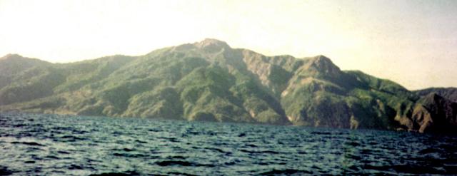
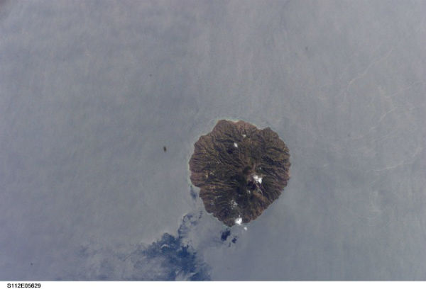
Also known as Paluweh, Rokatenda is a stratovolcano mountain located on the small island of Palu’e Island, north of Flores Island in Sikka Regency in the province of East Nusa Tenggara, Indonesia. The biggest eruption occurred on 4 August – 25 September 1928, when a strong explosive eruption was accompanied by landslide-induced tsunamis and lava dome emplacement.
 Paluweh captured by ISS in October 2002 (“Image courtesy of the Image Science & Analysis Laboratory, NASA Johnson Space Center/Astronaut Photography of Earth STS112-E-5629)
Volcano status as notified by Indonesia’s National disaster management agency:
| 7 Standby, 13 Watchful | |
| Name Mount |
As of Date |
| Raung | October 22, 2012 |
| Rokatenda | October 13, 2012 |
| Sangeangapi | October 10, 2012 |
| Karangetang | August 8, 2011 |
| Lokon | July 24, 2011 |
| Ijen | July 24, 2012 |
| Soputan | August 26, 2012 |
| Name Mount | As of Date |
| Gamalama | October 9, 2012 |
| Bromo | October 3, 2012 |
| Papandayan | January 31, 2012 |
Featured Image: Global volcanism program – An unvegetated lava dome is visible at the summit of Paluweh volcano, also known as Rokatenda. The complex stratovolcano forms an 8-km-wide island located north of the volcanic arc that cuts across Flores Island. Photo by Volcanological Survey of Indonesia.

Commenting rules and guidelines
We value the thoughts and opinions of our readers and welcome healthy discussions on our website. In order to maintain a respectful and positive community, we ask that all commenters follow these rules:
We reserve the right to remove any comments that violate these rules. By commenting on our website, you agree to abide by these guidelines. Thank you for helping to create a positive and welcoming environment for all.