
STEREO-SOHO detected six coronal mass ejections
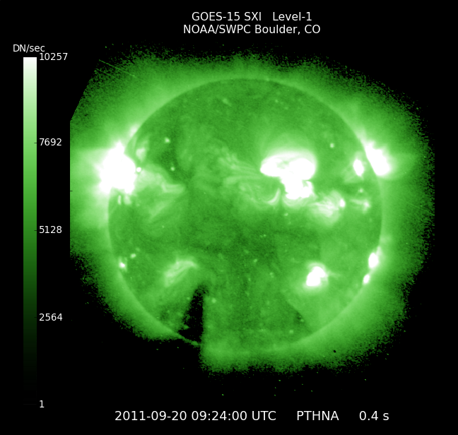
Image credit: TW
On Sept. 19th, the STEREO-SOHO fleet of spacecraft surrounding the sun detected six coronal mass ejections (CMEs). Two of the clouds rapidly dissipated. The remaining four, however, are still intact and billowing through the inner solar system. Click to view a movie of their forecasted paths:

According to analysts at the Goddard Space Weather Lab, who prepared the movie, one CME should hit Mercury on Sept. 20th at 05:40 UT while another delivers a glancing blow to Earth’s magnetic field on Sept. 22th at 23:00 UT. All impact times have an uncertainty of plus or minus 7 hrs.
High-latitude sky watchers (on Earth) should be alert for auroras when the CME arrives. (SpaceWeather)
Solar wind
speed: 429.0 km/sec
density: 1.3 protons/cm3
The Radio Sun
10.7 cm flux: 141 sfu
Planetary K-index
Now: Kp= 3 quiet
Interplanetary Mag. Field
Btotal: 4.1 nT
Bz: 1 nT south
Two mid level C-Class flares took place early on Monday. A C6.2 around Sunspot 1296 and a C6.1 around Sunspot 1301. There will remain a chance for an M-Class event. A near M-Class flare measuring C9.5 took place off the western limb at 05:13 UTC Tuesday morning. Any Coronal Mass Ejections (CMEs) at this point have a chance at being earth directed.
Persistant Sunspot 1289 is now rotating onto the western limb and will be out of direct earth view within the next couple of days. (SolarHam)
Alerts / Bulletins
Latest Alert: Sep 20 0749 UTC ALERT: Type II Radio Emission
Last Advisory Bulletin: None in last 7 days.


Earlier reporting
Nothing on Watchers was published in the last 24 hours. These are older articles.
- On October 22, 2017, a single flash of lightning stretched 515 miles from eastern Texas to near Kansas City, a distance that takes eight hours to drive, and nobody realized how far it had gone until scientists went back through the satellite data years later Epicenter
- CPC posts a slight risk of heavy rain from the Gulf Coast to the Northeast urban corridor November 25-29, and a moderate risk of West Coast wind and Sierra snow on November 25
- Florida's east coast faces a moderate flash flood risk Wednesday through Friday, with 4 to 8 inches of rain forecast and the St. Johns River near Cocoa already in major flood at 17.13 feet
- Cyclone Akvan to make landfall between Nellore and Visakhapatnam around noon on November 20, IMD forecasts 120-130 km/h winds gusting to 145
