Magnitude 6.4 (initially 6.7) earthquake struck near Vancouver Island, Canada
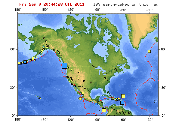
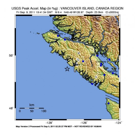
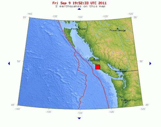
A strong earthquake with initial magnitude 6.7, later downgraded at 6.4, was registered 140 km (86 miles) SSE of Port Hardy, British Columbia, Canada. USGS registered depth of 23 km (14.3 miles).
USGS expects a strong shaking for only 2,000 people and a moderate shaking for 10,000 people. Based on these data, this earthquake will not generate serious damage. The quake could be felt nearly 300 kilometres away in Vancouver.
REAL-TIME SEISMOGRAPHS for Canada
Google satellite map showing the epicenter and the surrounding area
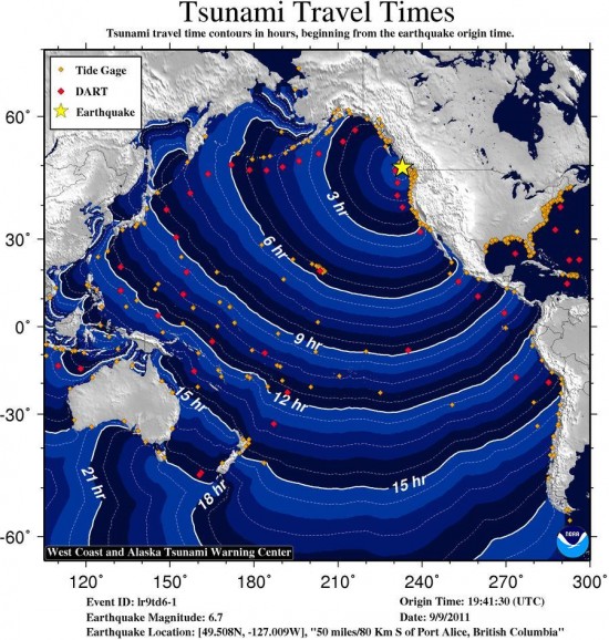
A tsunami IS NOT expected along the California, Oregon, Washington, British Columbia, or Alaska coast. NO tsunami warning, watch or advisory is in effect for these areas.
People reported buildings swaying for several minutes from the Fraser Valley to Campbell River at around 12:41 PT p.m., but there are no reports of damage.
2 similar earthquakes have occurred in the same area since 1900.
The 6.7-earthquake is a fairly large seismic event – slightly less than the recent 7.0 magnitude earthquake in Haiti. But the impact of the B.C. quake was muted because the event occurred 26 kilometres below the surface, said geologist Brent Ward of Simon Fraser University for TheGlobeAndMail.
However, the rumbling could be enough to crack brick walls and plaster in nearby Gold River and Zeballos, he said .
The Friday quake should be a “a good wake-up call” for British Columbians, Mr. Ward said. “It should remind people to get their earthquake kits together and have a plan in place,” he said.
"The earthquake was probably not a precursor of the Big One. In many cases, these are just a one-off. There could be minor after-shocks of magnitude 4 or 5,” Mr. Ward said.
Seismologists are warning to expect more tremors for the next couple of weeks.
Geological Survey of Canada reports the quake was only lightly felt in some parts of Vancouver Island and the mainland. If the epicentre were further to the east, near Vancouver or Victoria, the quake was powerful enough to cause extensive destruction. An earthquake of this size in an urban area could do a lot of damage.
Each year, seismologists with the Geological Survey of Canada record and locate more than 1000 earthquakes in western Canada. The Pacific Coast is the most earthquake-prone region of Canada. In the offshore region to the west of Vancouver Island, more than 100 earthquakes of magnitude 5 or greater (large enough to cause damage had they been closer to land) have occurred during the past 70 years. Part of the Pacific Ring of Fire, the concentration of earthquakes along the west coast is related to the presence of active faults, or breaks in the earth's crust. The surface of the earth is always changing, as the earth's crust is made up of "plates" (like pieces of a jigsaw puzzle) that are constantly moving relative to one another at speed's of about 2-10 cm/year (about how fast your fingernails grow). The plates can either slide past one another, or they can collide, or they can diverge (or move apart).
From northern Vancouver Island, to the Queen Charlotte Islands, the oceanic Pacific plate is sliding to the northwest at about 6 cm/year relative to North America. The boundary between these two giant plates is the Queen Charlotte fault – Canada's equivalent of the San Andreas fault. Canada's largest historical earthquake – a magnitude 8.1, occurred along this fault on August 22, 1949. This earthquake, larger than the 1906 San Francisco earthquake, caused nearly a 500-km-long segment of the Queen Charlotte fault to break.
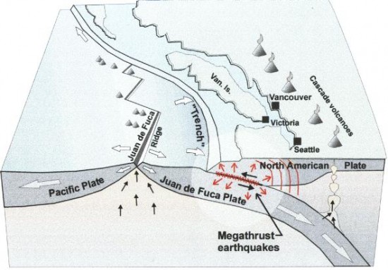
West of Vancouver Island, and extending from the north tip of the Island to northern California, the oceanic Juan de Fuca plate is moving towards North America at about 2-5 cm/year. This region is called the Cascadia subduction zone. Here, the much smaller Juan de Fuca plate is sliding (subducting) beneath the continent (it is about 45 km beneath Victoria, and about 70 km beneath Vancouver). The ocean plate is not always moving though. There is good evidence that the Juan de Fuca and North America plates are currently locked together, causing strain to build up in the earth's crust. It is this squeezing of the crust that causes the 300 or so small earthquakes that are located in southwestern British Columbia each year, and the less-frequent (once per decade, on average, damaging crustal earthquakes (e.g., a magnitude 7.3 earthquake on central Vancouver Island in 1946). At some time in the future, these plates will snap loose, generating a huge offshore "subduction" earthquake – one similar to the 1964 M=9.2 Alaska earthquake, or the 1960 M=9.5 Chile earthquake. Current crustal deformation measurements in this area provide evidence for this model. Geological evidence also indicates that huge subduction earthquakes have struck this coast every 300-800 years. (EarthquakesCanada)
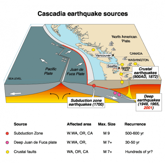
UNDERSTANDING WHY THE BIG EARTHQUAKE IS PREDICTED FOR VANCOUVER By Kate Potter

Christina commented on The Watchers:
Was anyone hurt? What was the magnitude in Vancouver?
Was anyone hurt? What was the magnitude in Vancouver?
Aoutch !
Hope everybody is alright !
Starting to get very worried about Yellowstone !
lots of smaller ones there so far.
Help us GOD`s