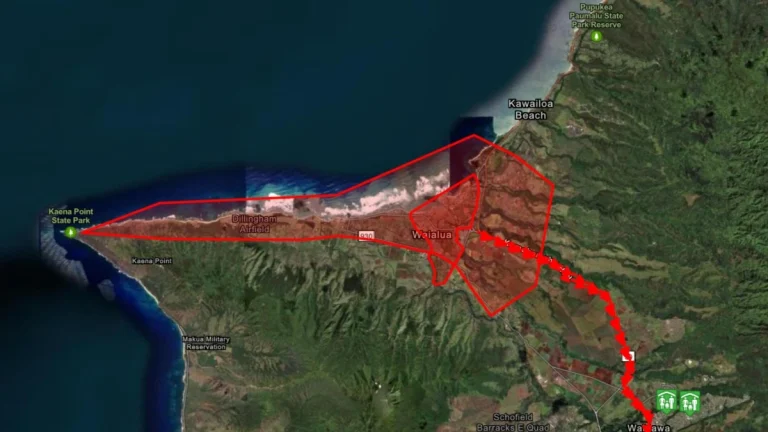
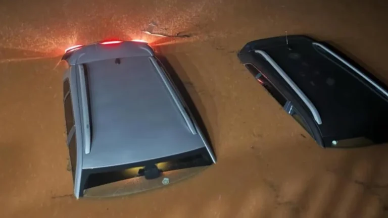
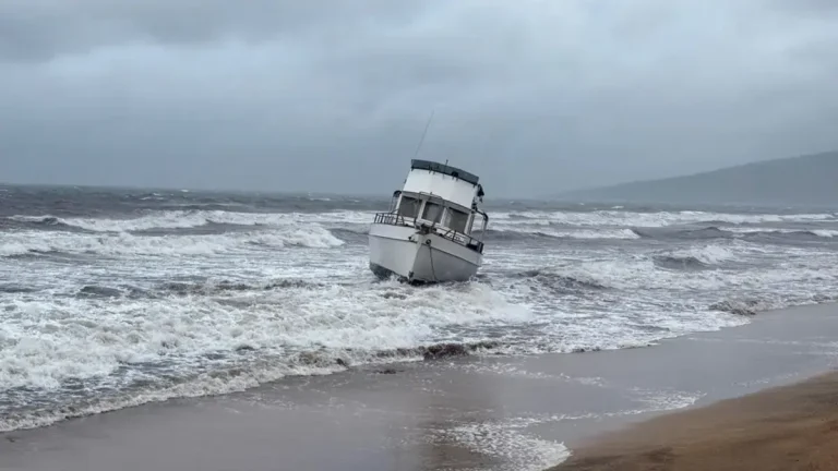
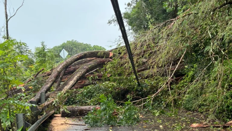
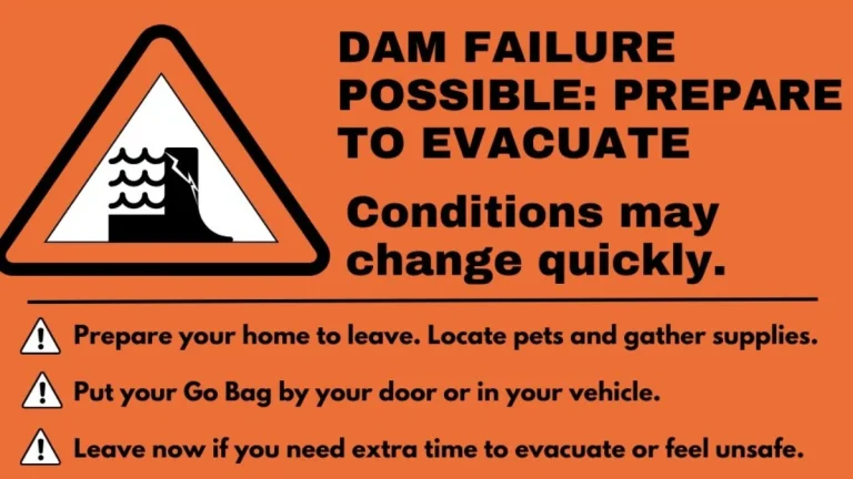
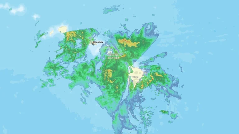
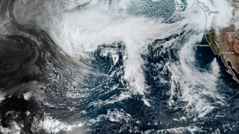
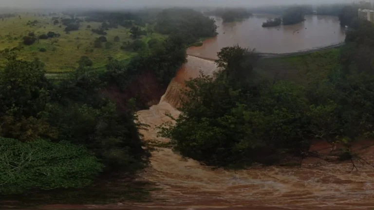
• Kona low triggers life-threatening flooding on Oʻahu’s North Shore, Hawaii

    Life-threatening flash flooding struck Oʻahu’s North Shore, Hawaii, on March 20, 2026, after a slow-moving Kona low produced more than 330 mm (13 inches) of rain in parts of northern Oʻahu in about 12 hours from the evening of March 19 into the morning of March 20. Flooding in the Haleiwa and Waialua areas cut off road access, prompted evacuation orders, and triggered emergency response operations.

  • Second kona low threatens renewed flooding in Hawaiʻi after record-breaking storm

    A second Kona low is expected to affect the Hawaiian Islands beginning the evening of March 19, 2026, bringing additional rainfall to areas already impacted by record-breaking flooding from a previous storm. A Flood Watch is in effect from 18:00 LT on March 19 through 18:00 LT on March 22 for Maui County, Oʻahu, and Hawaiʻi Island.

  • Kona low brings extreme rainfall to Maui and Oʻahu, causing flooding and landslides across Hawaiʻi

    A slow-moving Kona low brought extreme rainfall to the Hawaiian Islands between March 10–16, 2026, producing record-breaking totals at multiple long-term stations, particularly on Maui and Oʻahu. Honolulu and Kahului both set new daily rainfall records on March 13, while multi-day accumulations on Maui reached up to about 1 170 mm (46 inches), triggering flooding, landslides, and widespread disruption.

  • Over 130 000 customers lose power across Hawaii as Kona low brings damaging winds and flash flooding

    Over 130 000 electricity customers across Hawaii lost power on March 13, 2026, as a powerful Kona low brought heavy rainfall, damaging winds, and thunderstorms to the islands. Wind gusts up to 126 km/h (78 mph) were recorded on Oʻahu while forecasters warned rainfall totals of 250–500 mm (10–20 inches) could raise the risk of flash flooding.

  • Evacuation warning issued after possible Wahiawā Dam failure alert on Oʻahu, Hawaiʻi

    A potential failure of Wahiawā Dam on Oʻahu, Hawaiʻi, triggered an evacuation warning at 18:55 LT on March 13, 2026, for downstream communities, including Haleʻiwa and Waialua. Authorities said conditions existed that could lead to dam failure capable of causing catastrophic flooding, prompting residents to prepare for possible evacuation.

  • Kona low prompts statewide closures as severe weather threat intensifies across Hawaii

    A powerful Kona low on Friday, March 13, 2026, bringing widespread severe weather across the islands. The National Weather Service issued a Winter Storm Warning for the Big Island summits, where heavy snow and ice are forecast above 3 350 m (11 000 feet). Forecasters warned that persistent rainfall bands and severe thunderstorms could trigger flash flooding while damaging wind gusts affect multiple islands.

  • Powerful Kona low prompts emergency proclamations as Hawaii faces multi-day flood and severe storm threat

    A powerful Kona low is bringing a multi-day flood and severe weather threat to Hawaii on Wednesday, March 11, 2026, with the most dangerous conditions forecast for Friday into Saturday. The National Weather Service says the storm could produce flash flooding, damaging winds, and strong to severe thunderstorms across the island chain, while Governor Josh Green has issued two emergency proclamations tied to the event.

  • Kīlauea eruption sends ash plume to 9 km (30 000 feet), disrupts flights near Hilo, Hawaii

    Episode 43 of the ongoing eruption at Kīlauea began at about 09:17 LT on March 10, 2026, producing lava fountains exceeding 400 m (1 300 feet) from vents inside Halemaʻumaʻu crater, according to the USGS Hawaiian Volcano Observatory (HVO). Tephra fallout forced the closure of part of Highway 11 and disrupted flights at Hilo International Airport as an ash plume rose to about 9 km (30 000 feet) above sea level.