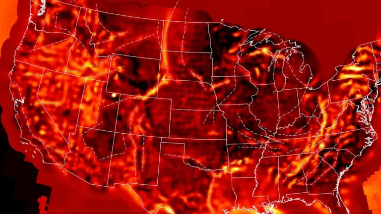
First-of-its-kind deep-Earth conductivity map reveals ancient continental fragments beneath the United States
A first-of-its-kind continent-scale conductivity map made using over 1 700 magnetotelluric stations deployed across the United States has revealed buried tectonic fragments beneath eastern North America, allowing researchers to reconstruct the continent’s deep electrical structure while exposing conductive regions linked to ancient continental collisions, mineral systems, and geomagnetic storm hazard propagation.