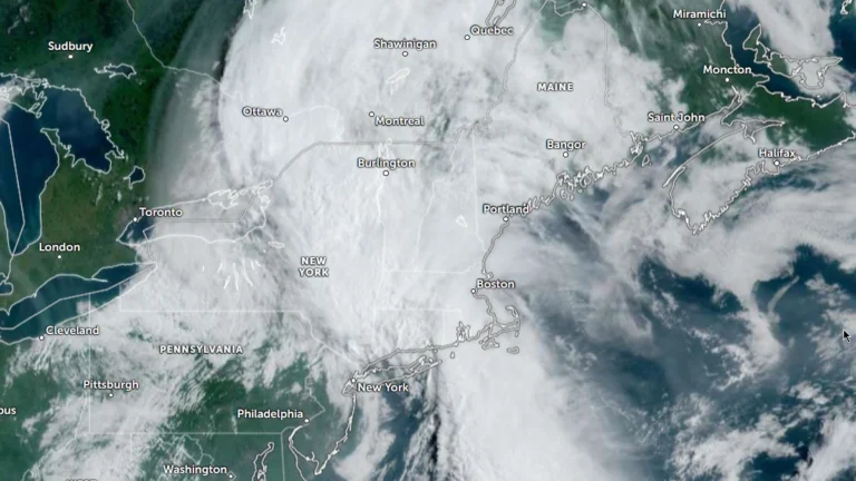
• Moderate Risk of excessive rainfall issued for parts of the Northeast, U.S.

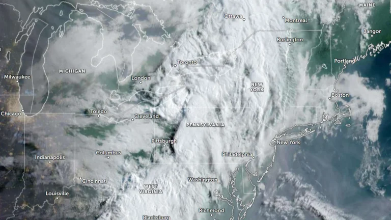
    The Weather Prediction Center (WPC) has issued a Moderate Risk (Level 3 of 4) of excessive rainfall for portions of the northeastern United States on Wednesday, July 29, 2026. Repeated rounds of heavy rainfall could produce significant and potentially life-threatening flooding across parts of eastern New York, western Massachusetts, southern Vermont, and adjacent areas of Connecticut.
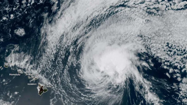

  • Dangerous surf to impact east-facing shores as Tropical Depression Fausto weakens north of Hawaii

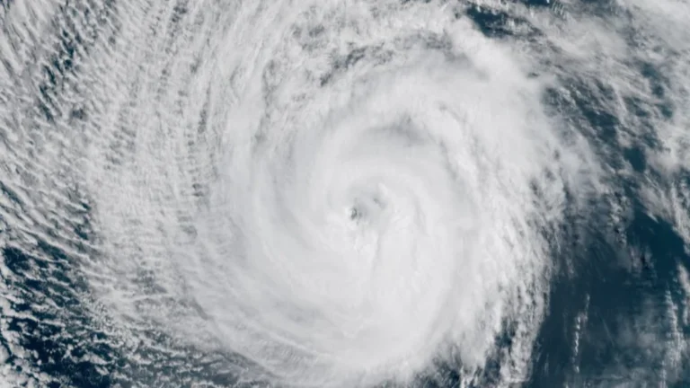
    Former hurricane Fausto weakened to a tropical depression as it tracked north of the Hawaiian Islands late Tuesday, July 28, 2026. Dangerous surf generated by it is building across exposed east-facing shores of the Hawaiian Islands and is expected to remain hazardous through Wednesday, July 29, as the weakening cyclone passes north of the state. Forecasts indicate the strongest winds and heaviest rainfall will stay north of the islands. There are no coastal watches or warnings currently in effect.

  • NWS confirms EF3 tornado in Wisconsin’s Fox Valley

    The tornado that struck Wisconsin’s Fox Valley on Tuesday, July 27, 2026 has been officially rated EF3 by the National Weather Service (NWS), with preliminary surveys estimating peak winds of 225 km/h (140 mph). The tornado formed near Appleton before moving through Fox Crossing and Menasha, while the same outbreak produced widespread wind damage and giant hail across much of northern and eastern Wisconsin.

  • Moderate Risk of excessive rainfall issued for Tri-State area as heavy rain threatens parts of the Northeast

    A Moderate Risk of excessive rainfall and potentially significant flash flooding is in effect for parts of New Jersey, New York, and Connecticut on Tuesday, July 28, 2026 as an unusually strong upper-level low develops over the Northeast. The National Weather Service’s Weather Prediction Center warns that repeated thunderstorms may produce rainfall rates of up to 51 mm (2 inches) per hour, with the greatest threat centered on the New York City tri-state region.

  • Local State of Disaster declared after tornado tears through Menasha, Appleton and Neenah, Wisconsin

    A destructive tornado crossed Lake Winnebago before striking communities across Wisconsin’s Fox Valley on Monday, July 27, 2026, causing extensive damage in Menasha, Appleton, and Neenah. Menasha declared a local State of Disaster as emergency crews responded to heavily damaged neighborhoods, gas leaks, and widespread infrastructure damage following a broader outbreak of severe thunderstorms.

  • Hurricane Genevieve briefly reaches Category 5, hazardous marine conditions continue along parts of Mexico’s Pacific coast

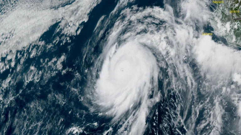
    Genevieve became the first eastern Pacific hurricane to reach Category 5 strength since Hurricane Kristy in 2024 after undergoing explosive rapid intensification on Monday, July 27, 2026. The hurricane weakened back to Category 4 later in the day as it entered an eyewall replacement cycle, with gradual weakening forecast over cooler waters during the coming days.

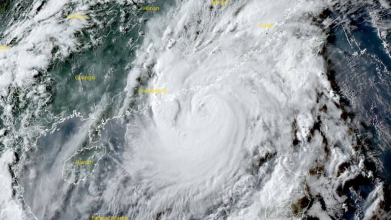
  • Typhoon Noul makes landfall in Guangdong, prompting Level II emergency response across southern China

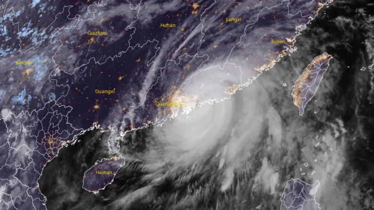
    Typhoon Noul made landfall in Huidong County, Huizhou City, China’s Guangdong Province, at 03:50 HKT (19:50 UTC on July 25) on July 26, 2026, as a severe typhoon with 10-minute maximum sustained winds of 149-165 km/h (93-103 mph). The storm prompted Chinese authorities to raise the national emergency response for major meteorological disasters to Level 2, while more than 700 000 people were relocated across Guangdong. Rail services were suspended, hundreds of flights were canceled, and the central government allocated CNY 100 million (USD 14.8 million) to support post-typhoon recovery and reconstruction.

  • Hurricane Fausto moving toward Hawaiʻi, dangerous surf forecast

    Dangerous surf generated by Hurricane Fausto is expected to build along east-facing shores of Hawaiʻi starting July 26, 2026, before spreading westward through July 27, with additional hazards including heavy rainfall and damaging winds possible early next week. Forecast details are expected to improve over the coming days as the hurricane approaches.

  • Over 20 000 evacuated as Typhoon Noul approaches Guangdong, up to 600 mm (24 inches) of rain forecast, China

    Typhoon Noul is forecast to make landfall over eastern Guangdong by July 26, 2026, bringing a significant threat of flooding across southern China. More than 20 000 people have been evacuated Guangdon with rainfall totals of 500 to 600 mm (20 to 24 inches) forecast as the storm approaches. Authorities have raised Guangdong’s emergency response for flood and typhoon control to Level III on July 25 as Typhoon Noul approached the province, while activating a Level IV flood emergency response for Jiangxi and Hunan.

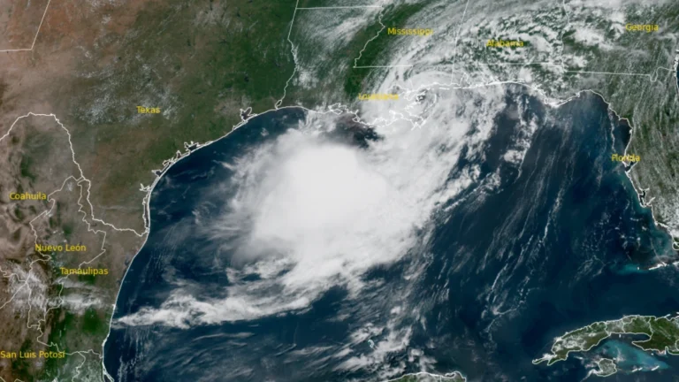
  • Tropical Storm Bertha makes landfall in St Bernard Parish, Louisiana, heads toward upper Texas coast

    Tropical Storm Bertha made landfall at approximately in St. Bernard Parish, Louisiana at approximately 13:50 CDT (18:50 UTC)on July 22, 2026, with maximum sustained winds of 72 km/h (45 mph). Storm surge of up to 1 m (3 feet), rainfall totals of 25 to 100 mm (1 to 4 inches) with isolated amounts reaching 150 mm (6 inches), and isolated flash flooding remain possible across portions of the central and western Gulf Coast through July 24.