
Moderate Risk of excessive rainfall issued for parts of the Northeast, U.S.
The Weather Prediction Center (WPC) has issued a Moderate Risk (Level 3 of 4) of excessive rainfall for portions of the northeastern United States on Wednesday, July 29, 2026. Repeated rounds of heavy rainfall could produce significant and potentially life-threatening flooding across parts of eastern New York, western Massachusetts, southern Vermont, and adjacent areas of Connecticut.
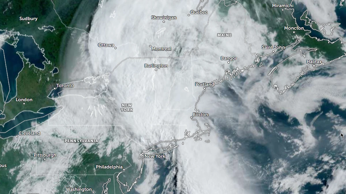
Satellite image of Northeast USA 12:40 UTC on July 29, 2026. Credit: NOAA/GOES-19, Zoom Earth, The Watchers
Weather Prediction Center (WPC) has placed parts of the northeastern United States under a Moderate Risk (Level 3 of 4) of excessive rainfall for Wednesday, July 29.
Repeated rounds of heavy rain are expected to bring significant flash flooding to eastern New York, western Massachusetts, southern Vermont, and parts of Connecticut.
The greatest concern is across the mid to upper Hudson Valley and areas extending east toward the Connecticut–Massachusetts border, where the WPC says high-end, life-threatening flash flooding is possible.
Forecasters expanded the Moderate Risk area westward into eastern New York after observations and forecast models showed a stationary convergence axis producing heavier rain farther west than expected.
Although atmospheric instability is limited, strong low-level convergence is supporting low-topped thunderstorms with efficient warm-rain processes.
The band of heavy rain is expected to pivot and remain over eastern New York and parts of western Connecticut and Massachusetts, increasing the risk of prolonged heavy rainfall over the same locations as a surface low near Long Island moves north.
Rainfall rates of 25 to 50 mm (1 to 2 inches) per hour are forecast through late morning and early afternoon on Wednesday. Rainfall totals could reach 50 to 100 mm (2 to 4 inches), with locally higher amounts possible where thunderstorms repeatedly track over the same areas.
WPC ensemble guidance shows a greater than 80% chance of at least 75 mm (3 inches) of rain across western and central Massachusetts into far southern Vermont, while localized totals of 125 mm (5 inches) have probabilities of 30 to 50%.
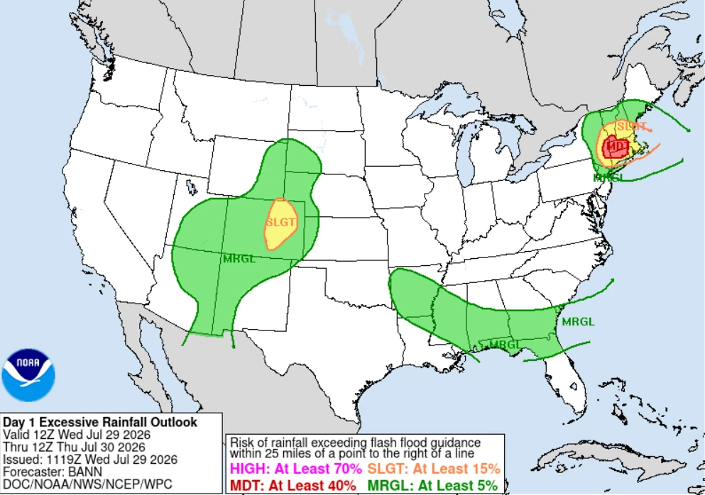
The heavy rainfall threat is associated to an amplified upper-level trough over the Great Lakes and Northeast and a cold front stretching from New England into the Mid-Atlantic.
Frontal convergence and anomalously moist air will support another round of repeated rainfall across parts of New England. Training thunderstorms may produce high rainfall rates and totals capable of causing flash flooding, especially in urban areas and places where soils are already saturated.
By Thursday, the northern part of the front is expected to move offshore, although lingering showers may keep an isolated flash flood threat in parts of New England.
Farther south, the trailing front across the Southeast and Gulf Coast is expected to produce scattered showers and thunderstorms, where a Marginal Risk (Level 1 of 4) of excessive rainfall remains in effect through Thursday.
Meanwhile, monsoonal moisture will continue to support numerous thunderstorms and localized flash flooding across the Four Corners region, the Rockies, and the adjacent High Plains.
The greatest flash flood threat is expected on Wednesday, when repeated bands of heavy rain affect the same locations across parts of the Northeast.
The WPC says significant flash flooding is likely within the Moderate Risk area, with the potential for high-end, life-threatening impacts across parts of eastern New York and areas extending toward the Connecticut–Massachusetts border.
References:
1 Excessive Rainfall Discussion – NWS/WPC – July 29, 2026
2 Short Range Forecast Discussion – NWS/WPC – July 29, 2026

Rishav Kothari is Editor-in-Chief of The Watchers, where he runs the newsroom and covers earthquakes, volcanoes, severe weather and space weather.
