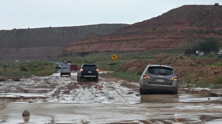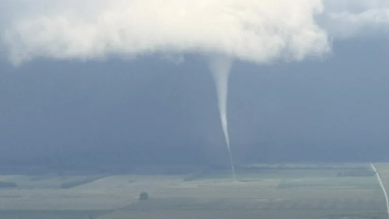
• Tornado touches down near Francis Peak in Davis County, Utah

    A tornado touched down east of Fruit Heights, Utah, at approximately 13:52 LT (19:52 UTC) on September 18, 2026, as severe thunderstorms moved across Davis County and surrounding areas. Rain and damage was reported in the affected areas. The National Weather Service (NWS) had issued a tornado warning for portions of Davis, Weber and Morgan counties just eight minutes before the reported touchdown.
  • Polar vortex strengthens over Arctic, very strong El Niño supports mid-winter weakening signal

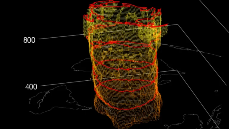
    The Northern Hemisphere polar vortex is forming normally over the Arctic and was stronger than average by NASA’s wind diagnostic in mid-September 2026. The developing very strong El Niño could favor atmospheric wave patterns that weaken the vortex later in winter, with seasonal guidance showing a possible weakening during January and February 2027.

  • Severe flooding inundates 16 310 homes, landslide kills 3 in Vietnam

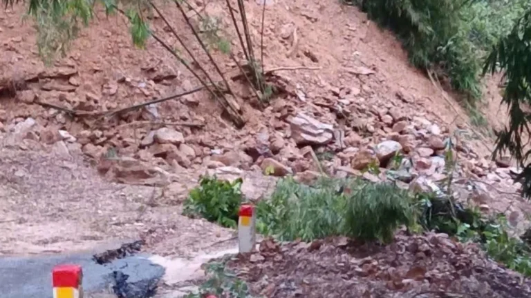
    Flooding across northern and north-central Vietnam had inundated 16 310 homes by 17:30 LT (10:30 UTC) on September 17, 2026, while a landslide in Phu Tho Province killed three members of one family, according to Vietnam’s National Civil Defense Steering Committee. Several rivers remained above Warning Level 3 (BĐ3) into the evening, and the National Center for Hydro-Meteorological Forecasting (NCHMF) maintained a Level 2–3 (of 5) natural-disaster risk warning for flooding.

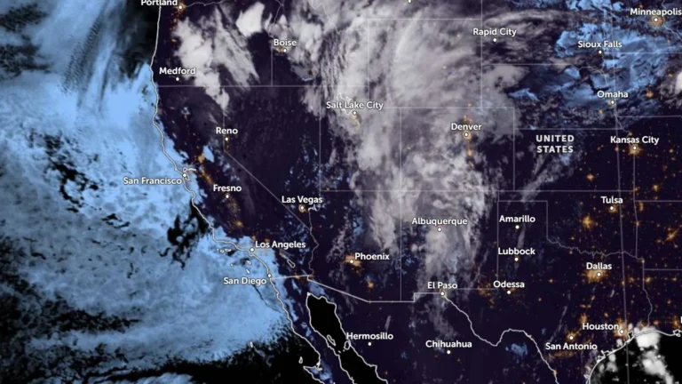
  • Flood Watches cover New Mexico, Utah and Colorado, heavy-rain threat shifts to South Dakota

    Another round of heavy showers and thunderstorms was forecast across parts of New Mexico, Utah and Colorado on September 17, 2026, prompting Flood Watches for areas vulnerable to rapid runoff and flash flooding. A moisture-rich disturbance was then expected to move northeast into South Dakota, where the National Weather Service’s Weather Prediction Center (WPC) forecast 51–102 mm (2–4 inches) of rain with locally higher totals.

  • Flash flooding kills 3 near Newcomb on Navajo Nation, New Mexico

    Two adults and a juvenile drowned after being swept away by floodwaters near Newcomb, New Mexico, early on September 16, 2026. The deaths occurred amid a Navajo Nation-wide state of emergency for severe monsoon storms, flash flooding and storm-related damage to roads and infrastructure.

  • Satellite imagery shows 15 years of decline at Elephant Butte Reservoir after lowest level since 1971

    Prolonged drought has been affecting the Rio Grande basin for several years. A Satellite loop released on September 15, 2026, showed the declining water levels in the Elephant Butte Reservoir and the smaller Caballo Reservoir to its south over the last 15 years. NASA had earlier reported that the reservoir stood at 1.4% of capacity on July 27, its lowest level since 1971.

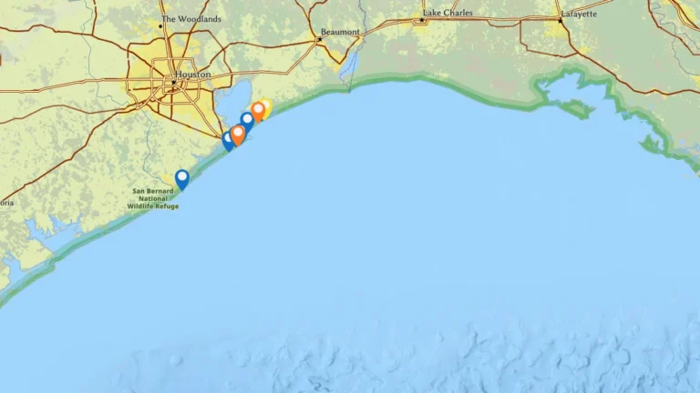
  • NOAA forecasts moderate to high respiratory irritation risk from red tide in Galveston County, Texas

    A Karenia brevis red tide bloom is affecting parts of Galveston County, Texas, on September 16, 2026, after state biologists confirmed moderate to high cell concentrations, fish kills and respiratory irritation along the coast. NOAA forecasts a moderate to high risk of respiratory irritation at some beaches on Galveston Island and Bolivar Peninsula as the bloom continues.

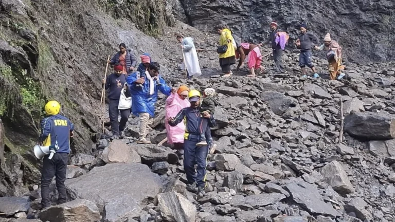
  • Kedarnath trekking route reopens after fatal Chirbasa landslide, India

    The Gaurikund–Kedarnath trekking route in Uttarakhand reopened on September 15, 2026, after crews cleared a landslide-hit section near Chirbasa, Rudraprayag Police said. The State Emergency Operation Centre (SEOC) reported that 7 350 pilgrims had been guided through the affected section by 10:15 IST (04:45 UTC).

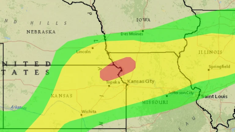
  • Moderate Risk of excessive rainfall issued for northeastern Kansas and northwestern Missouri

    The Weather Prediction Center (WPC) placed parts of northeastern Kansas and northwestern Missouri under a Moderate Risk of excessive rainfall from 07:00 CDT (12:00 UTC) on September 15 through 07:00 CDT (12:00 UTC) on September 16, 2026, as repeated thunderstorms threaten flash flooding. The Moderate Risk extends into far southeastern Nebraska, while parts of the northern Kansas City/Pleasant Hill forecast area have already received more than 127 mm (5 inches) of rain and could receive another 25–76 mm (1–3 inches).