
Hawaii’s largest freshwater lake was 200 feet deep at 10 a.m. on June 2, 2018. By that afternoon, lava from Kilauea had boiled it away
At about 10:00 HST on June 2, 2018, lava from Kīlauea entered Green Lake, Hawaiʻi’s largest natural freshwater lake. By 15:00 HST, an official overflight found its basin filled with lava and the lake gone. The destruction was documented within hours, but the widely repeated claim that the lake held water 200 feet (61 m) deep conflicts with a scientific survey measuring a maximum depth of just 19.7 feet (6 m). The historical 200-foot description referred to the surrounding crater hollow, not the depth of the water.
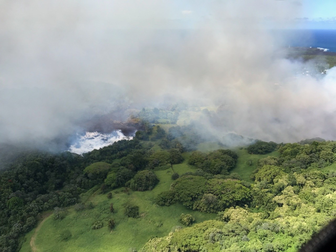
Lava flowing into Green Lake, Kapoho, Hawaii. Credit: United States Geological Survey (public domain), via Wikimedia Commons.
The lava came from fissure 8, the dominant vent in Kīlauea’s lower East Rift Zone eruption. On the morning of June 2, 2018, the advancing flow crossed the intersection of Highways 132 and 137, known locally as Four Corners, and continued into the Kapoho area. Green Lake, also known as Ka Wai a Pele, occupied a depression within Kapoho Crater. The Hawaiian Volcano Observatory (HVO) reported lava entering the lake at about 10:00 HST (20:00 UTC).
The contact between molten rock and water produced a large white steam plume. According to the U.S. Geological Survey (USGS), the plume was visible from a distance between approximately 11:30 and 13:30 HST. An aerial photograph taken a couple of hours later by the Hawaiʻi County Fire Department showed still-steaming lava inside the former lake basin. By approximately 15:00 HST (01:00 UTC on June 3), an overflight had established that the basin was filled with lava and the water had apparently boiled away.
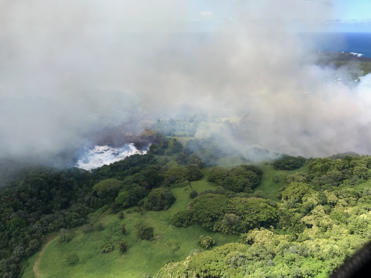
Those observations document the lake’s disappearance over a period of hours, but not the precise duration of evaporation. The recorded times establish when lava arrived, when the steam plume was visible and when the basin was found filled. No continuous record of the falling water level was provided, and the exact moment the last water disappeared was not established.
Water exposed to molten lava receives heat rapidly, producing vigorous boiling and steam. Lava entering a confined basin also displaces water as it occupies the available space. Although the eruption report described Green Lake’s water as having boiled away, the observations do not quantify how much evaporated, was displaced or escaped through surrounding material. The steam plume confirms intense lava-water interaction without providing a measurement of the total amount of water converted to vapour.
Green Lake was unusual in Hawaiʻi, where the permeability of volcanic rock often prevents water from accumulating in natural surface basins. Limnologist J. A. Maciolek identified it as the largest natural freshwater lake in Hawaiʻi in a scientific survey published by the Bernice P. Bishop Museum in 1982. Its surface area was small compared with many mainland lakes, but it represented a rare permanent body of natural freshwater in the islands.
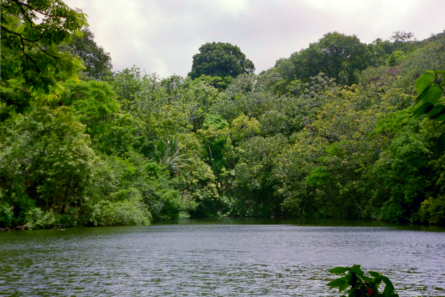
Maciolek’s measurements were based on fieldwork in December 1973. The lake covered 0.80 ha (2.0 acres), with a maximum water depth of 6.0 m (19.7 feet) and a mean depth of 3.6 m (11.8 feet). These were direct scientific measurements of the lake’s water column, not estimates of the depth of the surrounding crater. They provide a documented pre-eruption baseline, although they do not establish the lake’s exact dimensions on the morning of June 2, 2018.
The measurements conflict with a much larger depth repeated in reporting about the eruption. The Smithsonian Institution’s Global Volcanism Program described Green Lake as 60 m (197 feet) deep in its summary for May 30–June 5, 2018. That summary did not identify a new bathymetric survey establishing the figure. Maciolek’s earlier scientific table explicitly records a maximum water depth of 6.0 m, a difference of one order of magnitude.
The discrepancy is not a minor rounding issue. The depth of a lake affects estimates of its water volume, and the amount of water present would be central to any attempt to calculate the energy required for evaporation. Neither the 1973 survey nor the 2018 eruption observations established the water depth at exactly 10:00 HST on June 2. The origin of the 60 m figure in the eruption summary has not been independently established.
A historical description provides a possible point of confusion, but not a proven explanation for the later discrepancy. William Ellis, writing about his journey through Hawaiʻi in 1823 in a book published in London in 1827, described an oval hollow at Kapoho approximately 61 m (200 feet) deep. He placed a lake at the bottom of that hollow. The measurement referred to the surrounding depression, not to 61 m of water.
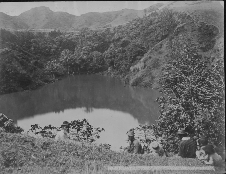
Ellis described cultivated ground near the water, including taro, bananas and sugar cane, as well as trees growing along its margins. He recorded the Hawaiian name Ka Wai a Pele and described the lake water as brackish. His account offers a detailed description of the nineteenth-century landscape, but it was not a scientific measurement of the water depth or a modern analysis of its chemistry.
The difference between Ellis’s brackish description and Maciolek’s later freshwater classification also needs to be considered in context. Roughly 150 years separated the observations, and the two accounts were produced using different methods. They do not establish when the water’s salinity may have changed or whether its chemistry remained stable during the intervening period.
Maciolek’s survey recorded dissolved mineral content of approximately 300 mg/L. During measurements made on December 27, 1973, the lake was thermally stratified, with temperatures ranging from approximately 25°C near the surface to 22.2°C in deeper water. Water below about 3 m (9.8 feet) lacked dissolved oxygen at the time of sampling. Winds weakened the stratification during the following night, showing that the lake’s physical conditions could change over relatively short periods.

Vegetation overhung the lake and shaded approximately one-fifth of its surface. The survey identified numerous planktonic algae and aquatic invertebrates, while fish sampling yielded Asian catfish. These observations documented a small but established aquatic environment, rather than an uninhabited pool of water. That environment disappeared when the advancing lava occupied the basin.
The landform containing Green Lake had its own volcanic history. Hazlett et al. (2024) examined the origins of large explosive eruptions in Kīlauea’s lower East Rift Zone, including the deposits and structure of Kapoho Crater. Their study interpreted the main tuff cone as the product of phreatomagmatic activity, in which rising magma interacted explosively with external water.
The researchers identified marine diatoms within volcanic deposits, supporting an interpretation that seawater was involved in the cone-forming eruption. Their reconstruction also identified later explosive activity inside the existing crater that produced smaller depressions. Green Lake subsequently occupied one of those depressions, where groundwater accumulated. These conclusions are based on geological evidence preserved in the crater, rather than direct observations of the ancient eruptions.

The lake therefore occupied a landscape shaped by different episodes of volcanism. Earlier eruptions created the crater and the smaller depression that eventually held water. In 2018, lava from fissure 8 entered that depression and replaced the lake. Although both episodes involved interactions between volcanic material and water, the geological processes were not identical.
The destruction of Green Lake was part of a larger transformation of the lower Puna district. After crossing Four Corners, lava from fissure 8 continued through the Kapoho area, burying roads and developed land. The flow eventually reached Kapoho Bay at approximately 22:30 HST on June 3 (08:30 UTC on June 4), according to the USGS chronology. In the following days, lava advanced into the bay and created new coastal land.
During helicopter observations on June 4, USGS personnel recorded the developing ocean entry at approximately 06:15 and 13:38 HST. By the afternoon flight, lava had nearly filled the shallow bay. Contact between lava and seawater produced a plume commonly called laze, containing steam, acidic gases and fine particles. It was distinct from the freshwater steam plume seen when lava entered Green Lake two days earlier.
Fissure 8 continued to supply the channelized lava flow after the lake disappeared. In footage recorded on June 17 and published on June 19, USGS cameras documented lava pulsing above the growing spatter cone and cascading into the established channel. The sustained discharge helps explain how the eruption was able to alter a substantial part of the Kapoho landscape beyond the loss of the lake itself.
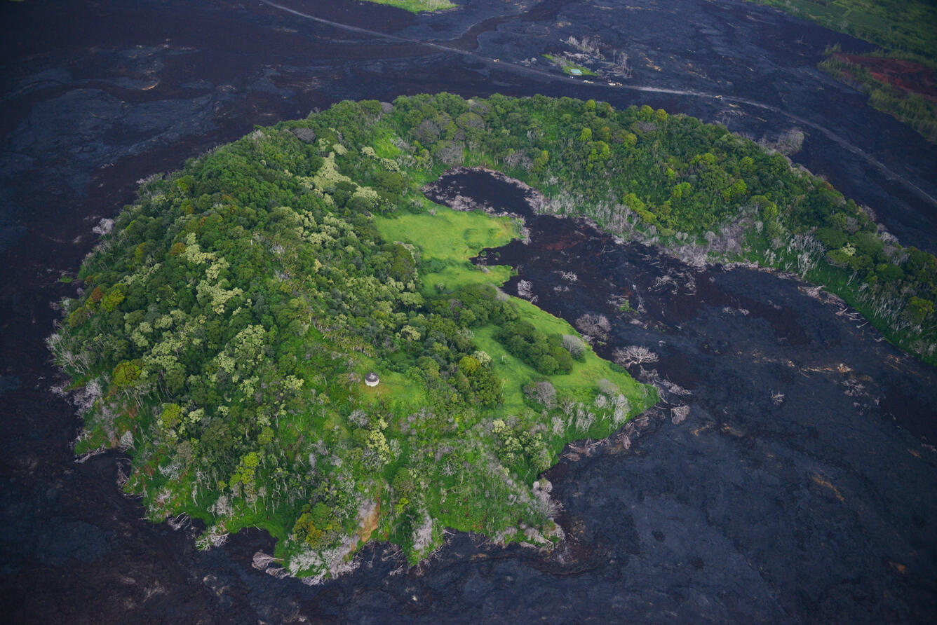
The physical change at Kapoho Crater remained visible after the eruption. A USGS photograph published in August 2019 shows vegetated crater slopes surrounded by dark lava. Green Lake had previously occupied a depression near the center of the crater, but that part of the landscape had been filled by the 2018 flow.
The evidence for Green Lake’s destruction is substantially stronger than the evidence for its exact depth immediately before the event. HVO documented the timing of the lava’s arrival, the steam plume and the lava-filled basin. Maciolek’s earlier work provides a direct measurement of the lake’s water column, while the 60 m depth repeated in a 2018 eruption summary remains unsupported by an identified independent sounding.
Records from three different periods preserve what is known about the lake: Ellis described its cultivated surroundings in the nineteenth century, Maciolek measured its water and aquatic environment in the twentieth, and HVO documented its destruction in 2018. The precise amount of water present on the final morning and the proportions lost through boiling, evaporation or displacement remain unknown. By the afternoon of June 2, however, the lake itself was gone.
References:
1 Photo and Video Chronology – Kīlauea – June 2, 2018 – U.S. Geological Survey – June 2, 2018
2 Global Volcanism Program. (2018). Volcanic activity report on Kīlauea (United States), May 30–June 5, 2018. Weekly Volcanic Activity Report. Smithsonian Institution / U.S. Geological Survey.
3 Maciolek, J. A. (1982). Lakes and lake-like waters of the Hawaiian Archipelago. Occasional Papers of Bernice P. Bishop Museum, 25(1), 1–14. Original scientific publication – April 30, 1982
4 Ellis, W. (1827). Narrative of a tour through Hawaii, or, Owhyhee. London. Chapter XI, account of the 1823 journey. Digitized historical publication, ETH-Bibliothek Zürich.
5 Hazlett, R. W., Schmith, J., Lerner, A., Downs, D. T., Fitch, E. P., Parcheta, C. E., Gansecki, C. A., & Spaulding, S. A. (2024). Origins and nature of large explosive eruptions in the lower East Rift Zone of Kīlauea volcano, Hawaii: Insights from ash characterization and geochemistry. Journal of Volcanology and Geothermal Research, 452, 108114. DOI: 10.1016/j.jvolgeores.2024.108114
6 Kīlauea Volcano – Video Compilation of Kapoho Bay Ocean Entry – U.S. Geological Survey – June 4, 2018

I’m a science journalist and researcher at The Watchers, contributing to the Epicenter edition, where I cover peer-reviewed scientific research and emerging discoveries across Earth and space sciences. With a background in astronomy and a passion for environmental science, I’ve worked in shark and coral conservation in Fiji, conducting reef and shark-behavior research, contributing to mangrove restoration, and earning PADI Open Water and Coral Reef Certifications. I bring a blend of scientific rigor and storytelling to illuminate the discoveries shaping our planet and beyond.
Published in the last 24 hours
- A South Dakota man put the widest and heaviest hailstone on US record in his freezer, and a power cut melted part of it before NOAA measured it at 8 inches across and nearly 2 pounds in 2010 Epicenter
- Black kites and brown falcons in northern Australia have been seen snatching smoldering sticks from wildfires, flying them into unburned grass and dropping them, starting new fires that send lizards, rodents and insects running straight toward the waiting birds Epicenter
- A levee protecting a highway north of San Francisco is pocked with animal burrows and only 3 feet wide in places, and a report warns this winter's El Niño could push water over the top Epicenter
- In January 2000, chunks of ice weighing up to 6 pounds fell out of clear blue skies over Spain for 10 days. One smashed through a car windshield, and scientists still can’t fully explain where they came from Epicenter
