
Major winter storm forecast to bring heavy snow, sleet, and freezing rain to the southern U.S.
A major winter storm will bring widespread snow, sleet, and freezing rain from the Southern Plains to the Mid-Atlantic between Friday, January 23, and Sunday, January 25, 2026.
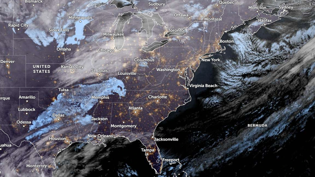
Satellite image of eastern and central U.S. as of 08:10 UTC on January 21, 2026. Credit: NOAA/GOES-19, Zoom Earth, The Watchers
- Heavy snow is forecast across parts of Oklahoma, Arkansas, Tennessee, and into the central Appalachians.
- Freezing rain and sleet are forecast farther south across Texas, Louisiana, Mississippi, Alabama, and the Carolinas, through the weekend into early next week.
- Residents in the southern United States are advised to prepare for winter conditions before Friday.
- Travel disruptions, power outages, and hazardous conditions are expected from Texas to the Carolinas.
An Arctic air mass is forecast to bring significant winter weather to the eastern two-thirds of the United States through the end of the week.
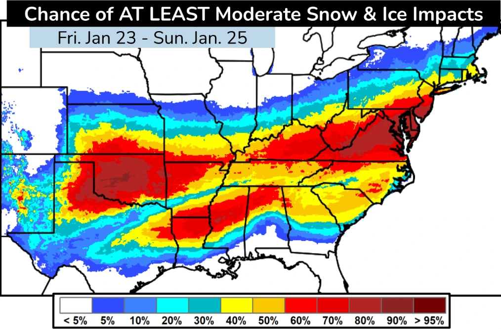
This air mass will interact with moist southern flow from the Gulf of Mexico, creating a broad corridor of winter precipitation. There is a high probability of at least moderate snow and ice impacts extending from the Southern Rockies and south-central Plains eastward into the Mid-Atlantic.
Heavy snow is forecast across parts of Oklahoma, Arkansas, Tennessee, and into the central Appalachians, while freezing rain and sleet are forecast farther south across Texas, Louisiana, Mississippi, Alabama, and the Carolinas, through the weekend into early next week.
Hazardous freezing rain and sleet will be the main problem for the southern part of the country.
The Weather Prediction Center (WPC) forecasts a 60–90% rare ice accumulation across northeastern Texas, northern Louisiana, central Mississippi, and northern Alabama. Ice accretion on power lines and trees could lead to power outages and dangerous travel.
North of this zone, heavy snow is expected from Oklahoma through Kentucky and into western Virginia, where totals of over 150 mm (6 inches) are possible. Snow-covered roads and low visibility are likely to create travel disruptions.

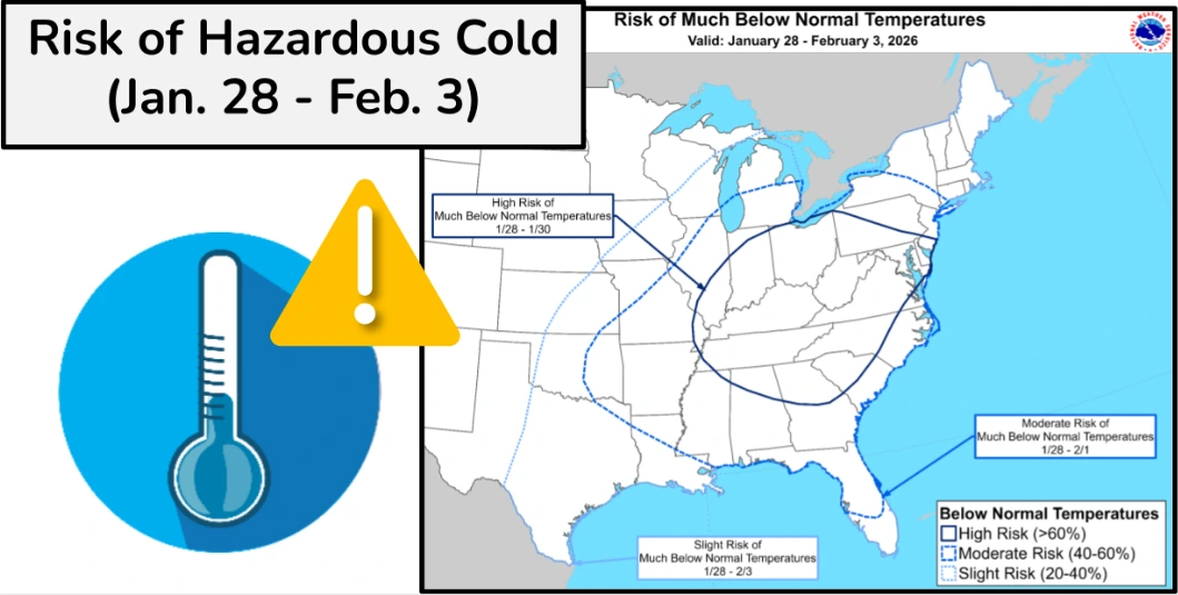
In the wake of the storm, a strong Arctic high-pressure system will drive temperatures to 15–25°C (27–45°F) below normal across the Midwest, Southeast, and Gulf Coast. Wind chills below −30°C (−22°F) are forecast for parts of the central Plains, with sub-zero values extending as far south as northern Mississippi and Alabama.
The extreme cold will persist into early February, with a high risk of below-normal temperatures being forecast for the Ohio Valley, Mid-Atlantic, and Southeast from January 28 to February 3. Prolonged exposure will bring a risk of frostbite and hypothermia, especially for unprotected populations and livestock.
Residents in the southern United States are advised to prepare for winter conditions before Friday. Travel disruptions, power outages, and hazardous conditions are expected from Texas to the Carolinas.
References:
1 Short Range Forecast Discussion – NWS/WPC – January 21, 2026
2 Key messages for major January winter storm – NWS/WPC – January 20, 2026

I am an Assistant Editor and Severe Weather & Science Journalist at The Watchers, specializing in real-time severe weather coverage, geophysical event reporting, and research-driven scientific analysis. You can reach me at rishav(at)watchers(.)news.
Commenting rules and guidelines
We value the thoughts and opinions of our readers and welcome healthy discussions on our website. In order to maintain a respectful and positive community, we ask that all commenters follow these rules.