
Series of impactful atmospheric rivers forecast to bring widespread heavy precipitation to California
A series of impactful atmospheric rivers is forecast to bring heavy precipitation across California from Friday, December 19, 2025, through Wednesday, December 24, with seven-day precipitation totals expected to exceed 380 mm (15 inches) in parts of the Sierra Nevada.
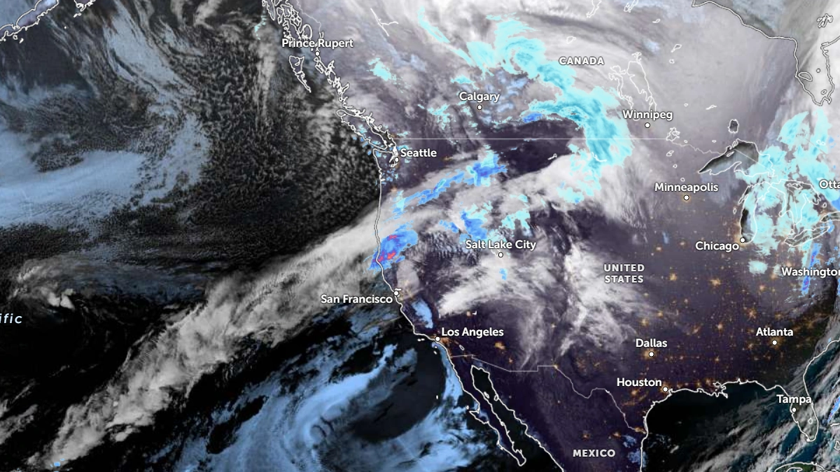
Satellite image of the AR moving the the US West Coast at 13:30 UTC on December 19, 2025. Credit: NOAA/GOES-19, Zoom Earth, The Watchers
Forecast confidence has steadily increased over recent days for a prolonged period of active weather in California this weekend and next week.
Ensemble guidance from the U.S. Global Ensemble Forecast System (GEFS), the European Centre for Medium-Range Weather Forecasts (ECMWF), and CW3E’s West-WRF model shows a high probability of at least three AR landfalls through the next week.
The first AR made landfall overnight Thursday into Friday, affecting Northern and Central California. Moderate to heavy precipitation is expected across the Klamath Mountains, Northern California Coast Ranges, and the northern Sierra Nevada.
A second, stronger system is forecast to arrive between Saturday, December 20, and Monday, December 22, spreading southward into the Bay Area and Central Sierra Nevada. The Weather Prediction Center (WPC) has issued a slight risk of excessive rainfall outlook for Sunday into early Monday due to expected higher precipitation totals during this phase.
The third atmospheric river is expected to reach Central and Southern California between Tuesday, December 23, and Wednesday, December 24.
While forecast uncertainty increases beyond day six, this system may produce widespread heavy rainfall across much of the state and significant snow accumulations at high elevations.
According to CW3E ensemble forecasts, cumulative 7-day precipitation totals are projected to exceed 125 mm (5 inches) in the Bay Area and Sacramento Valley, 180–250 mm (7–10 inches) in the Northern California Coast Ranges and Central Sierra Nevada, and 250–380 mm (10–15 inches) in the northern Sierra Nevada.
Some catchments upstream of major reservoirs–Lake Oroville, New Bullards Bar, and Englebright Dam could receive over 20% of their normal annual precipitation within this period.
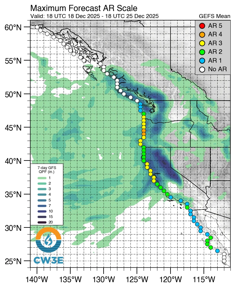
Despite these substantial totals, widespread riverine flooding is not currently forecast, attributed to the prolonged dry conditions since late November. However, as soils saturate through the sequence of storms, the risk of flooding is expected to rise later next week.
References:
1 Heavy Precipitation Expected in California This Weekend and Next Week – CW3E – December 18, 2025

I am an Assistant Editor and Severe Weather & Science Journalist at The Watchers, specializing in real-time severe weather coverage, geophysical event reporting, and research-driven scientific analysis. You can reach me at rishav(at)watchers(.)news.
Commenting rules and guidelines
We value the thoughts and opinions of our readers and welcome healthy discussions on our website. In order to maintain a respectful and positive community, we ask that all commenters follow these rules.